
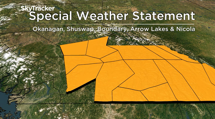
Environment Canada has issued a special weather statement for the Okanagan, Shuswap, Boundary and Arrow Lakes for a vigorous cold front that’s expected to sweep through the southern Interior on Friday night.

Strong southwesterly winds with gusts up to 60 km/h are expected ahead of the front on Friday afternoon.
Stronger northerly winds with gusts up to 70 km/h or more are anticipated once the front passes overnight Friday.
Recreational boaters are encouraged to re-visit their boating plans for Friday afternoon and evening.
Be prepared for strong and gusty winds. Consider anchorages or moorings protected from westerly and northerly winds.
Sunshine will prevail in the forecast for the next 5 days with the exception of Friday night, when a few clouds will filter through.
Some showers could clip the Shuswap late Friday as well.
Daytime highs will spike into the low 30s on Friday before bumping back into the upper 20s on Saturday.


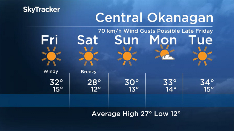
An upper ridge of high pressure will funnel back in 30 degree heat on Sunday with afternoon highs soaring into the mid-30s early next week.
For weather on the go download the Global News SkyTracker Weather App for iPhone, iPad or Android.
- Train goes up in flames while rolling through London, Ont. Here’s what we know
- Wrong remains sent to ‘exhausted’ Canadian family after death on Cuba vacation
- Liberals having ‘very good’ budget talks with NDP, says Freeland
- Peel police chief met Sri Lankan officer a court says ‘participated’ in torture
Comments