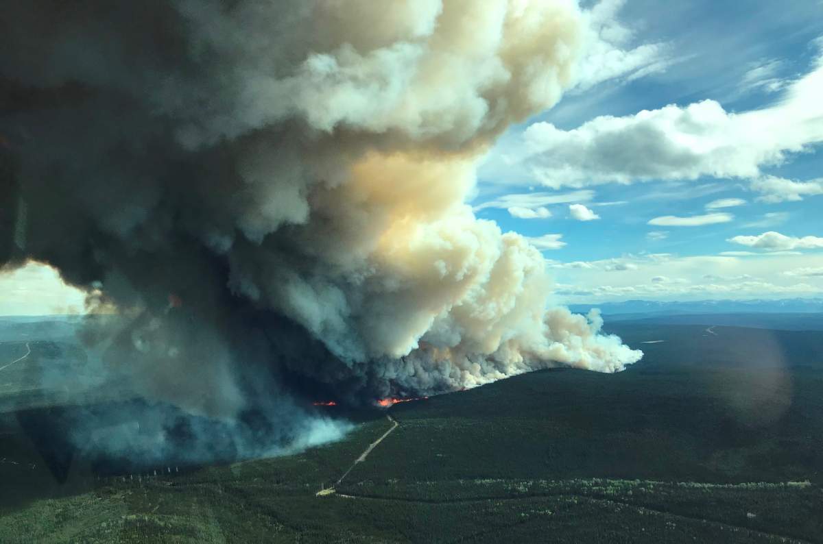
The wildfire danger across the province is quickly climbing.

Right now, there are eight “wildfires of note” burning across B.C. and smoke is visible in many communities.
Over the past 24 hours, the Allie Lake wildfire grew to 1,600 hectares. It is burning 55 kilometres northwest of Kamloops and is considered out of control.
It is burning near the site of last year’s massive Elephant Hill wildfire.
“To see another aggressive fire so close and so early in the year, quite frankly I’m sure it’s got people on edge up there,” said chief fire information officer Kevin Skrepnek.
It is not threatening any homes at this time.
“It’s not uncommon to see fires at this time of year. What is unusual is just how hot and dry it’s been the last few weeks,” he added. “And just how large and aggressive these fires have been burning.”
The Xusum Creek fire, burning approximately 10 kilometres northeast of D’Arcy and 35 kilometres west of Lillooet, near Anderson Lake, is now an estimated 400 hectares in size.
This fire has prompted 14 properties to be put on evacuation order and 51 properties on evacuation alert.
“Definitely this fire is close to structures,” says Ryan Wainwright with the Squamish-Lillooet Regional District. “The nice thing for us it that it’s burning, burning uphill right now. Moving towards the alpine where there’s rocks.”
Area resident Peter Gardner told Global News his neighbour at Xusum Creek has lost his cabin.
“It blew up pretty fast because it’s been pretty hot these days and in no time it was up the mountain,” he says.
The Muddy Lake fire, burning approximately 20 kilometres northeast of Telegraph Creek, is also considered a wildfire of note.

Get breaking National news
It is 612 hectares in size, but is considered 100 per cent contained.
Other wildfires of note include one burning approximately 58 kilometres southwest of Fort Nelson.
It is an estimated 4,793 hectares in size and zero per cent contained.
The fire is not threatening any structures, but firefighters are unable to fight the blaze due to dangerous terrain and a lack of accessible roads.
The Beatton River fire is located approximately 27 kilometres northeast of mile 109 Highway 97 – the Alaska Highway.
It is an estimated 1,800 hecatres in size but is not threatening any structures.
The Kahta Creek fire is also burning off Highway 97, the Alaska Highway. It is northeast of Pink Mountain.
The blaze is an estimated 1,700 hectares in size but is not threatening any structures.
The Milligan Hills wildfire is burning 140 kilometres north of Fort St. John and 40 kilometres west of the Alberta border.
It is about 700 hectares in size and 15 per cent contained.
Finally, the Tommy Lakes Road fire is burning approximately 29 kilometres northeast of Mile 109 Highway 97, the Alaska Highway.
- Snowmobilers fall through ice, bodies recovered days later after lake refreezes: RCMP
- Vancouver city councillor apologizes for calling fellow members ‘drug users’
- Dozens of bus shelters vandalized across Metro Vancouver
- B.C. business leaders criticize budget, saying province is in ‘an entrepreneurial drought’
It is an estimated 1,700 hectares in size and zero per cent contained.
It is not threatening any structures at this time.
All eyes on the weather
Skrepnek says the key will be any rain that will fall between now and Canada Day.
“The rain that we see from now until the Canada day long weekend — those June rains — are such a critical factor in terms of how the season is going to play out,” he says.
“Just because we had such a massive season last year does not at all mean we’re going to see less activity this year.”
Officials are also asking visitors to stay out of any back-country where fires are burning this weekend.
“Obviously, enjoying the back-country is a great thing for this part of the world but we’re asking you to stay well clear of the area,” says Wainright.
“Those areas that burned last year probably won’t have the same degree of experience with wildfire this year, but there’s a lot of other places in the province where there’s still lots of trees, lots of dead-fall, where a fire can get going really easily.”


Comments
Want to discuss? Please read our Commenting Policy first.