
Ever want to know what the New Brunswick flooding looks like from space? Thanks to NASA, now you can.

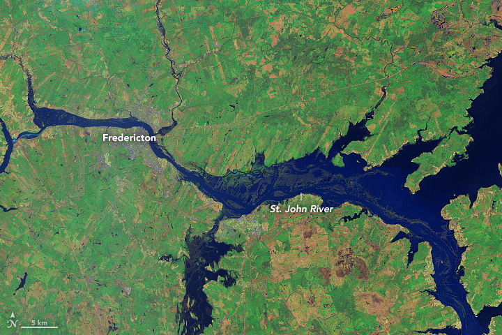
NASA’s Earth Observatory has released a pair of photos that compare what New Brunswick looked like along the Saint John River in 2016 and 2018.

Both images are false colour, which makes flood water appear dark blue and vegetation dark green.
NASA says when the image of the flood was acquired, the water level near Fredericton had stabilized at 8.12 metres, well above the flood stage of 6.5 metres for that part of the river.
READ MORE: Justin Trudeau to visit flood-struck New Brunswick as crucial highway re-opens
Levels have gone down to about 4.8 metres in Saint John, which is still above the flood stage.


River levels in the port city are expected to drop below the flood stage by Sunday.
WATCH: Justin Trudeau tours flood-stricken New Brunswick communities

The Canadian Armed Forces say it will deploy 60 members to assist with flood relief.
Comments