

UPDATE: Most of Saskatchewan remains under extreme cold warning

-40 to -50 wind chills settle in along with extreme cold warnings.
Extreme Cold Warning
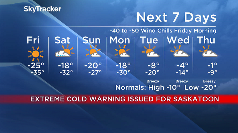
Environment Canada has issued an extreme cold warning for Saskatoon, Prince Albert, Regina and much of central, extreme northern and eastern Saskatchewan for a prolonged period of very cold wind chills.
Wind chill values near -40 can be expected over much of Saskatchewan today through Friday.
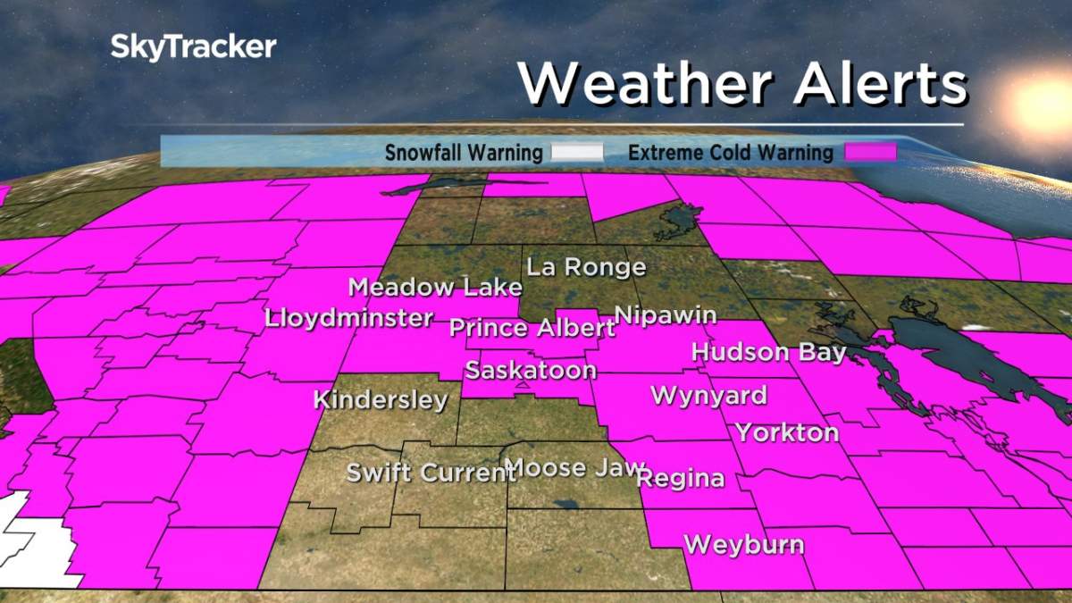
For the latest weather alerts download the Global News SkyTracker Weather App for iPhone, iPad or Android.
Saskatoon Forecast
Thursday
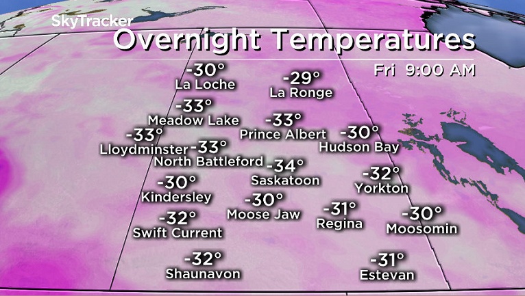
-39 is what it felt like in the city with wind chill to start the day as temperatures plummeted back to -29 overnight as light snow moved out of the area.
Despite the cold, pure blue skies and sunshine stuck around for the morning as we warmed up into the mid -20s before noon with wind chills remaining near -40.
Sunny skies continued for the rest of the day under the arctic high that suppressed our heating with an afternoon high of -22 and wind chills in the mid -30s all day.

Get daily National news
Thursday Night
Clear skies continued through Thursday night, which will allowed the mercury to nose dive even further, with an overnight low into mid -30s and extreme wind chills in the mid -40s.
Friday
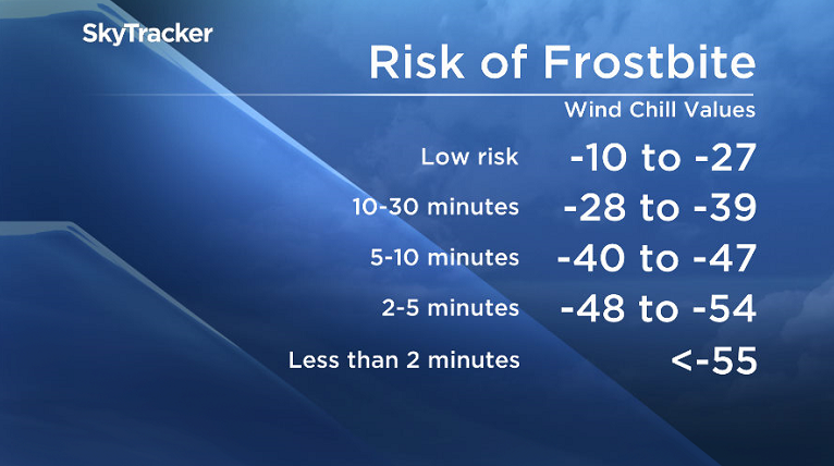
-45 wind chills will finish off the second week of 2018 on Friday morning, meaning exposed skin can freeze in 5 to 10 minutes, so be sure to bundle up as you head out the door.


Beautiful blue skies and sunshine will once again dominate the day as the arctic high that’s brought in the frigid conditions sticks around and keeps our daytime high once again in the mid -20s with wind chills in the -30s all day.
Weekend
That high will get shoved aside this weekend with a pulse of milder air mixing in on Saturday, which will help bring in some clouds and should boost our daytime high into the minus teens.
Sunday will be cooler as another arctic high drops in, knocking temperatures back into the -20s and bringing us back into some sunshine to round off the second weekend of the year.
Work Week Outlook
After a cooler start to the week on Monday with the mercury diving back into the -30s to start the day before another upper ridge slides in with clouds, which will help bump up daytime highs into minus single digits by mid-week.
The Jan. 11 Your Saskatchewan photo was taken by Amber Grunow at Île-à-la-Crosse:

READ MORE: Get a 2018 Your Saskatchewan Calendar today
Saskatoon weather outlook is your source for Saskatoon’s most accurate forecast and is your one stop shop for all things weather for central and northern Saskatchewan with comprehensive, in depth analysis that you can only find here.
Comments
Want to discuss? Please read our Commenting Policy first.