

UPDATE: The special weather statement issued by Environment Canada mentioned in this story has ended

Snow slid in to start winter, which will be followed by -40 to -50 wind chills for Christmas!
Special Weather Statement
Environment Canada has issued a special weather statement for Saskatoon, Regina, Prince Albert and much of eastern, central and southern Saskatchewan.
A blast of Arctic air is set to begin moving southwards into the Prairies this weekend, bringing bitterly cold conditions to portions of the Prairies for the holidays.
The agency says exposure to extreme cold can be deadly.
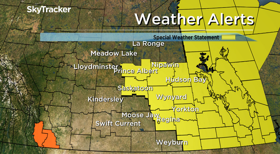
This cold front will move southwards through the weekend and bring a large-scale outbreak of bitterly cold air.
By Sunday, daytime highs colder than -20 degrees will be seen, with highs colder than -30 in the north.
This cold weather will continue through the holidays and the remainder of next week as the polar vortex becomes entrenched over the region.
With such cold temperatures in place, periods of extreme wind chill will likely occur.

For the latest weather alerts download the Global News Skytracker weather app for iPhone, iPad or Android.
Motorists planning to head out on roads are advised to use caution and check in with Saskatchewan Highway Hotline before heading out.
Saskatoon Forecast
Thursday
The final few moments of fall were felt early Thursday morning with temperatures in the mid-minus teens and wind chills in the mid -20s under partly to mostly cloudy skies.
Winter officially began at 10:28 a.m. CT, and just after it kicked off, the snow started to fall as we warmed up to -11 by noon with visibility reduced to a few kilometres in the flurries.
Light snow stuck around for the afternoon as we warned into minus single digits for a daytime high with breezy southwesterly winds.

Get breaking National news
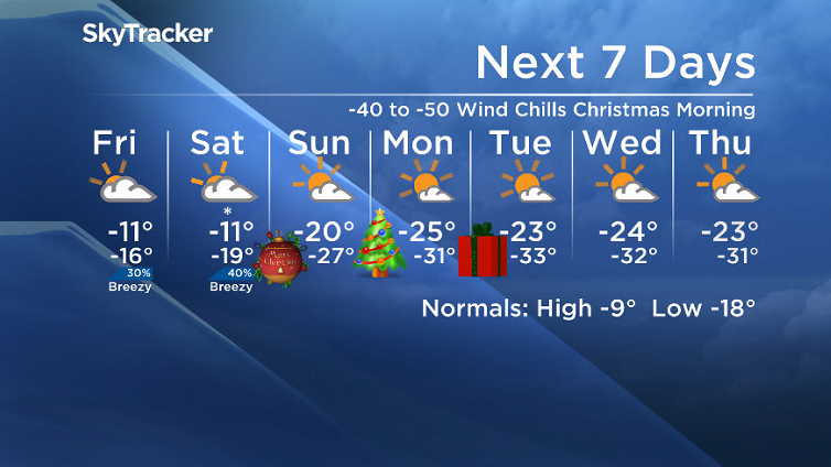
Friday
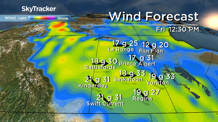
-26 is around what it’ll feel like with wind chill to start off Friday, the first full day of winter, under mostly cloudy skies with a slight chance of flurries during the day.
West-northwesterly winds will remain a bit breezy during the day with gusts upwards of 30 to 40 km/h possible as we warm up to an afternoon high around -11 degrees with wind chills around -20 all day.
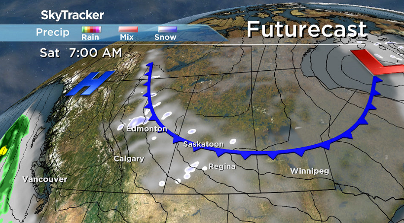
Saturday
Another surge of arctic air ploughs through on Saturday with a cold front that could kick up a few more flurries during the day and will keep us under mostly cloudy skies for the majority of the day.
- After experiencing 2016 wildfire, Fort McMurray survivor addresses evacuation trauma
- Edmonton organizations watch out for seniors during hot, smoky conditions
- Calgary air quality on Friday among the worst cities on earth
- Thorhild, Westlock counties declare state of agricultural disasters due to rain


We will climb up toward, but not quite into minus single digits for a daytime high with breezy winds at times.
Christmas Eve Sunday
The polar vortex, the cold pool of arctic air that normally sits over the North Pole, makes its triumphant return to the region for Christmas Eve on Sunday.
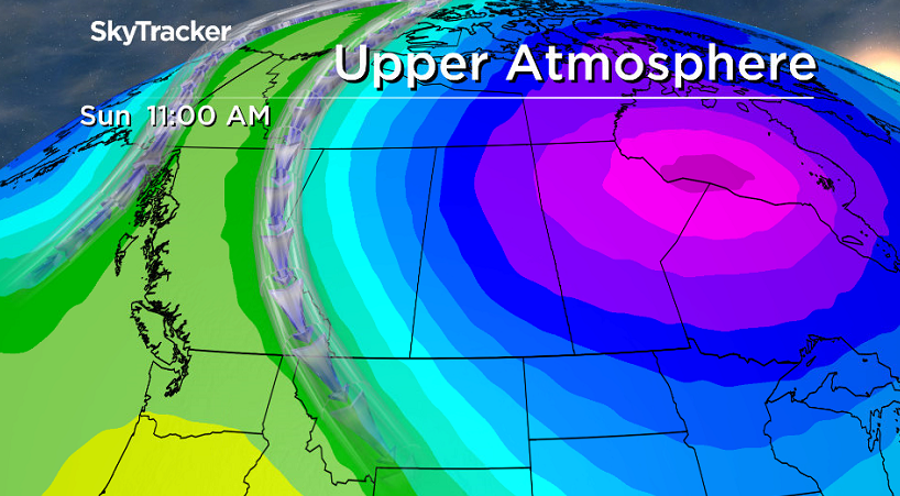
As skies clear, temperatures will plummet into the -20s all day with wind chills pushing into the -30s, especially into the evening as Santa gets ready to make his rounds!
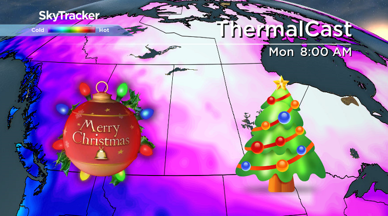
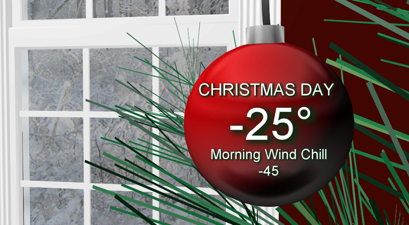
Christmas Day Monday
-40 to -50 is what it’ll feel like with wind chill Christmas morning as the mercury tumbles into the -30s to start the day.
After the frigid start to the big day, we should manage to warm up into the mid -20s with wind chills only rising into the -30s during the day, but we will have lots of sunshine during the day!
Boxing Day Tuesday
There is still a bit of discrepancy in the Boxing Day forecast with some models bringing in some clouds and milder air and others keeping conditions clear and cool.
What does appear to be clear is that we can expect a daytime high somewhere in the -20s and morning lows in the -30s with some sunshine and cloud cover at times.
Week After Christmas Outlook
Long-range forecast models are keeping daytime highs in the -20s for the remainder of the week with morning lows dipping into the -30s with wind chills into the -40s at times as clouds slide in and out.
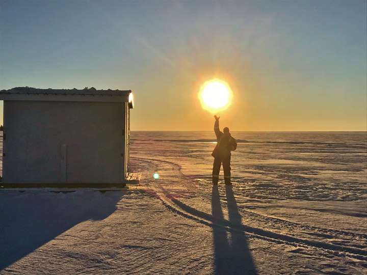
Turtle Lake was the setting for Brian Clark to take the Dec. 21 Your Saskatchewan photo:
READ MORE: Get a 2018 Your Saskatchewan Calendar today
Saskatoon weather outlook is your source for Saskatoon’s most accurate forecast and is your one stop shop for all things weather for central and northern Saskatchewan with comprehensive, in depth analysis that you can only find here.
Comments
Want to discuss? Please read our Commenting Policy first.