

The big cool down has begun as we dive into the deep freeze for Christmas!

Saskatoon Forecast
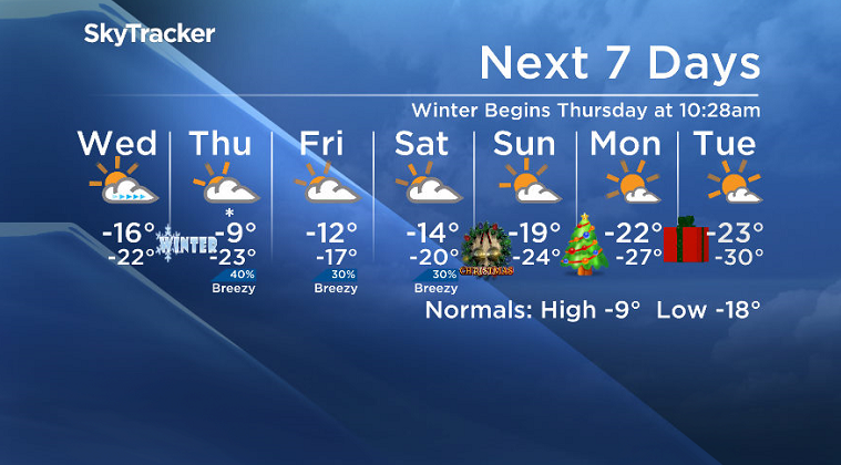
Tuesday
The cool air has started to set in with temperatures down to -16 to start the day and wind chills making it feel like -23.
Mostly sunny skies stuck around all morning as an arctic high dropped in with the mercury rising only a few degrees by noon.
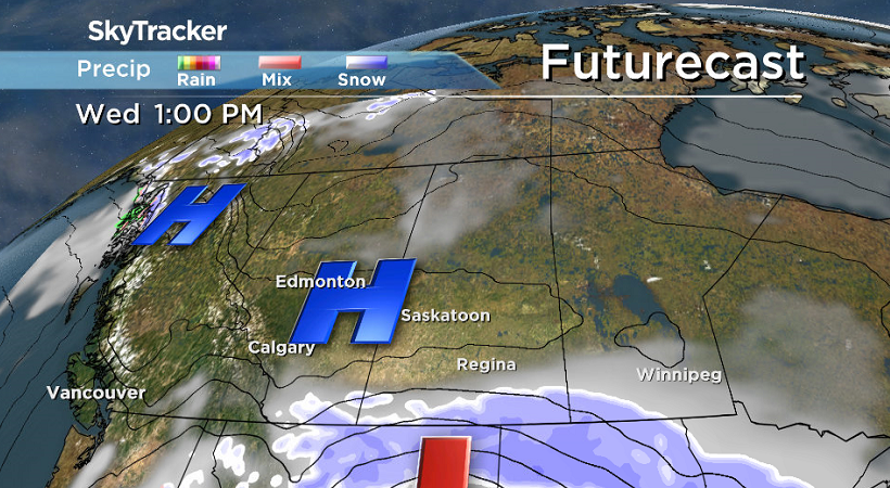
The arctic high will make it challenging to warm up much further beyond the minus teens in the afternoon, but it will keep the area under mostly sunny skies with light winds.
Tuesday Night
Clouds will begin to roll back in Tuesday night as a system expected to bring 10 to 15 centimetres of snow to extreme southern Saskatchewan, where a snowfall warning has been issued, moves in.
Temperatures will fall back into the -20s overnight with wind chills pushing into the -30s in the Saskatoon area.

Get breaking National news
Wednesday
-30 is around what it’ll feel like with wind chill as you head out the door Wednesday morning with clouds to start the day.
Those clouds should then clear out midday as sunshine returns and we get back under the influence of an arctic high pressure system that’ll suppress our daytime high, keeping it around -16 degrees with wind chills in the -20s all day.
Thursday-Friday
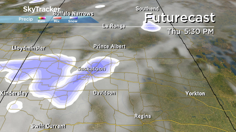
A brief break from the cold will push in on Thursday along with a trough that’ll bring in some cloud and a decent chance of a centimeter or so of snow to help freshen things up a touch before Christmas.
Clouds will then linger with a slight chance of flurries behind the system on Friday with daytime highs dropping from -9 on Thursday back into minus double digits to round off the week.


Christmas Weekend Outlook
The big question on many people’s minds is, “what will it be like for Christmas?” In short, the answer is cold.
The weekend will start off in the clouds as a trough swings through that’ll bring in a chance of flurries on Saturday, but we’ll get into some more sun for Christmas Eve on Sunday and then under mostly sunny skies for Christmas Day on Monday and Boxing Day on Tuesday.
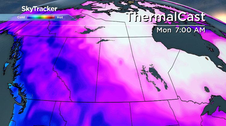
The polar vortex will be moving into the upper atmosphere on Christmas Eve and linger into Christmas Day, so daytime highs will drop from the mid-minus teens Saturday, toward -20 Christmas Eve and then into the mid -20s for Christmas Day and Boxing Day.

Morning lows will diving right back toward the -30s Christmas Eve and Boxing Day with morning wind chills possibly pushing into the -40s.
Braden Ottenbreit took the Dec. 19 Your Saskatchewan photo near Hepburn.

Saskatoon weather outlook is your source for Saskatoon’s most accurate forecast and is your one stop shop for all things weather for central and northern Saskatchewan with comprehensive, in depth analysis that you can only find here.
Comments
Want to discuss? Please read our Commenting Policy first.