

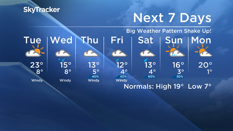
Significant changes moves into the forecast with a big cool down and rain on the way!

Wildfire Update
Weather was prime for the spread of wildfires in northern Saskatchewan over the weekend.
Officials are reporting that both the Granite and Preston fires grew in size since Friday.
The Preston fire is approximately 2.5 times the size of Regina, meantime the Granite fire is now 6 times the size of Regina, currently at 110,000 hectares.
Residents of Tyrell Lake are the latest to evacuate, being forced from their homes Monday afternoon as the fire began threatening the community.
READ MORE: Sask. wildfire evacuees rally government to allow them to aid in firefight
Over 2,500 are registered as being evacuated and are staying with family in friends or in hotels or evacuation centres in Saskatoon and Prince Albert.
Officials said Monday that fires in the Pelican Narrows area “are going to burn for awhile.”
The fire danger rating in the area remains at extreme, but there is some relief in the forecast ahead.
Saskatoon Forecast
Monday
It was another cool start to the work and school week, but not as chilly as last week’s +1!
We kicked off the second week of school around 5 degrees with some high cloud and a south-southeasterly wind helping to warm us up into the 20s before noon.
The sun continued to shine through the high cloud through the afternoon as winds continued and we warmed up to a high in the upper 20s.

Get breaking National news
Monday Night
Mostly clear skies stuck around overnight as we dipped back into mid-single digits.
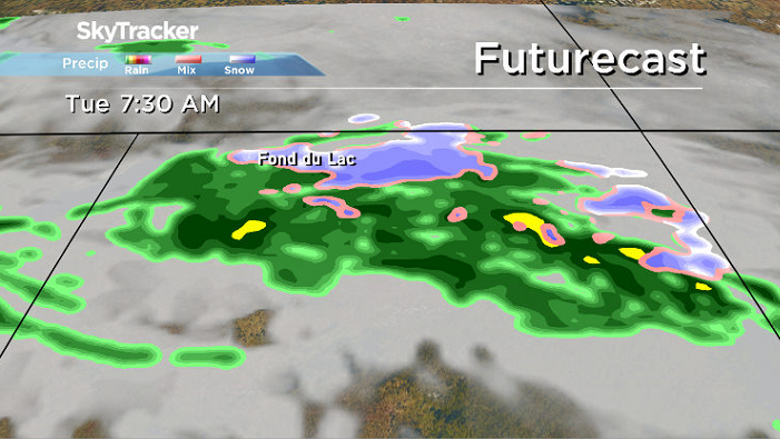
A system swinging into Saskatchewan brought in a good chance of some wet snow overnight into Tuesday morning in extreme northern Saskatchewan along with some rain.


Tuesday
A bit of sunshine should start off our Tuesday before cloud cover builds in during the day.
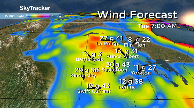
A breezy northwesterly wind around 20 km/h with gusts upwards of 40 km/h from morning right into the late afternoon will keep conditions slightly cooler with an afternoon high around 23 degree or so.
Wednesday-Friday
Big changes are on the way for the rest of the week as cool air continues slumping in along with rain on Wednesday, possibly lingering into Thursday and Friday as an upper low swings by.
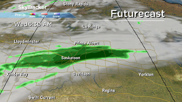
This is much needed moisture to help relieve the fire danger rating, but it will come with a breezy northerly component to the wind, which will push daytime highs from the mid teens into low double digits by week’s end.
Weekend Outlook
The upper trough that’s bringing in the big weather shake up will continue to sit over the area this weekend, bringing in a risk of rain Saturday as an upper low swings by with some more sunshine possible Sunday.
Temperatures will also kick back into the mid teens for the weekend with winds expected to ease back a bit.
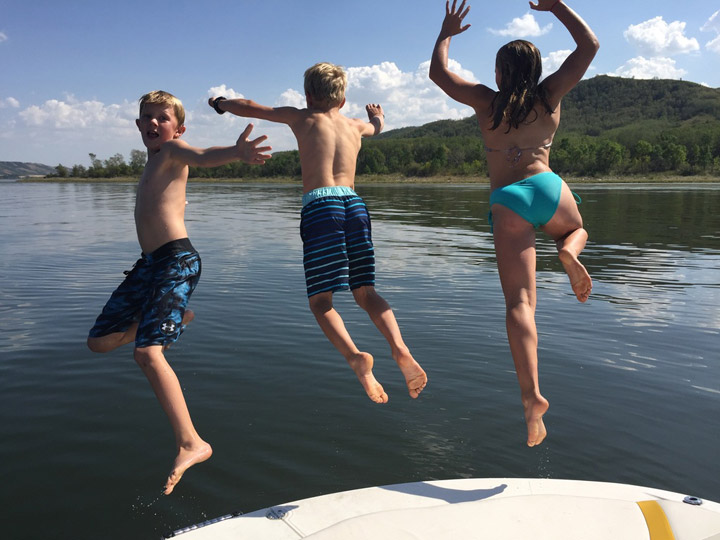
The Your Saskatchewan picture for Sept. 11 was taken at Round Lake by Wendy Trask:
Saskatoon weather outlook is your source for Saskatoon’s most accurate forecast and is your one stop shop for all things weather for central and northern Saskatchewan with comprehensive, in depth analysis that you can only find here.
Comments
Want to discuss? Please read our Commenting Policy first.