

After 12 days of double digit heat, the big cool down has begun with snow in the forecast.

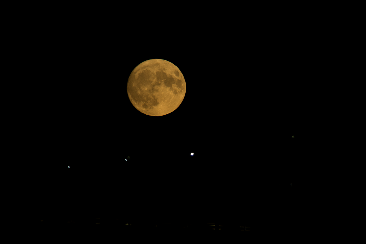
Saskatchewan Supermoon Sightings
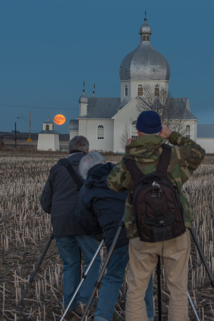
Clear skies overnight and over the past few nights have given people across Saskatchewan perfect viewing conditions for the supermoon!
PHOTO GALLERY: Supermoon sightings across Saskatchewan


READ MORE: ‘Supermoon’ bringing closest full moon to earth in almost 70 years
Saskatoon Forecast
Today

Get breaking National news
It was a cooler start to the day in Saskatoon with temperatures dipping back to -3 this morning under clear skies.
Sunshine dominated the morning with the mercury warming up to 4 C by noon.
Clouds will push in this afternoon with a daytime high expected to be around 6 degrees or so this afternoon.
Tonight
Cloudy skies will stick around tonight with a chance of showers as temperatures cool back toward the freezing mark.
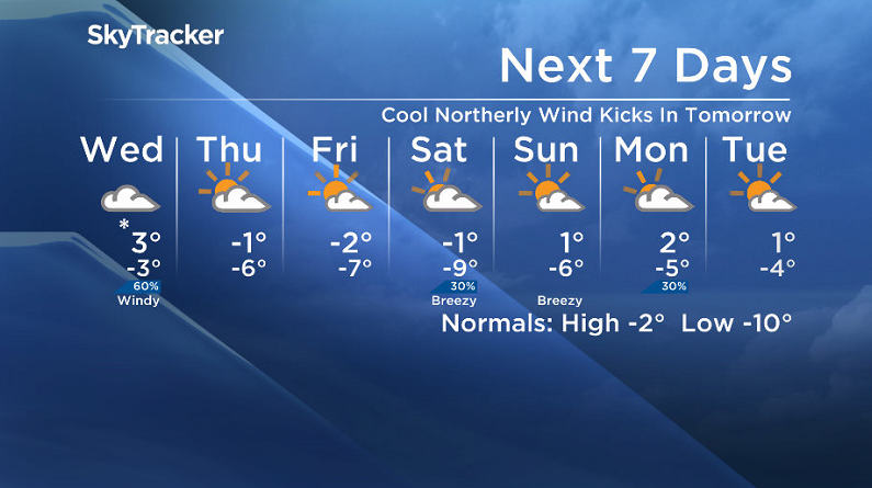
Wednesday
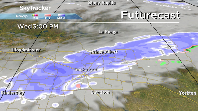
It will be a bit of a wild Wednesday across the region with a low pressure system swinging through kicking up the wind, cooler temperatures and even some snow!
The day should start off under cloudy skies with temperatures just above freezing before snow moves in during the morning and continues into the early afternoon before tapering off.


The ground is warm enough that most of the snow that falls is likely to melt, however some surfaces could see some slight accumulations.
There is still quite a bit of discrepancy as to the exact timing of the snow tomorrow, some models are holding it off until later in the day, so we will keep an eye on the situation and keep you update as the day progresses and we get a better idea of the track of the system.
If the snow does start earlier in the day, we could see some rain mixed in until mid-morning when the atmosphere cools.
The mercury will fall below freezing by the end of the day with moderate northerly winds kicking in behind the system up to sustained speeds in the 30 km/h range with gusts upwards of 50 km/h possible.
Thursday-Friday
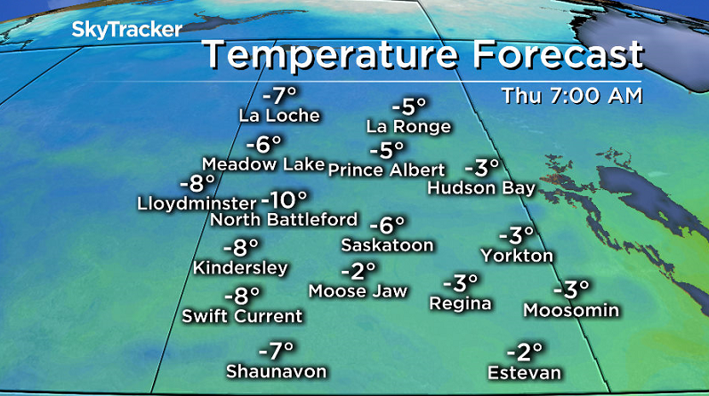
Cooler air plunges in for the rest of the work week under a mix of sun and cloud, once clouds clear on Thursday.
Daytime highs will be below zero with overnight lows in mid-minus single digits and wind chill values pushing into minus double digits right through the morning, so it’s time to pull back out the winter coats!
Weekend Outlook
Warmer air looks to try and make a return this weekend.
As such, daytime highs will push back up toward the freezing mark and potentially even a degree or so above zero for Sunday under partly to mostly cloudy skies.
This Your Saskatchewan photo was taken by Bruce Johnson of the super moon at Smuts:
Saskatoon weather outlook is your one stop shop for all things weather for Saskatoon, central and northern Saskatchewan with a comprehensive look at your local forecast that you can only find here.
Comments
Want to discuss? Please read our Commenting Policy first.