
Monday, November 14, 2016 – Weather forecast update at 4pm:

After an above seasonal stretch last week, our daytime high temps will stay in the single digits for the next several days.
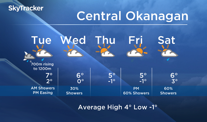
Freezing levels will fall to near 700m Monday night, rising to 1200m Tuesday, with snow possible for higher elevations Tuesday morning.

Get breaking National news
Get breaking Canada news delivered to your inbox as it happens so you won't miss a trending story.
By providing your email address, you have read and agree to Global News' Terms and Conditions and Privacy Policy.
Showers will develop overnight and linger Tuesday morning for the valleys, with a drier trend Tuesday afternoon and Wednesday.
- Gatineau homes at risk from rising waters as Ontario, Quebec face flooding concerns
- State of emergency declared in Peguis, Fisher River ahead of potential flooding
- Special weather statements issued for parts of Ontario, Quebec
- Most homes at risk of flooding on Manitoba First Nation still need protection: Kinew


Tuesday’s daytime high range: 4 to 9C
We will have the rest of your weather details coming up at 5 and 6:30 and 11pm – Hope you can join us!
~ Duane/Wesla
Comments
Want to discuss? Please read our Commenting Policy first.