
Saskatoon certainly wasn’t shining much in October, but that’ll change soon – the big November warm-up is almost here!

This will be perfect weather for farmers who need to finish up harvest with double digit daytime highs, dry conditions and sunshine nearly every day of the next 7.
Saskatoon Forecast
Today
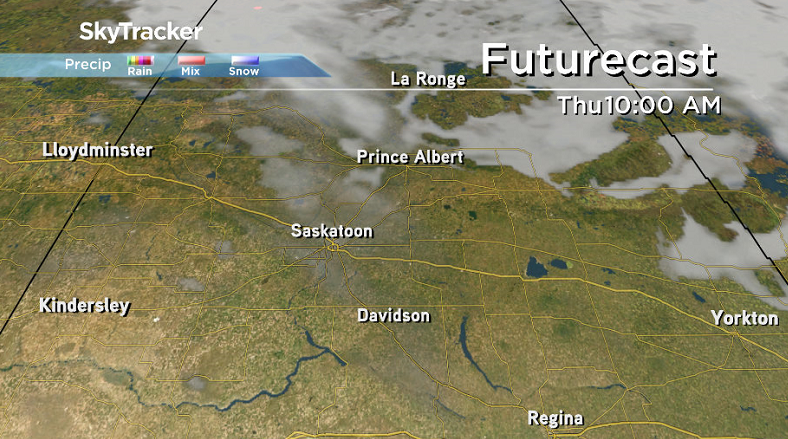
After an October with less than half our normal sunlight (see October 2016 recap details below), today will finally be Saskatoon’s last cloudy day in quite awhile!
We did see some clear moments overnight, but as soon as the sun rose, mostly cloudy skies moved back in.
-7 was what it felt like with wind chill early this morning as the mercury dipped back to -2 this morning, before quickly warming back up above freezing.
We pushed up to 4 degrees by noon with snow north of the city and rain to the south.
We may see a few sprinkles into the afternoon as cloud cover continues and temperatures top out around 5 degrees or so later today.

Get daily National news
Tonight
Clouds should finally clear out of the area overnight tonight as thermometers dip back a degree or so below freezing with a few fog patches possible.
Thursday
-4 is what it’ll feel like with wind chill when you head out tomorrow morning, so you’ll want the gloves to start out your day, but you’ll probably be able to shed them by afternoon.
A few clouds will stick around early in the day on Thursday as a warm front pushes through, but sunshine will become the dominating feature progressing through the day as temperatures climb up into low double digits by afternoon!
Friday
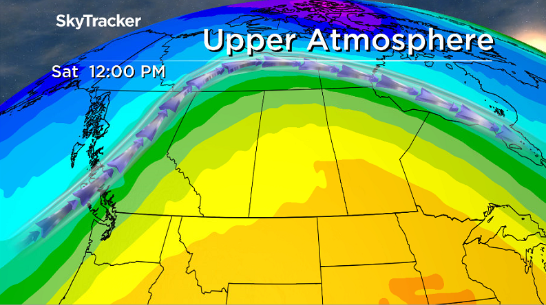
A massive upper ridge of high pressure that will span around half of North America continues to build in over the area on Friday.
That’ll keep us under mostly sunny skies with a daytime high once again pushing into low double digits.
Weekend Outlook
The ridge looks to hold strong right through the weekend with afternoon temperatures potentially topping out as warm as the low teens both Saturday and Sunday with mostly sunny skies across the board!
October 2016 Recap
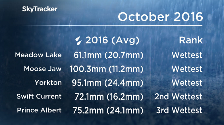
October 2016 was the wettest October ever recorded in parts of Saskatchewan, including Meadow Lake, Yorkton and Moose Jaw with Prince Albert reporting the 3rd wettest.


After coming off of a warmer and drier than normal September, the month of October was completely the opposite for Saskatoon!
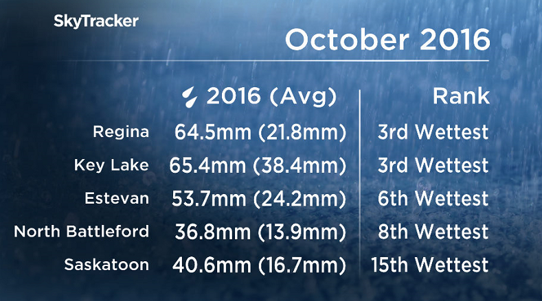
October 2016 was much colder and wetter than normal in the city with temperatures an average of two degrees cooler than normal and over two times our normal precipitation.
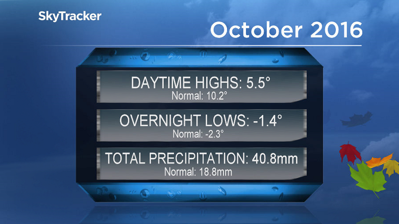
When you break the numbers down, the city saw 40.8 millimetres of melted snow, rain and other forms of precipitation throughout the month when normally we would see 18.8 millimetres.
Temperatures were particularly interesting as overnight lows actually trended almost one degree warmer than normal during the month, but it was countered by overnight lows that were nearly five degrees colder than normal!
It was also a very cloudy month for Saskatoon with 12 whole days with absolutely no sunshine!
This Your Saskatchewan photo was taken near Leader by Linda Coates:

Saskatoon weather outlook is your one stop shop for all things weather for Saskatoon, central and northern Saskatchewan with a comprehensive look at your local forecast that you can only find here.
Comments
Want to discuss? Please read our Commenting Policy first.