
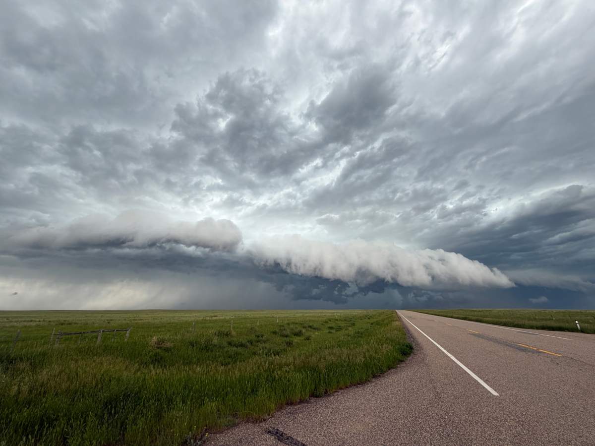
A tornado warning was issued for about an hour for a rural area between Brooks and Medicine Mat, where a severe thunderstorm was sweeping across southeastern Alberta on Tuesday afternoon.

Environment Canada said at 3 p.m. its meteorologists were tracking a severe thunderstorm just south of Tilley that was possibly producing a tornado.
The thunderstorm was moving southeast at 40-65 km/h across a rural area between Brooks, Medicine Hat and Lethbridge — essentially following the route of the Trans-Canada Highway.
The warning was downgraded from a red tornado warning to an orange severe thunderstorm warning at 4:11 p.m., when Environment Canada said it was capable of producing damaging wind gusts, loonie to ping pong ball-size hail and heavy rain.
The communities in the path of the storm include Medicine Hat and Seven Persons, while Redcliff, Canadian Forces Base Suffield and Bow Island were dropped from the warning.
Significant damage to buildings and/or trees is likely, the national weather agency said.
People outside are advised to protect themselves from flying debris and hail. If you hear roaring wind, see a funnel cloud, flying debris, or any threatening weather approaching, take shelter immediately.

Get breaking National news
Tornado warnings are issued when a thunderstorm is producing or is likely to produce a tornado, creating a life-threatening situation.
While the warning was downgraded, Environment Canada noted a severe thunderstorm can still produce tornadoes.
Severe thunderstorm warnings are issued when imminent or occurring thunderstorms are expected to produce damaging hail, wind or rain.
Action to take:
- Take cover immediately in a basement, interior room, or a sturdy shelter when threatening weather approaches
- If no shelter is available, lie in a low spot and protect your head from flying debris
- If you are out on the water when threatening weather approaches, return to shore and seek shelter, if possible
- Otherwise, move away from the path of the tornado to escape
- Wear your lifejacket, lie face down and protect your head
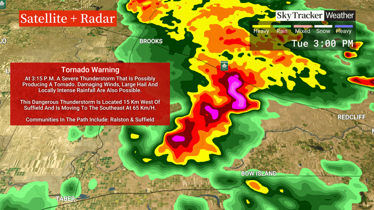


The tornado warning via an Alberta Emergency Alert was initially issued for the County of of Newell near Tilley and Rolling Hills, and shortly later expanded to include Cypress County near Suffield, Bowell, Redcliff and Hwy 879.
The storm comes after a severe thunderstorm watch was issued Tuesday morning for much of southern Alberta.
Environment Canada said conditions were favourable for the development of severe storms in the afternoon and evening that may be capable of producing strong wind gusts, large hail and heavy rain, as well as a chance of tornadoes.
Environment Canada says wind gusts of up to 80 kilometres per hour are also possible in the Lethbridge and Medicine Hat areas — and may be strong enough to damage trees, buildings and overturn vehicles.
There have been at least 10 tornadoes in Alberta this year so far, all the southern portion of the province, but The Northern Tornado Project and Environment Canada said they were all landspouts, not supercell twisters, and didn’t cause any damage.
This is a breaking news story. More to come…
With files from Ken MacGillivray, Global News
Comments
Want to discuss? Please read our Commenting Policy first.