

A significant weather system mid-week could bring more snow, possibly even mixed with rain, to southern Ontario just days after the area got dumped with the white stuff — and there looks to be another storm by the weekend.

“After a system over the weekend that brought the most significant snow of the season so far for the GTA we are tracking another system that will move in by midweek,” Global News meteorologist Ross Hull said on Monday.
Hull said a Texas low (a system forming over Texas) is coming for the Great Lakes and southern Ontario, including the Greater Toronto Area, by late Wednesday.
“Texas lows can often be tricky to forecast because their track is often key to determining precipitation type,” Hull continued, adding more will be known about the system’s track over the next 24 hours. “They can advect warm air from the southern U.S., which can lead to a mix of precipitation or even rain in some cases.”
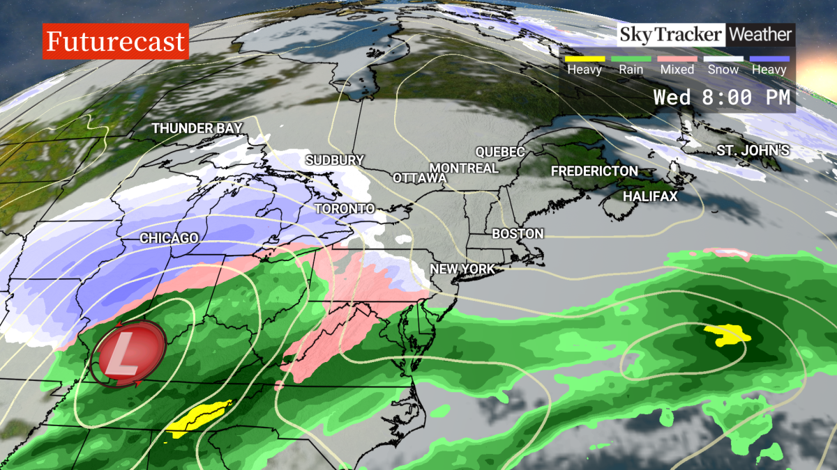
However, Hull said there appears to be enough cold air in place by Wednesday afternoon for the system to bring snow, which could be heavy at times. He notes this could have a big impact on the Wednesday evening commute.

Get daily National news
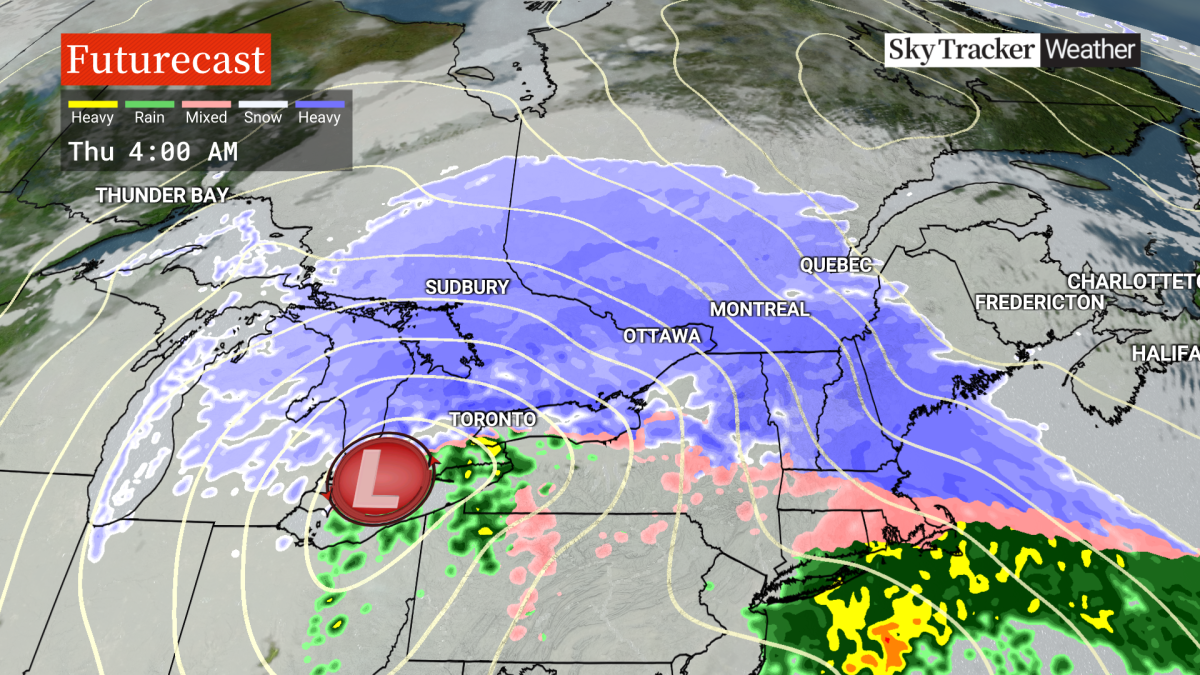
He said meteorological computer models are showing between 10 and 20 cm with the initial wave of precipitation for Wednesday night into early Thursday.
But, Hull said some models are showing a transition to mixed precipitation for the northern shores of Lake Ontario and Lake Erie — including parts of the GTA — that may be a mixed bag of freezing rain, ice pellets and even a snow-rain mix that could reduce the overall snow accumulations in the area.
Environment Canada issued a “significant weather outlook” for this week that included a “potentially impactful system” on Wednesday night into Thursday that is expected to bring freezing rain and snow into southern Ontario.
Areas such as Caledon, Orangeville, Barrie, Orillia and cottage country towards Sudbury to Ottawa were placed under a winter storm watch on Tuesday. Snow accumulation is estimated at between 20 to 40 cm in this area, according to Environment Canada.
The weather agency also noted peak snowfall rates could possibly exceed 5 cm per hour.
This next round of snow comes days after Toronto and parts of southern Ontario got dumped with of up to 20 cm of snow in some areas on Saturday night into Sunday.
- Old Man Winter wallops B.C.’s Mainland/Southwest region, major highway closed
- Calgary hit by unexpected blast of spring snow, causing dozens of crashes
- False spring strikes again: Saskatchewan prepares for incoming winter weather
- Albertans’ interest in alternative forms of travel growing as fuel prices spike


For those with travel plans on the road or by air, Hull said this is a system to watch out for on Wednesday.
As well, Hull said models are showing another potential winter storm emerging from the U.S. this upcoming weekend, which could bring more heavy snow to the area on Saturday into Sunday — making it three storms in one week for southern Ontario.


Comments
Want to discuss? Please read our Commenting Policy first.