

January’s deep freeze appears to be thoroughly in the rear-view mirror as a series of wet and temperate weather systems rolls towards B.C.’s South Coast.

Global BC senior meteorologist Kristi Gordon says the forecast shows the potential for a pair of atmospheric rivers to hit the region, starting late this weekend.
“The exact timing of these AR events is still a little uncertain, however, current estimates show a Sunday into Monday event and then a Tuesday into Wednesday event,” Gordon said.
Both systems are currently classified by the Center for Western Weather and Water Extremes as “weak” or “AR2,” meaning “mostly beneficial, also hazardous.”
B.C.’s Ministry of Emergency Management and Climate Readiness issued a statement late Thursday, warning of significant rainfall accumulations.
“The Province is monitoring conditions closely, working directly with communities on preparedness activities, and prepared to deploy as many as four million sandbags and other flood-related emergency-response strategies if needed,” the ministry said.

Get breaking National news
The ministry said West Vancouver Island and the Coast Mountains could see as much as 300 mm of rain in the five days between Jan. 27 and Jan. 31.
The Howe Sound region could get up to 250 mm, inland Vancouver Island could get up to 150 mm, the Fraser Valley could get up to 120 mm, it said.
The inbound systems have prompted the B.C. River Forecast Centre to issue a flood watch for the South Coast and Vancouver Island, along with a high streamflow advisory for the Lower Fraser River.
The agency forecasts the heaviest rain to fall over West Vancouver Island and the Coast Mountain, with the peak on Monday.
“Temperatures are expected to warm during this period, and snowmelt at lower and mid-elevations will provide additional runoff to rivers,” it warned.
The region has already seen a wet week, and Gordon said there are still two more rain systems on deck Friday and Saturday before the Atmospheric Rivers move in late weekend.
The ground will be saturated is already saturated, meaning there is the possibility of a large amount of runoff.
Another big concern is the impact on the South Coast mountains, Gordon explained.
“The current El Niño season has already brought a record warm December 2023 and very little snow and now the end of January is proving to be similar.”


Atmospheric rivers are a normal meteorological phenomenon, and are essentially ‘rivers in the sky’ that transport warmer subtropical moisture thousands of kilometres — with the potential to significantly raise local freezing levels.
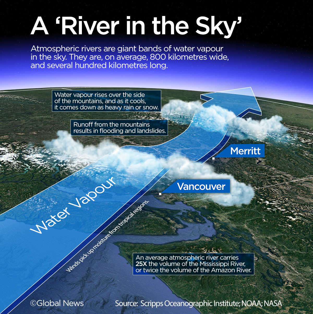

Gordon said the forecast shows the potential for freezing levels on the South Coast to climb above 2,000 metres late Saturday through Wednesday.
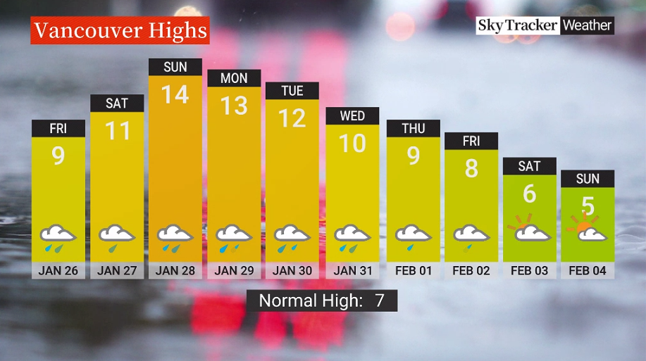
Temperatures in Metro Vancouver could reach 14 C on Sunday, seven degrees above seasonal for this time of year, Gordon said.
While significant uncertainty remains about the exact locations and totals for the heaviest rainfall, the River Forecast Centre is warning people to be prepared for elevated flooding hazards and to keep away from fast-flowing waterways.
Comments
Want to discuss? Please read our Commenting Policy first.