

Parks Canada gave an update on the Verdant Creek wildfire on Tuesday, explaining the unique way the fire was first detected by staff in Calgary and how drones are currently being used to help put out hotspots.

The wildfire was ignited by lightning on July 13 or 14 and is active in Kootenay National Park and Mt. Assiniboine Provincial Park, but Parks Canada says it remains on the west side of the Continental Divide, adjacent to Banff National Park.
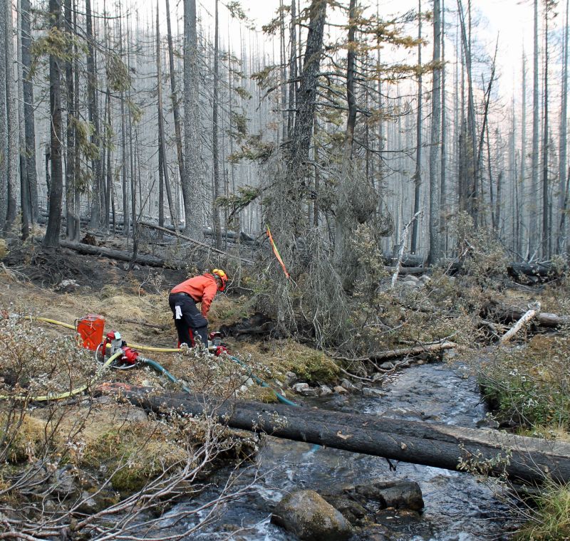
Parks Canada incident commander Jed Cochrane said crews discovered the fire on July 15. He said it wasn’t a “typical” case, in that usually people driving on the highway or hiking in the backcountry call in to report such fires.
“In this case, the fire was in Verdant Creek…one of the most remote places in probably the Rocky Mountain national parks; it’s tucked way in the backcountry,” Cochrane said. “So the fire was actually found by one of our fire staff in Calgary who noticed the heat signature from the satellite on the camera and phoned us to let us know that there was a likely a fire in the backcountry of Verdant.”
The current size of the fire is estimated to be approximately 15,555 hectares with 7,756 hectares burning in Kootenay National Park, according to Parks Canada.

Cochrane said the fire currently appears to be one or two hotspots in the area and crews are there “patrolling.”
“We’re using infrared drones to scan the area at night,” he said.
“Those drones are looking for the little heat signatures, the little hotspots on the ground.”
He explained those drones send back a GPS coordinate and then crews go to those coordinates to put the hotspots out.
“It’s kind of a long, tedious, slow process that will continue for the coming weeks,” he said. “And the crews are just in there, working away and doing that right now.”
On Tuesday, Parks Canada provided members of the media with an aerial tour of the fire and an update on where it’s currently burning and what’s being done to fight it.


The wildfire has had a significant impact so far: Sunshine Village was forced to close temporarily, as were certain trails in Banff National Park. Sunshine has since re-opened, but some parts of Banff remain closed.
A travel advisory is still in effect for Highway 93 South from Castle Junction to Radium, according to DriveBC.
“Firefighters will be working adjacent to the highway and reduced speed zones will be in place,” reads an alert on the website. “Drivers should anticipate possible delays.”
What’s closed:
In Banff National Park:
- Fatigue Creek Trail, Fatigue Pass, Citadel Pass Trail and backcountry campground Su8
- Ball Pass Trail from west of Re21 to the Park Boundary and Re21
- Redearth Pass Trail past Egypt Lake Warden Cabin, including trail to Talc Lake
In Kootenay National Park:
- Area northwest of Honeymoon Pass Trail including Hawk Creek Trail
- Verdant Creek and Simpson River area
- The southwestern portion of the Vermilion valley
Click here for the latest update on the wildfire from Parks Canada.
You can check Drive BC and Alberta 511 for the latest traffic information
Comments