
Unsettled weather and cooler temperatures are in the forecast for parts of Ontario, with single-digit lows even likely soon in northern areas of the province.

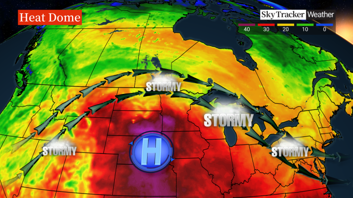
Global News meteorologist Anthony Farnell said a “major heat dome” is developing over the central United States, with Ontario remaining on the periphery.
“Showers and thunderstorms ride around the ridge … and will keep the weather unsettled for the second half of the week,” Farnell said, noting that thunderstorms are in the forecast on and off through Tuesday night extending into Thursday night for areas on that ridge.
“Some of these storms could be strong-to-severe with frequent lightning and very heavy rainfall.”
He said the strongest storms are likely across southwestern Ontario.
“It will also keep the temperature cooler in places like the GTA where highs in the low 20s are likely to last right through the middle of next week,” Farnell said.

Get breaking National news
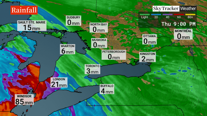
Parts of southwest Ontario will be the exception, he said, with at least a couple days of “oppressive heat and humidity this week.”
Thursday will likely be the hottest day for that part of the province, with highs in the low-to-mid 30s and a humidex “easily” topping 40.
“The sunshine will be back in full force everywhere by Sunday, but the cooler weather will continue, especially at night,” Farnell said.


Low teens are expected in Toronto at night, but single-digits are likely up north “which is a sign that the season is getting ready to change,” he said.


Comments
Want to discuss? Please read our Commenting Policy first.