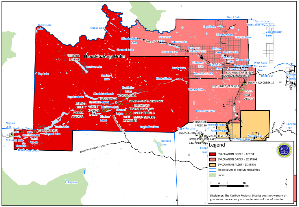
An evacuation alert in B.C.’s Cariboo region was upgraded to an order on Friday evening, forcing residents of the Lhoosk’uz area out of their homes.

The Cariboo Regional District’s order covers 135 parcels of land — and 333, 972 hectares — west of Quesnel.
The district said due to the urgent risk to health and safety, police or other groups will be “expediting” the evacuation.
Residents are urged to head east on 3900 Road or 4000 Road towards Nazko Road before arriving in Quesnel.
Afterward, they must continue north on Highway 97 to an emergency service centre at 2181 Ospika Road in Prince George, the district said in a Friday news release.
There are a handful of wildfires of note in the region, including Townsend Creek, Teepee Lake, Pelican Lake, Finger Lake, Finger Lake, Greer Creek, Davidson Creek, Gatcho Lake, and Nithi Mountain.
The closest one, the Townsend Creek wildfire, was first detected on July 8 and is believed to be caused by lightning. It is now burning out of control at an estimated 2,665 hectares.
Air quality in the area, meanwhile, has been compromised.
Environment Canada warned Saturday that residents of both Quesnel and Williams Lake were at “moderate risk,” with a “very high risk in smoke.”
According to B.C.’s air quality health index rating, the two communities were at 10-plus — the highest rating possible. Residents are encouraged to avoid or reduce strenuous outdoor activities.
As of Saturday morning, some 367 wildfires burned across the province, with more than 35 evacuation orders in place and almost as many evacuation alerts.


Comments