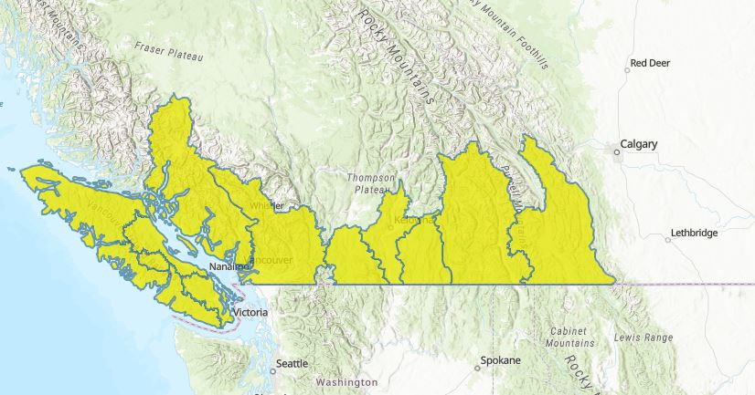
Residents of most of southern British Columbia are being advised to steer clear of creeks and rivers amid ongoing wet weather.

The B.C. River Forecast Centre issued new high-streamflow advisories for smaller and lower elevation creeks in the Okanagan and Similkameen regions Monday.
Those advisories are in addition to high-streamflow advisories already in place for the South Coast, Vancouver Island, the Boundary region and both the East and West Kootenay regions.
The forecast centre said a fontal system was forecast to affect the Southern Interior and stall over the Kootenays on Monday, bringing rainfall of up to 50 millimetres through to Tuesday.

Get daily National news
Environment Canada issued rainfall warnings for the West Kootenay and Elk Valley regions, while the Kootenay Lake, Boundary and Arrow Lakes to Slocan Lake region were under special weather statements due to forecast rain.

- Old Man Winter wallops B.C.’s Mainland/Southwest region, major highway closed
- Calgary hit by unexpected blast of spring snow, causing dozens of crashes
- False spring strikes again: Saskatchewan prepares for incoming winter weather
- Albertans’ interest in alternative forms of travel growing as fuel prices spike
Freezing levels were also forecast to rise to between 2,000 and 2,500 metres, bringing the potential for snowmelt.
“River flows in the South Interior are currently below normal as the freshet snowmelt season has yet to significantly begin. The upcoming moderate to heavy rainfall is expected to cause flashy rises in creeks and rivers in the region,” the forecast centre said.
“Smaller, low elevation creeks with remaining snowpack are most at risk. These rain-on-snow events have a high amount of uncertainty based on rainfall totals, ripeness of the snowpack to melt and the fluctuation of the freezing level.”
While the high-streamflow advisory for the South Coast and Vancouver Island remained in effect, Global BC chief meteorologist said the regions were expected to only see showers Monday, with the weather beginning to clear Tuesday and the potential for sunny breaks on Wednesday.


Comments
Want to discuss? Please read our Commenting Policy first.