
Conservation authorities have extended a flood watch for all waterbodies throughout the Peterborough, Ont., area.

On Tuesday Otonabee Conservation extended its flood watch which was first issued on March 29 for all watercourses and the Trent-Severn Waterway. The conservation authority’s jurisdiction includes Peterborough, sections of the City of Kawartha Lakes, and the townships of Asphodel-Norwood, Cavan Monaghan, Douro-Dummer, Otonabee-South Monaghan and Selwyn as well as the Municipality of Trent Hills.
Likewise, Kawartha Conservation issued a flood watch for its jurisdiction which includes the majority of water bodies within the City of Kawartha Lakes (including 27 lakes), along with the Municipality of Trent Lakes, Cavan-Monaghan Township, and Durham Region municipalities (Scugog, Brock, Clarington).
The conservation authorities note the region is to experience warm air temperatures and a potential thunderstorm with rainfall between 25 to 35 mm starting overnight Tuesday into Wednesday.
Environment Canada issued a special weather statement for Peterborough, Peterborough County and City of Kawartha Lakes with freezing rain also possible.
Otonabee Conservation says as a result, flooding is possible.
“The remaining snow and ice within the watershed is expected to convert to snowmelt run-off,” said Neil MacFarlane, Otonabee Conservation’s flood forecasting and warning duty officer. “Melting snow and ice combined with the forecasted rainfall and saturated ground conditions will cause possible flooding along local watercourses.”

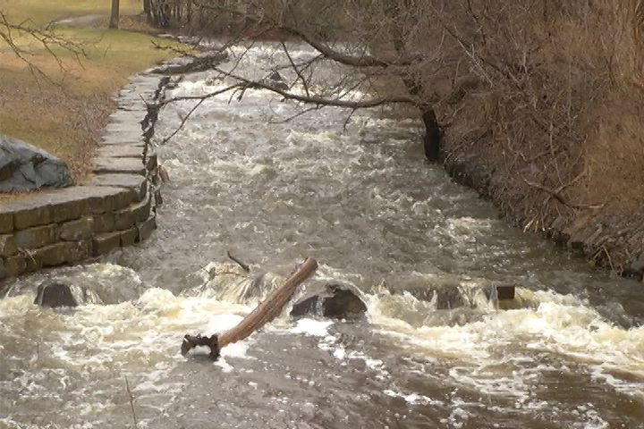
Along the Trent-Severn Waterway, inflows are accelerating into the Kawartha Lakes, Otonabee River, Rice Lake and Trent River, noted MacFarlane. As of April 4, flows on the Otonabee River currently measure 240 cubic meters per second.
“Water levels and flows on the Otonabee River have the potential to rise once the storage capacity of the Kawartha Lakes is exceeded,” he said. “Flooding of low-lying areas along the Otonabee River is expected.”
He said the influx of water entering the Kawartha Lakes will result in water levels rising and the ice cover breaking, which could lead to ice jamming and flooding.
“Flooding of low-lying areas along the Kawartha Lakes shoreline is expected,” he said.


Kawartha Conservation
Kawartha Conservation says no widespread flooding is expected but flooding in low-lying areas, areas adjacent to streams and road ditches may occur. Its flood watch will remain in effect until April 10.
“There is still a considerable snowpack in the watersheds to the north of the Kawartha Region which is expected to melt, and combined with the rainfall, will contribute to higher water levels in the Kawartha Region,” stated the authority.
“No flooding concerns have been reported at this time, however, pooling water in low-lying areas, ditches, and areas with poor drainage, has been observed. Residents in the Mariposa, Gull and Burnt River Watersheds as well as those that are in low-lying flood-prone areas are advised to monitor conditions.”
Both conservation authorities advise residents and businesses in low-lying areas to prepare for flooding and remain away from lakes, rivers, streams, creeks, wetlands, ditches, culverts and water control structures such as bridges.
Area water level information can be monitored online at:
- Trent-Severn Waterway’s Water Management InfoNet
- Water Survey of Canada Real-Time Hydrometric Data
- Otonabee Region Conservation Authority website
- Satellite built by N.B. students not responding a week after entering Earth’s orbit
- Stuck in B.C. lagoon for weeks, killer whale calf is finally free
- T. Rex an intelligent tool-user and culture-builder? Not so fast, says new U of A research
- Nearly 200 fossil fuel, chemical lobbyists to join plastic treaty talks in Ottawa
Comments