
You’re halfway to the weekend !

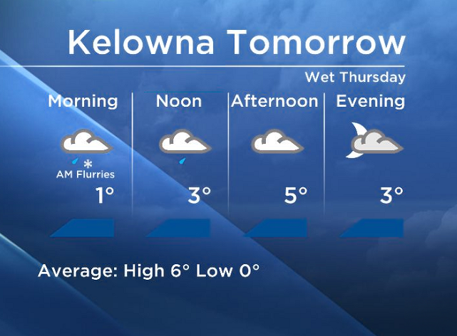
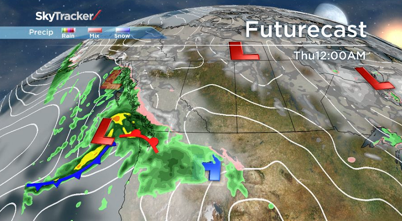
It will be a wet start for the second half of the work week as another system is on its way.
As freezing levels drop tonight, northern regions of our broadcast area will see snow overnight before it changes to rain tomorrow midday.
 Central and Southern Okanagan regions will see the possibility of flurries in areas higher than 650m Thursday morning, but as the day progresses the freezing levels will rise up to about 1000m.


The precip will taper off on Friday, and most areas will be dry on Saturday morning before another wave of moisture moves in Saturday evening.
Your full forecast coming up on Global Okanagan.
~Wesla/Duane
Comments
Want to discuss? Please read our Commenting Policy first.