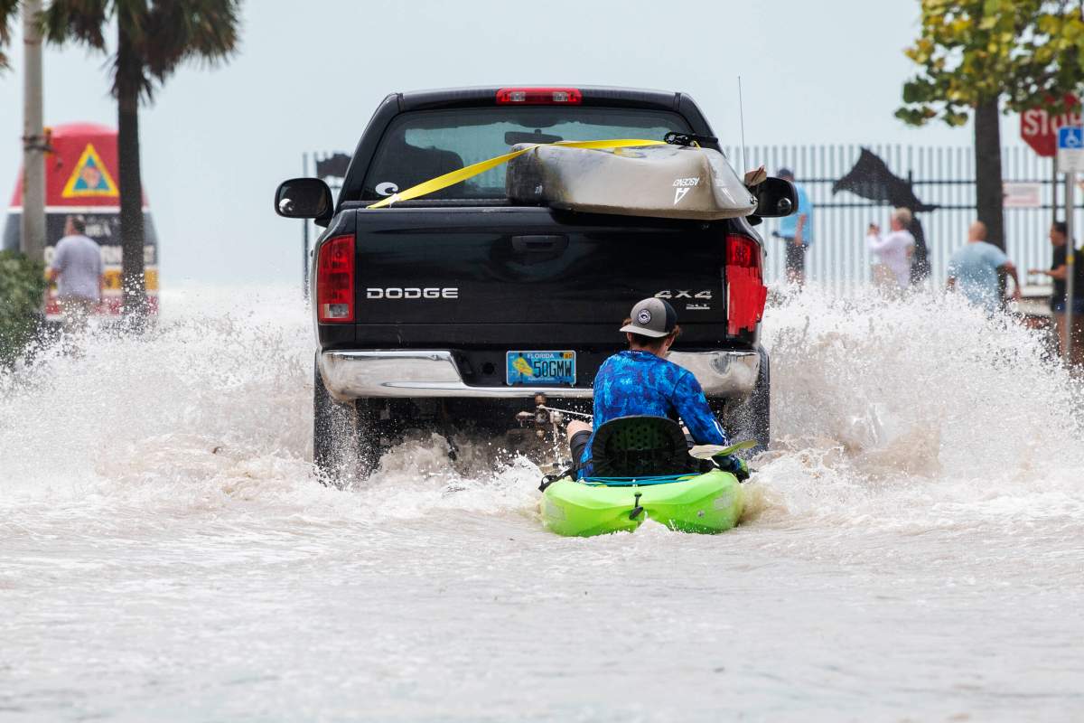
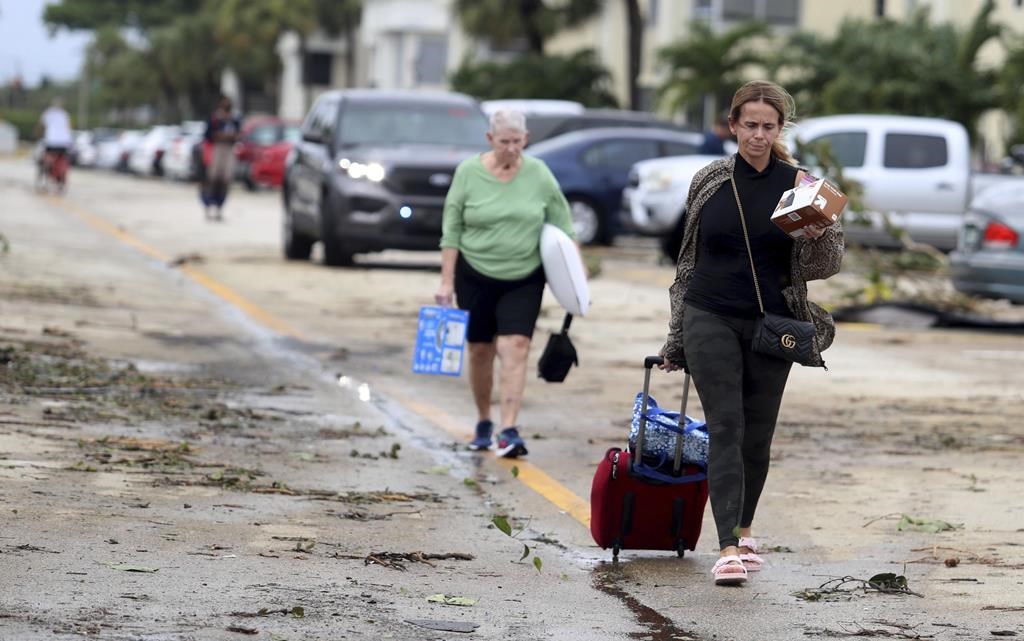
Hurricane Ian plowed into Florida’s Gulf Coast with catastrophic force on Wednesday, unleashing howling winds, torrential rains and a treacherous surge of ocean surf that made it one of the most powerful U.S. storms in recent years.

Crashing ashore as a Category 4 hurricane with sustained winds of up to 150 miles per hour (241 kph), Ian quickly transformed an idyllic stretch of sandy beaches and coastal towns into a disaster zone inundated by seawater.
Early video images of the storm’s fury on local TV and social media showed floodwaters sweeping away cars, nearly reaching rooftops in some communities and the ruins of homes as palm trees were bent almost in half.
Up to 30 inches (76 cm) of rain is forecast to fall on parts of central Florida as the storm moves inland, threatening to cause extensive flash floods. Nearly 2 million homes and businesses statewide were without power as of an hour before sunset, utilities reported.
“This storm is doing a number on the state of Florida,” said Governor Ron DeSantis, who asked U.S. President Joe Biden to approve a major federal disaster declaration providing a wide range of U.S. emergency aid to the entire state.
U.S. border authorities said 20 Cuban migrants were missing after their boat sank off the Florida coast as Ian neared the coast on Wednesday.
There were no immediate official reports of other storm-related casualties.

An unknown number of people were stranded in “high-risk” evacuation zones and in need of help after defying orders to seek higher ground, but rescue crews were unable to immediately reach them, the governor said.
Having swept past Cuba on Tuesday, leaving it without power for hours, Ian made landfall in Florida at 3:05 p.m. EDT (1905 GMT) on Wednesday near Cayo Costa, a barrier island just west of Fort Myers, the U.S. National Hurricane Center (NHC) reported.
The storm’s peak wind speeds put it just shy of a Category 5 designation on the Saffir-Simpson scale, the maximum classification.

Ian then churned ashore on Florida’s mainland, south of the harborside town of Punta Gorda, with slightly diminished winds topping out at 145 mph.

Get daily National news
DeSantis said Ian had generated life-threatening storm surges – waves of wind-driven seawater rushing in along the coast – of up to 12 feet (3.7 meters) in some places. Forecasters also warned of intense thunderstorms and possible tornadoes.
“This is a storm that we will talk about for many years to come, an historic event,” said Ken Graham, director of the National Weather Service.

The sprawling, slow-moving storm pushed farther inland as darkness fell, and within six hours of landfall was downgraded to Category 2, with top sustained winds of 105 mph (170 kmh), the NHC reported.
Further weakening was forecast over the next day or so as Ian crosses the Florida peninsula on a northeasterly track, expected to reach the Atlantic Coast on Thursday afternoon.
The governors of Georgia, South Carolina and North Carolina declared states of emergency as they braced for potential impacts as the storm moves north.
Scenes of devastation
The region around the landfall is home to miles of sandy beaches, scores of resort hotels and numerous mobile home parks, a favorite with retirees and vacationers alike.
An hour after landfall, video posted on social media and TV news outlets showed water fueled by storm surges rushing through several communities.
The town of Fort Myers Beach was nearly submerged by floodwaters. A view of Sanibel Island posted on Twitter showed the ocean sweeping over a seawall into a resort hotel’s swimming pool. Other video from the island showed roads inundated by the storm surge, rising to the tops of street signs.
Ian had knocked out power to at least 2 million homes and businesses in the first hours after landfall, local utilities reported.
- Iranian facing deportation for sanctions evasion tries to sponsor mother to immigrate
- ‘We’re there to help our allies’: Trump once again shifts reasoning for Iran war
- U.S. lifts sanctions on Venezuela’s acting president after Maduro capture
- Lost dog reunited with owner, rescued by helicopter after week in New Zealand forest
In terms of its sustained wind speeds, which peaked at 155 mph before landfall, Ian ranks as one of the most ferocious hurricanes to strike the U.S. mainland in recent years. By comparison, Hurricane Michael came ashore in Florida’s panhandle in 2018 with steady winds of 155 mph, while Ida last year packed sustained winds of 150 mph when it landed in Louisiana.

To stay or go
Even as Ian lashed the coast in the final hours before it swept ashore, authorities warned residents it was too late for anyone who had yet to evacuate to safely do so.
Earlier this week, more than 2.5 million residents had been told to evacuate. Doug Coe of Venice was one of those who chose to ignore warnings and stay put.
“I’m staying vigilant, but trying not to worry,” he said.

The region is dotted with mobile home parks, which most residents had abandoned, taking refuge in local schools and other facilities converted to emergency shelters. The area’s numerous assisted-living facilities were mostly evacuated, too.
Heartis Venice, an assisted-living home north of Venice, was an exception. Of its 107 residents, 98 decided to stay put with staff and some family members, general manager Michelle Barger said. The facility, opened two years ago, had stocked up in advance with food, water, medication and other provisions and was built to withstand a Category 5 storm, Barger said.
“Our community is locked down. We’re secure and we’re prepared for this,” she said.
Climate change is making hurricanes wetter, windier and more intense. There is also evidence that it is causing storms to travel more slowly, meaning they can dump more rain in one place, scientists say.
“Hurricane Ian’s rapid intensification could prove to be another example of how a warming planet is changing hurricanes,” said Kait Parker, meteorologist and climate scientist at IBM’s weather.com. “Research shows we are seeing this far more often than we did in decades past.”
(Reporting by Brad Brooks in Sarasota and Brendan O’Brien in Washington; Additional reporting by Jarrett Renshaw, Leah Douglas and Tyler Clifford in Washington; and Rich McKay in Atlanta; Writing by Brendan O’Brien; Editing by Frank McGurty and Lisa Shumaker)
—Additional files by Global News


Comments
Want to discuss? Please read our Commenting Policy first.