Looks like the South Coast will now string together four days of dry weather, possibly more.

This will be the first time in over two months we’ve been able to enjoy a sunny stretch of weather. (Perfect timing for the May long weekend.)
Why has our spring weather been so wet, cold and gloomy? Well, you can blame La Niña.
La Niña has been the key driver behind our weather since last summer. The strength of La Niña and its influence started off weak but strengthened to moderate in the fall and has remained that way since.
What does this mean?
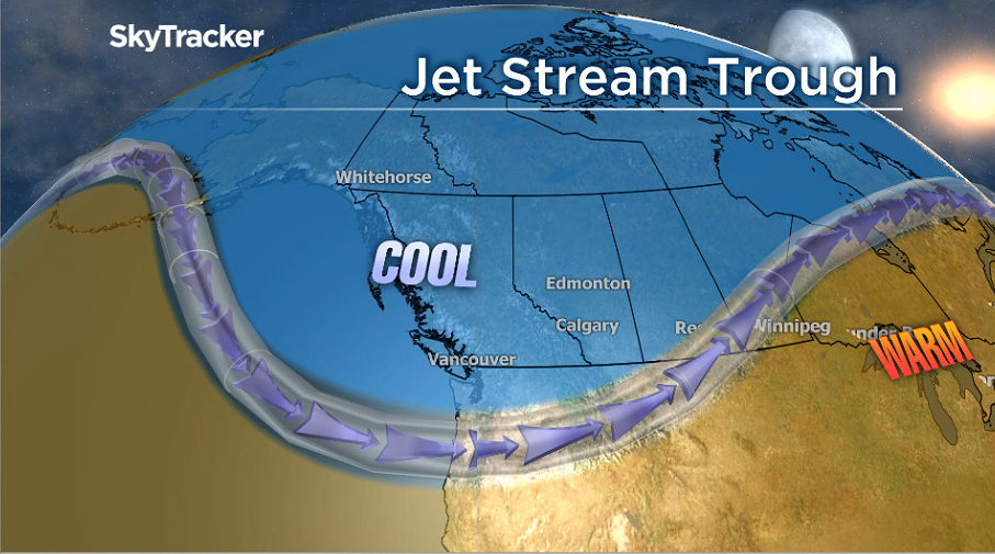
La Niña is an upwelling of cold water in the eastern Pacific Ocean near the equator. This giant pool of cold water near the surface influences the position of the jet stream. It pushes the jet stream northward over the U.S. Pacific Northwest and B.C.
Since low-pressure systems run along the jet stream, the target of most wet weather ended up being B.C., Washington and Oregon.

Get daily National news
In addition, western Canada experienced a relentless series of what meteorologists call upper-level troughs. These are dips or ‘troughs’ in the jet stream which allow cold air down from the arctic.
This type of feature was responsible for the record-breaking stretch of cold B.C. endured in December and the continued cool weather we’re experiencing this spring.
Climatologist Faron Anslow compares our current La Niña influence to that of 2011.
“Unfortunately for warm weather lovers, the cool spring in 2011 lasted until mid-July,” he said.
“However, there are many reasons to celebrate a cool, moist spring: much-needed snow in the mountains, ample water resources, maybe a reduced fire season (too soon to tell), and cool streams for salmon.”
Anslow adds, “the major downside is that a rapid warm-up could lead to freshet flooding in southern B.C.”
At this time, there is a 59 per cent chance La Niña will continue into summer. If this is the case, and B.C. doesn’t experience a sudden period of extreme heat, we may be spared the devastating spring flood season.
The current warm stretch of weather expected for the May long weekend doesn’t indicate a change from the La Niña influence.
Temperatures in the coming days will climb to near seasonal values and thankfully not much higher.
Residents should be pleased though, highs of 17 degrees Celsius along the coast will feel quite balmy compared to what we’ve been used to.


Comments
Want to discuss? Please read our Commenting Policy first.