

A winter storm warning remained in effect for London and Middlesex County early Thursday evening, as snowfall, set to continue through the night, began blanketing the region.

Winter storm and snowfall warnings are in place across a majority of southern Ontario, all due to the same weather system that’s tracking northeast across the province and across several parts of the U.S.
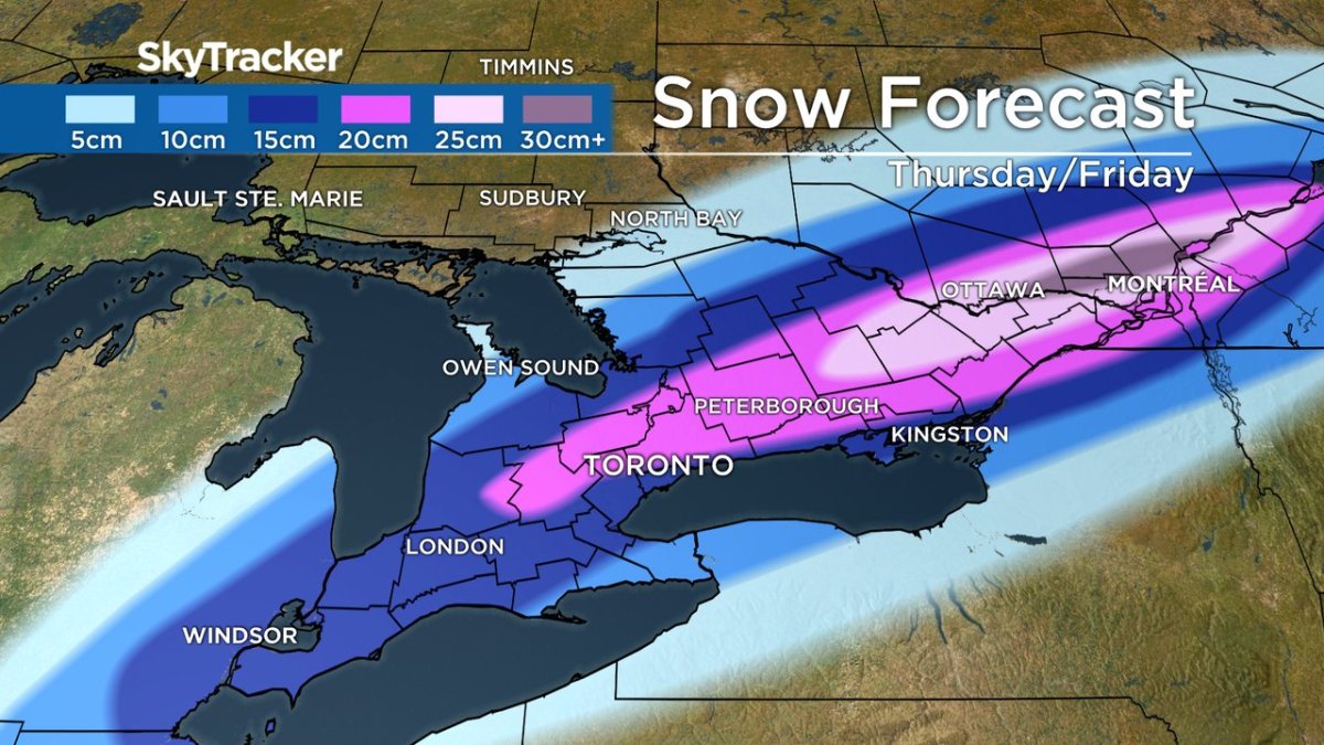
According to Environment Canada, total snowfall accumulations of 10 to 20 centimetres are expected in the region as a result of the system, and snowfall may be heavy at times, causing reduced visibility and blowing snow.
The national weather service says snowfall is expected to end early Friday morning.
Road conditions are expected to be slick as a result of the freezing rain and ice pellets that fell across the London region throughout the afternoon Thursday.
The messy weather led the Thames Valley District and London District Catholic school boards to close their schools Thursday. Western University also suspended evening operations as of 4:30 p.m.
Flood warnings are in place for Catfish Creek Conservation Authority for low-lying areas, and for Long Point Region Conservation Authority for riverines.
- Life in the forest: How Stanley Park’s longest resident survived a changing landscape
- Bird flu risk to humans an ‘enormous concern,’ WHO says. Here’s what to know
- More youth are seeking EI amid rising unemployment rates: StatCan
- Mental health support still lacking 4 years after mass shooting: Nova Scotia mayor
Flood watches are also in place from the Lower Thames River and Upper Thames River conservation authorities.
In a statement Thursday, the Upper Thames River Conservation Authority (UTRCA) warned members of the public to stay off frozen bodies of water, and to exercise extreme caution around waterways, saying any ice cover would be unstable.
“The ice on flood control reservoirs, including Fanshawe, Pittock, and Wildwood Reservoirs, is especially hazardous due to fluctuating water levels. Banks adjacent to rivers and creeks are very slippery and, combined with the cold, fast-moving water, pose a serious hazard,” the statement read.


UTRCA authorities said roughly 20 to 40 millimetres of rain had been received in the upper Thames River basin since Wednesday night. Coupled with the milder temperatures seen Wednesday through early Thursday, melting of the snowpack had caused streams and rivers to rise quickly due to thaw.
“Flows in the London area are expected to peak around midnight tonight,” UTRCA’s statement said. No serious flooding is expected, but low-lying areas that are known to flood may see some water spill over the riverbank.
“The UTRCA’s flood control reservoirs at Fanshawe, Wildwood, and Pittock Conservation Areas are at seasonal levels and are being operated to reduce any downstream flooding,” officials said.

Comments