Only days after the southern parts of British Columbia were devastated by a historic atmospheric river, fresh warnings of the potential for flooding have been issued for parts of the north coast.

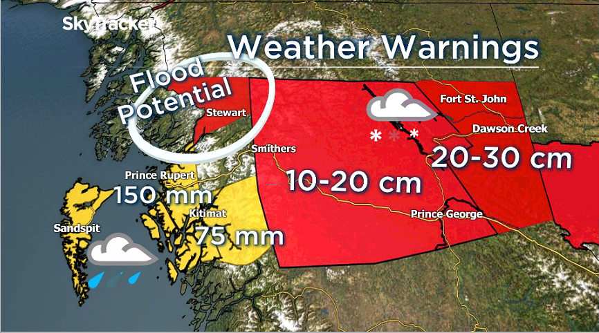
Environment Canada has issued a winter storm warning for inland regions of the north coast, including Stewart.
This region has received significant snow lately and up to 25 centimetres is expected Friday night and Saturday.
The threat of flooding arrives Sunday as B.C.’s sixth atmospheric river of the season is forecast to hit the region.
Read more: B.C. floods: Highway route restored between Lower Mainland, B.C. Interior for essential travel
This potent system will bring heavy rain and mild temperatures through Monday. This will cause freezing levels to soar to 1,000 meters while the region is pounded with rain.

Get daily National news
Snow on the ground and lower mountains could melt rapidly.
The term “snow eater” has been used to describe this type of scenario, and the resulting flooding can be swift and devastating, as southern B.C. knows all too well.
According to Environment Canada, the snow “will melt as the rain system arrives and drainage systems could be blocked or overwhelmed.”
“Localized or perhaps widespread flooding could result. Landslides could occur,” the national weather agency added.
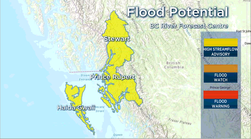
Meanwhile, a high streamflow advisory has been issued for areas closer to the coast.
The B.C. River Forecast Centre issued the advisory for the “north coast including Haida Gwaii and areas around Prince Rupert, Kitimat, Hartley Bay, Kemano and surrounding areas.”
According to Environment Canada, these areas could see 100-150 millimetres of rain over the weekend.
Read more: B.C. floods: Land, plants expected to recover, but concern for livestock remains, experts say
However, the B.C. River Forecast Centre is expecting even more — 200-300 millimetres through Monday.
“Rivers are expected to rise rapidly overnight Saturday and through Sunday,” the centre warns.
“Flooding is not anticipated at this time, however forecasts and conditions can change rapidly.”


Comments
Want to discuss? Please read our Commenting Policy first.