


The massive White Rock Lake wildfire burning in B.C.’s Southern Interior is burning aggressively to the south, prompting new evacuation orders and alerts spanning five jurisdictions on Sunday.

The wildfire, first discovered on July 13, is burning approximately 34 kilometres northwest of Vernon, B.C.

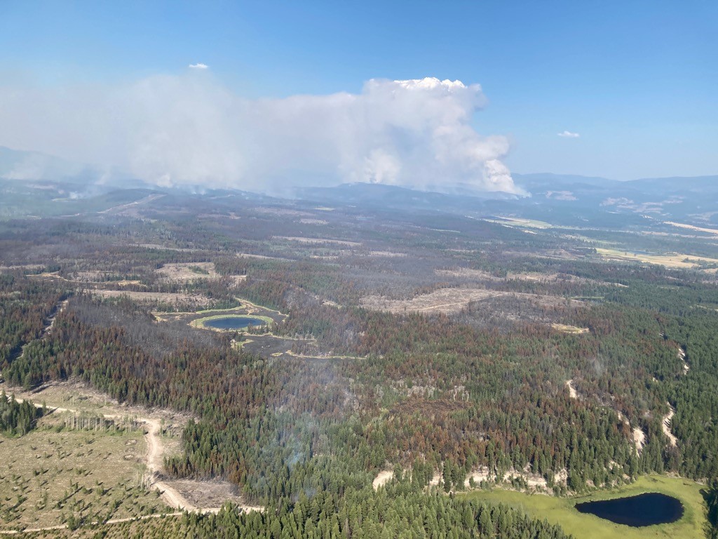
“Conditions on-site continue to be extremely smoky, which is hampering the ability for aircraft to fly and is challenging suppression efforts,” The BC Wildfire Service said in a community bulletin.
“Variable amounts of precipitation were seen on the perimeter of the fire yesterday, August 1.”
The northern areas on the fire in the Westwold area received up to 10 mm of rain, which was enough to provide a reprieve from fire behaviour over the next 24-48 hours, officials said.

The southern part of the fire received minimal precipitation. Temperatures are expected to remain in the mid-20s with gusty winds.

“In the south, fire behaviour continues to be quite active,” the fire service said.
“Crews are continuing to work towards safe, achievable operational objectives under extremely adverse conditions.”
The Thompson-Nicola Regional District (TNRD) has implemented an evacuation order for 85 properties and an alert for an additional 576 properties due to the wildfire.
The Columbia-Shuswap Regional District (CSRD) has evacuation orders and evacuation alerts in place.
The alert includes the southwest corner of CSRD Electoral Area D, including the communities of Falkland and Sweetsbridge, and all properties along ChaseFalkland Road to Joyce Lake.
On August 1, the Regional District of North Okanagan (RDNO) partially upgraded the evacuation alert area to an evacuation order for 49 properties in the Electoral Area B, above Westside Road, north of the Central Okanagan Regional District boundary, west of the Okanagan Indian Band IR #1 and south and west of Six Mile Creek Road.


The evacuation order for 20 properties and alert for 23 properties remains in effect.
On Sunday, the Okanagan Indian Band (OKIB) partially upgraded the evacuation alert to an evacuation order for areas below the Whiteman Creek drainage, south of the Mud Hole, including Parker Cove and Whiteman subdivision.
The existing alert for the remainder of OKIB IR#1 Reserve up to Newport Beach, including but not limited to Newport Beach, Old Mill site, Komasket Part Area, 6 Mile, Parkers Cove, and Whiteman’s Creek, is still in place.

The alert issued on July 31 for properties in the Regional District of the Central Okanagan (RDCO) was raised to an evacuation order.

In addition, a state of local emergency has been issued for the RDCO along North Westside Road resulting in an evacuation order for all properties in Westshore Estates.
There are 245 active wildfires burning in B.C., including 78 in the Kamloops Fire Centre, which includes the Okanagan region.
Province-wide, 63 evacuation orders have been issued, impacting 4,186 properties, as of Sunday. An additional 21,131 properties are under alert.
- Ontario First Nation declares state of emergency amid skyrocketing benzene levels
- ‘Sciatica was gone’: hospital performs robot-assisted spinal surgery in Canadian first
- Do Canadians have an appetite for electric vehicles? Experts are divided
- TikTok vows to sue over potential U.S. ban. What’s the legal outlook?
Comments