

Residents in the small recreational community of Eastgate, southwest of Princeton in B.C.’s Southern Interior, were forced to flee their homes on Saturday night due to a wildfire.

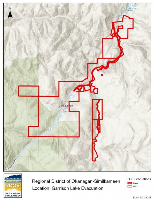
The Regional District of Okanagan-Similkameen issued the evacuation order for more than 100 properties on Saturday evening due to the Garrison Lake wildfire in electoral area H.
RCMP and search and rescue expedited notifications to clear people from the area.
The full list of impacted properties can be found on the RDOS website.
The evacuation order does not include the Manning Park Resort and area campgrounds, the RDOS said.
They include properties along Highway 3, Garret Road, Bonnevier Road, Thistle Road, Rivers End, Towers Road, Airstrip Road, Lupine Road and Garrett Circle.
All evacuees are asked to register online with the Emergency Support Services (ESS) Evacuee Registration & Assistance (ERA) tool even if you do not require referrals such as housing or other services: ess.gov.bc.ca
Due to a shortage of hotel accommodations, people displaced are urged to stay with family and friends.
Those who require services can visit the ESS Reception Centre at Chilliwack Secondary School.
The Eastgate community contains approximately 100 cabins and is located alongside the Similkameen River and EC Manning Provincial Park, approximately 55 kilometres southwest of Princeton.
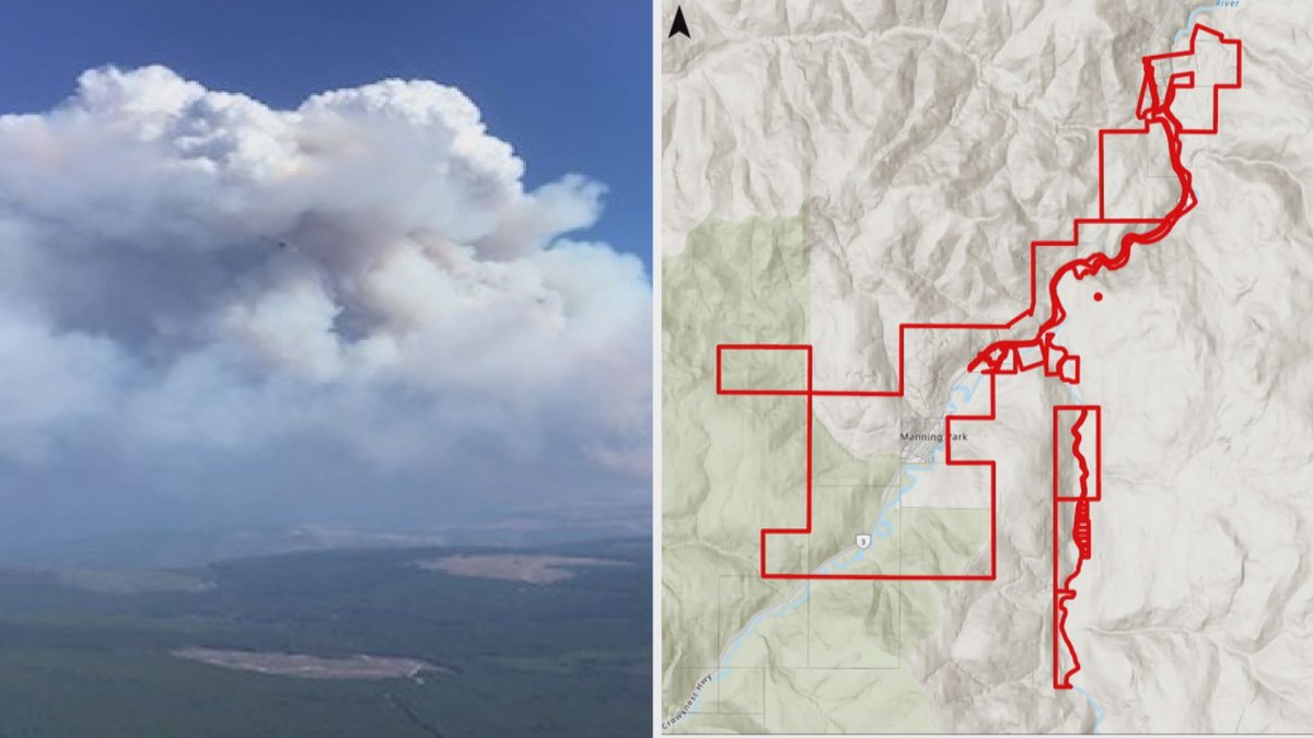
According to the BC Wildfire Service, the nearby Garrison Lake wildfire, first discovered on July 23, has grown to 8,175 hectares in size.


Fire officials report significant growth over the past 24 hours and aerial resources and ground personnel are involved in the firefight.
“Heavy smoke in the area has resulted in visibility issues for aircraft, and aggressive fire behaviour is occurring on-site due to heavy winds,” a Saturday update said.
“BC Parks has been notified about this fire as it has moved slightly into Manning Park.”
B.C.’s transportation ministry has issued a travel advisory along Highway 3 between Manning Park and Princeton due to limited visibility caused by wildfire smoke.
The road is open to traffic but motorists should drive with caution between Manning Park Resort and Frontage Road for 64 kilometres, the advisory stated.
Another 30-hectare wildfire, called the Fat Dog Creek wildfire, is also burning in Manning Park.

-
![]() Returning home after the Bush Creek East wildfire
Returning home after the Bush Creek East wildfire -
![]() Early start to B.C. wildfire season
Early start to B.C. wildfire season -
![]() 1,600 hectare wildfire burning between Quesnel, Williams Lake
1,600 hectare wildfire burning between Quesnel, Williams Lake -
![]() Global Okanagan News at 5:30: April 20, 2024
Global Okanagan News at 5:30: April 20, 2024 -
![]() Wildfire simulation on North Shore allows crews to prepare
Wildfire simulation on North Shore allows crews to prepare -
![]() Whistler prepares for wildfire season
Whistler prepares for wildfire season -
![]() New wildfire training centre coming to Kamloops
New wildfire training centre coming to Kamloops -
![]() New dedicated wildfire training and education centre in Kamloops
New dedicated wildfire training and education centre in Kamloops -
![]() Whistler’s wildfire defence plan
Whistler’s wildfire defence plan -
![]() 2024 B.C. wildfire season has started
2024 B.C. wildfire season has started


Comments