
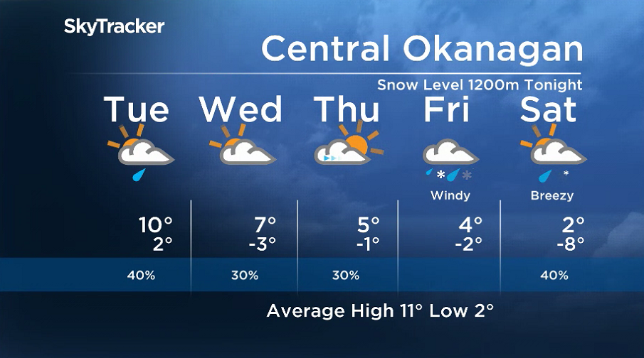
Clouds and a few showers will linger on Monday with the next wave of moisture pushing through, with daytime highs climbing towards double digits in the afternoon.

With the frontal system passing through, showers are likely to linger into Tuesday and temperatures hitting high single digits or low double digits.
Sunny breaks will finally return on Wednesday. However, the next front is likely to bring back clouds and a chance of showers later on, as temperatures climb to around 7 C.

A cooling trend is expected for the remainder of the week, with daytime highs falling into mid-single digits under partly-to-mostly cloudy skies.
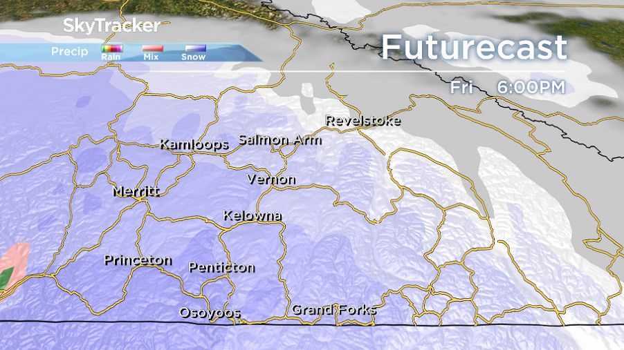
A major system pushes in on Friday, with the potential for significant rain and valley bottom snow on Friday into Saturday.


Get daily National news
It will be accompanied by strong winds and daytime highs back into mid-single digits.
For weather on the go download the Global News SkyTracker Weather App for iPhone, iPad or Android.


Comments