

On Jan. 29 through Jan. 31, 2020, B.C.’s coast got completely drenched with record rainfall — up to 140 millimetres in just over 48 hours.

Various regions were put under flood watch as rivers and streams rose to dangerous levels.
The Alouette Reservoir experienced record inflow levels. There were land and rock slides closing Highway 1 near Hope and the railway near White Rock for a period of time.
The side of an excavation wall caved in at a construction site in Vancouver and there was significant damage to the lot next to it.
Localized flooding and pooling water on roads were experienced in most low-lying regions.
Plus, there was significant loss to the mountain snowpack as freezing levels soared to 2000 meters.
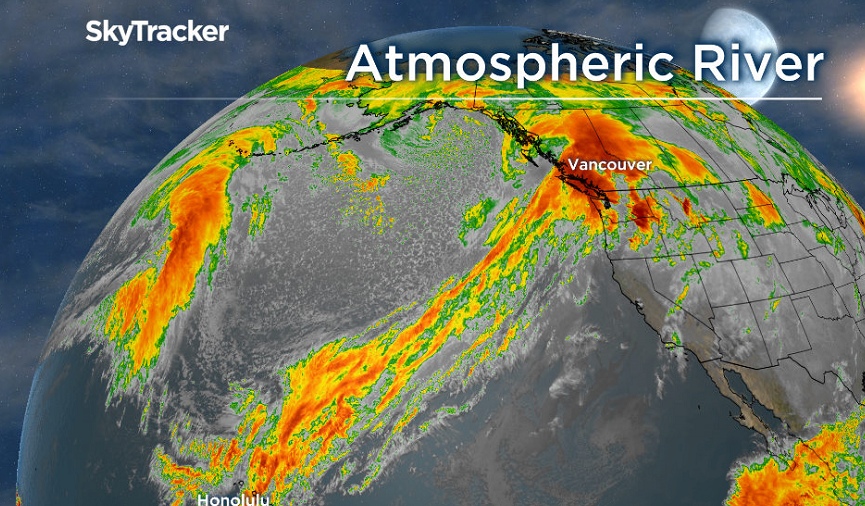
So why did we see so much rain? It was all thanks to an intense Category 4 Atmospheric River.
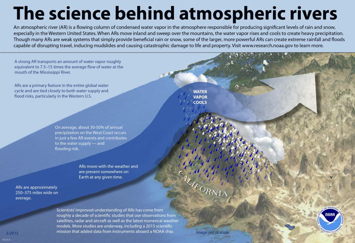
An Atmospheric River (AR) is a long, narrow feature in the atmosphere that can transport copious amounts of tropical or subtropical moisture in the form of water vapour. As the name suggests, it’s sort of like a river in the sky.
In fact, according to the U.S.-based National Oceanic and Atmospheric Association (NOAA), “a strong AR transports an amount of water vapor roughly equivalent to 7.5 to 15 times the average flow of water at the mouth of the Mississippi River.”

Get breaking National news
It dumps all of that water vapour as heavy rain, or snow for high elevation mountains.
This isn’t the first time the B.C. coast has experienced something like this.
The region can experience more than 20 atmospheric rivers in a single year. According to the NOAA, on average the west coast receives between 30 and 50 per cent of its annual precipitation from atmospheric river events.
Some of you may be wondering: “I thought this was a Pineapple Express?” You’re right: an Atmospheric River is the same thing as a Pineapple Express.
Those of us on the west coast have been using the term Pineapple Express for many years; perhaps it makes us feel a little better about getting soaked. But the term Atmospheric River was chosen by Atmospheric Scientists because it can be applied globally.
Just like other “newly” termed weather phenomena like the Polar Vortex or Bomb Cyclone, Atmospheric Rivers are becoming more prominent — and their impact more significant — as our climate changes.


A study done by the Pacific Climate Impacts Consortium found “the frequency of atmospheric rivers in British Columbia will increase by 2041-2070 under a high emissions scenario.” They project the average number of atmospheric river days could more than double along the coast.

This understanding has prompted a surge in the number of teams researching these major impact weather phenomena.
In fact, a research team out of the University of California – San Diego is using specialized aircraft called Hurricane Hunters (the planes used in hurricane reconnaissance missions) to fly into these Atmospheric Rivers in order to better understand their potential impact.
The team also created a new five-point scale in order to categorize the severity of a particular AR.
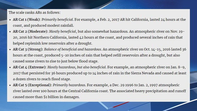
The Jan. 29 to 31, 2020 Atmospheric River was categorized as a Level 2 to 4 across the South Coast; a Level 3 to 4 for parts of southern Vancouver Island, Metro Vancouver, the Fraser Valley and Howe Sound; and a Level 2 for central and northern portions of Vancouver Island.
Note that the categorizing scale addresses the importance of rainfall for our reservoirs etc., but provides the ability to warn the public when the hazardous impact of a particular AR will outweigh the benefits.
Comments
Want to discuss? Please read our Commenting Policy first.