The worst is over in terms of extreme cold across Saskatchewan, but don’t expect warnings to go away anytime soon.

Extreme cold came crashing into Saskatchewan for the second full week of 2020 with warnings issued first for Saskatoon on Sunday night and then for Regina by early in the week.
After wind chills as low as -52 were reached in Saskatoon Wednesday morning and down to -47 in Regina, values finally started to moderate by Thursday morning, back into the -40 to -50 range.
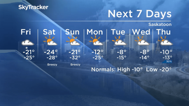
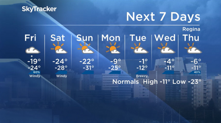
Cloud cover coming in helped bring in much-appreciated relief to the province on Thursday, which will keep wind chills in the -30 to -40 range for Friday as a system brings up to five centimetres of snow to some areas.
Skies clear back out this weekend with a return to overnight lows around the -30s and morning wind chills approaching the -40s both Saturday and Sunday mornings as daytime highs remain in the -20s.
That means during the day, even though temperatures could get as warm as -20, it will still feel like the -30s with wind chill, which means frostbite can set in on exposed skin in 10 to 30 minutes.
There is relief in the long-range forecast, with daytime highs expected to get into minus single digits by the middle of next week as the arctic high-pressure system that brought the cold finally slides aside.

The frigid weather brings ample opportunity to try some cold weather experiments like seeing how long it takes wet clothes to freeze and throwing boiling water into the cold air.
Because cold air can’t hold as much water vapour, water quickly condenses and the water droplets quickly freeze and form ice crystals.

Get daily National news
When you blow soap bubbles in the cold, they form quite quickly as well because a layer of water gets trapped between 2 layers of soap particles with the water layer in between freezing and causing a magnificent bubble to hold its shape as they freeze into a crystalline structure.
For the latest conditions and warnings, download the SkyTracker weather app.


Comments
Want to discuss? Please read our Commenting Policy first.