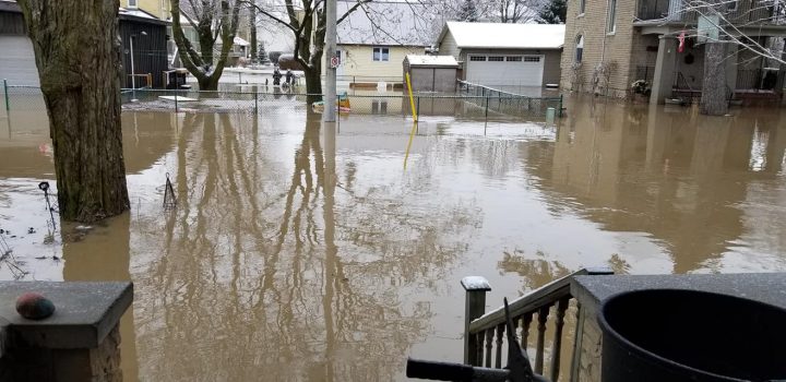
Communities across southern Ontario are assessing the damage that was caused as a result of a major storm that brought flooding and freezing rain to several areas.

Areas northwest of the Greater Toronto Area — such as Shelburne — experienced a heavy amount of freezing rain followed by snow. Several trees and properties became coated with a thick layer of ice, causing tree branches and trees to fall down.
Road closures were reported in Orangeville as crews worked to clear tree debris from roadways.
As of early Sunday, Hydro One reported hundreds of customers in the Shelburne area lost power. The electrical authority attributed some of the outages to downed trees.
Environment Canada issued a special weather statement for the community saying widespread power outages were expected to continue Sunday after approximately 10 to 25 millimetres of ice accumulation occurred.
“Although the freezing rain has now ended, strong wind gusts near 40 km/h are expected to continue this morning before easing off early this afternoon,” the statement read.
“Ice accretion on trees or power lines, in addition to the strong wind gusts this morning, has the potential to cause widespread power outages.”
The statement also covered areas north and west of Shelburne, including The Blue Mountains, Owen Sound, Hanover, and Mount Forest.

“Ice accretion due to freezing rain was most significant in the Shelburne and Hopeville areas, where ice build-up was close to 25 millimetres,” Global News meteorologist Ross Hull said.

Get daily National news
“The freezing rain in these areas was followed by a burst of heavy snow adding even more weight to the already stressed trees and power lines.”
Meanwhile, in the GTA, parts of York Region and Simcoe County saw mostly rain on Saturday and into early Sunday.
Several residences near Lake Simcoe in Innisfil saw front yards filled with water. Crews from the Town of Innisfil worked to pump water away from affected areas into the day Sunday.
Flooding was also reported in New Hamburg, west of Kitchener, where flows on the Nith River were expected to peak Sunday morning, according to the Grand River Conservation Authority.
The downtown area of Ayr, west of Cambridge, was also threatened by flooding, the agency said. There, the Nith River was expected to peak late Sunday.
Toronto police said officers closed the southbound lanes of the Don Valley Parkway Saturday evening due to overflow from the Don River that caused “excess flooding” on the highway. It reopened several hours later.
Officials also said that crews had to use a boat to rescue a man who got caught in the water near the Humber River Sunday morning.
In terms of rain, the Toronto and Region Conservation Authority’s real-time precipitation monitoring gauges in different parts of its service area recorded approximately 70 to nearly 100 millimetres of precipitation between early Saturday and Sunday morning.
Meteorologists said that amount of rain is equivalent to the total amount we would see in January and February combined in a typical year.
Places that did not initially see freezing rain still experienced a freeze overnight, leading to ice-covered roads and sidewalks.
“An unprecedented amount of rain fell across the GTA and parts of southern Ontario with this system,” Hull said.
“When that much rain falls in January with the ground frozen and saturated, it’s not surprising that there was flooding across the area.”


Comments
Want to discuss? Please read our Commenting Policy first.