
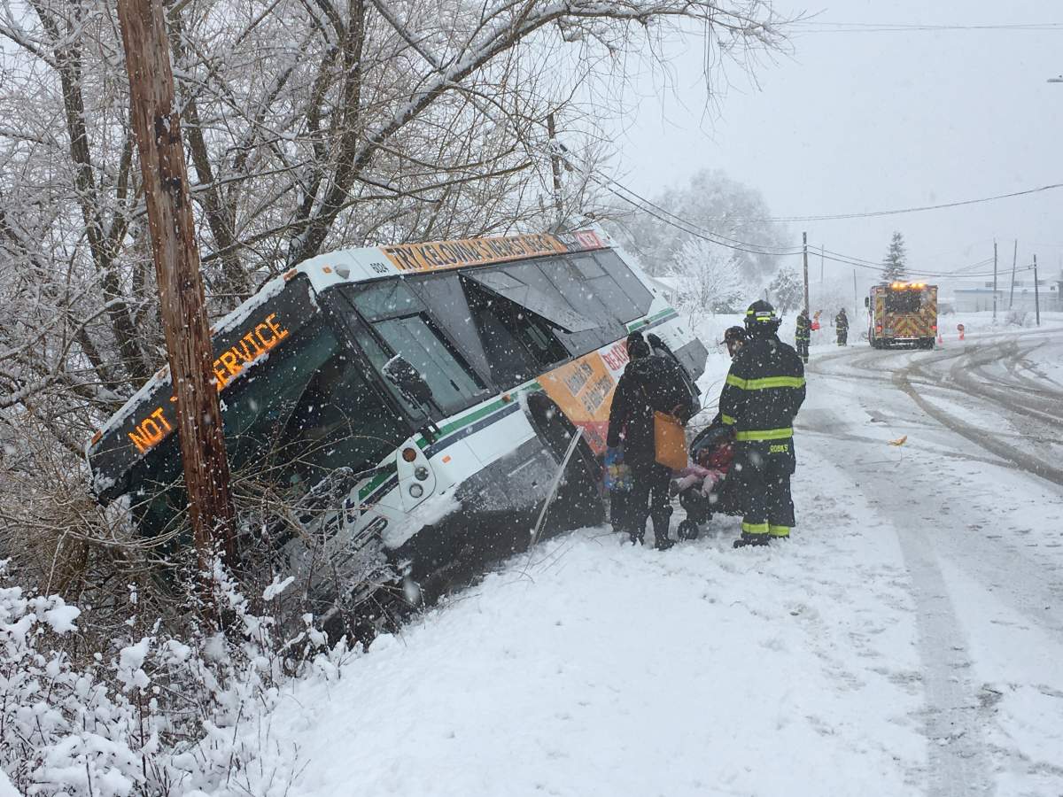
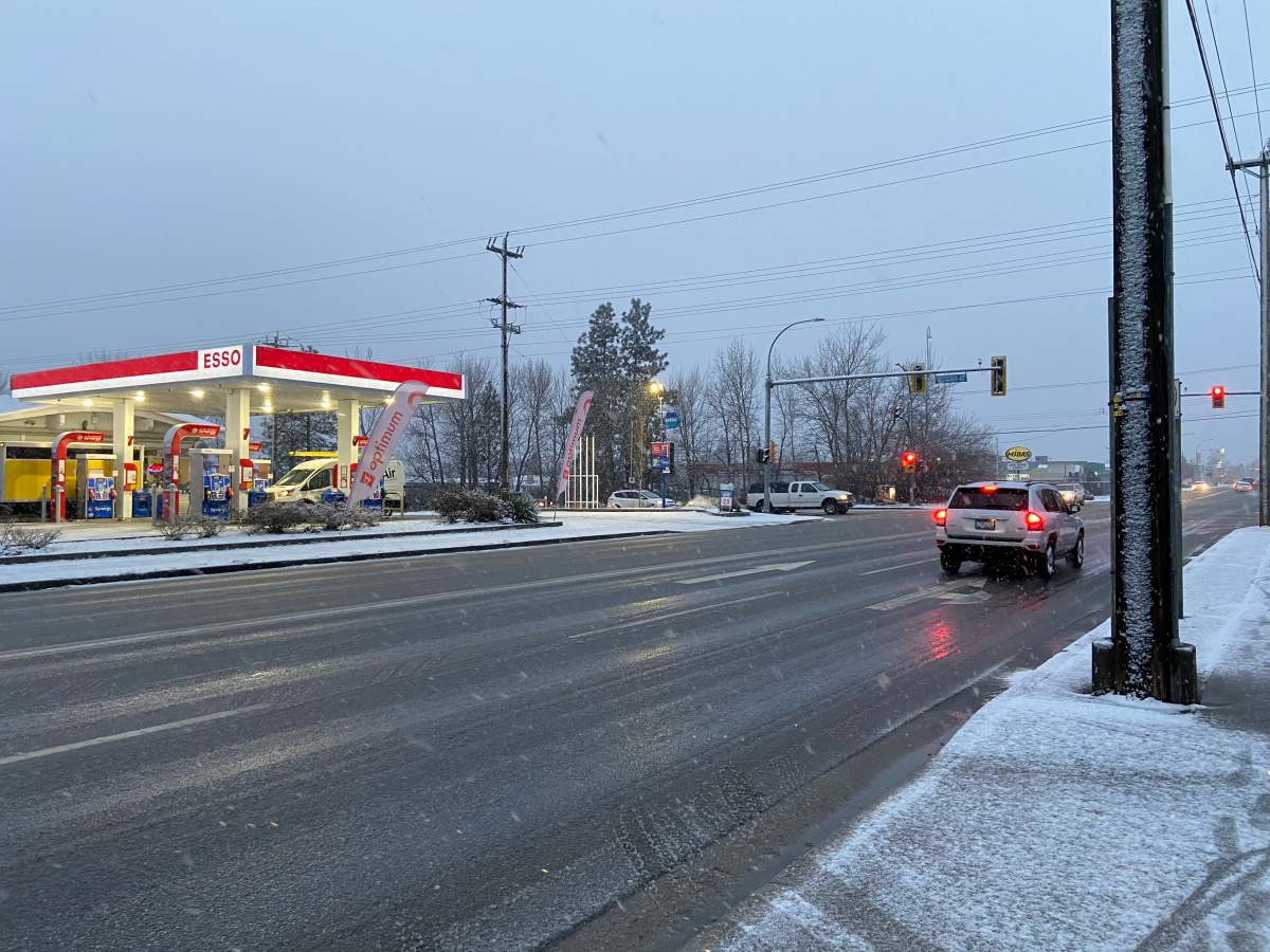
It’s a slushy and cold start to the New Year in B.C.’s southern interior as people head back to work and children return to school Monday morning.

Snowfall and winter storm warnings are in effect for the central and north Okanagan, Similkameen, Boundary, West Kootenay and Arrow Lakes regions.
Two pacific warm fronts are expected to bring 15-25 centimetres of snow to the Okanagan, but will shift to rain on Tuesday as warmer air moves into the region, according to Environment Canada.

“It’s giving us some really heavy snowfalls, some pretty significant accumulations are forecast.”
“We’re talking a lot of snow across the southern interior over the next 36 hours,” says meteorologist Doug Lundquist.

You can see an updated list of alerts here.
Drivers travelling on the B.C. Interior high elevation highway mountain passes, including the Okanagan Connector between Merritt and Kelowna, the Coquihalla Highway from Hope to Merritt, and Highway 3 between Hope and Princeton, are warned of snowfall in the amounts of 10-15 centimetres Monday and an additional 10-20 centimetres forecast to fall overnight.
“All passes are going to get significant snowfalls,” Lundquist said. “All of the passes in the southern interior are being affected by this snow storm.

Get breaking National news
“The only part of B.C. that is escaping that is areas in the central interior and further north to the Peace.”

The national weather service says there is also a risk of freezing rain developing Monday night and Tuesday morning.

Highway 3 at Paulson Summit in the Selkirk Mountains will be hit hardest, with up to 70 centimetres of snow expected to fall over the Kootenay Pass over the next 24 hours.
Travel is not recommended as poor weather conditions are likely to contribute to long-lasting transportation delays, according to Environment Canada.

The service is urging commuters to postpone non-essential travel until conditions improve.
“Surfaces such as highways, roads, walkways and parking lots will become icy, slippery and hazardous,” the warning states.
At lower elevations in the Kootenays, a long period of snowfall with total amounts of 20-30 centimetres is expected.
In the Similkameen Valley, Environment Canada is warning of hazardous winter conditions with accumulations of 10 centimetres of snow expected to fall on Monday.
“As warm Pacific air aloft progresses inland while cold air remains trapped near the surface, freezing rain will develop by early evening Monday and persist for several hours before ending overnight,” the warning states.

Meanwhile, winter storm “watches” have been issued for the Shuswap, West Columbia, West Kootenay, North Columbia, Kinbasket, Elk Valley and West Columbia regions.
Watches are issued when conditions are favourable for the development of severe weather, while warnings are issued when severe weather is either imminent or occurring.
Winter tires or chains are required on most routes in British Columbia from Oct. 1 to April 30.
Road maintenance contractors are issuing travel advisories and reminding drivers to clear snow from their vehicles before braving the roads.
Meanwhile, the weather system is bringing heavy downpours to B.C.’s south coast with rainfall warnings issued for the Fraser Valley as well as parts of Metro Vancouver and Vancouver Island.
Total rainfall accumulations of 60 to 90 mm are expected and the weather service warns of the potential for flash floods and localized flooding in low-lying areas.
Another significant snowstorm is expected to hit the province on Thursday night, into Friday and Saturday.
“This could make another huge dump of snow across the southern interior, and because the next one is coming with a little colder air, even the valley bottoms might get more,” Lundquist said.
Comments
Want to discuss? Please read our Commenting Policy first.