



After 12 days straight of rain being recorded at the Kelowna airport, slightly drier weather is on the way.

Seven degrees was where temperatures dipped to early Thursday morning under mostly cloudy skies, with sunny breaks returning for the afternoon as the mercury makes it back into the high teens.
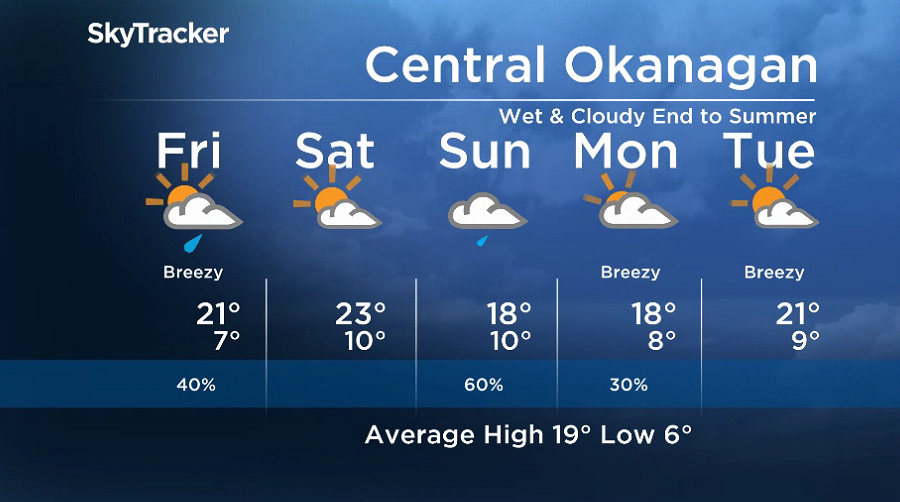
A frontal system sweeping through Thursday night will kick up the chance of showers right into the morning hours on Friday, before skies start to clear during the day.

Get daily National news
Friday afternoon sunshine should help return temperatures to the low 20s to finish off the week, before diving back into mid-single digits to start the final weekend of summer.


Saturday will bring a mix of sun and cloud during the day, with the valley warming back up to around 23 degrees in the afternoon.
The heat and sunshine doesn’t last long though. The next upper trough will drop in on Sunday, bringing a return to clouds, showers and daytime highs in the high teens.
Fall officially begins early Monday morning at 12:50 a.m. PDT, and it will start with some lingering clouds and a chance of showers that will linger into the middle of the week as highs eventually return to the 20s.
For weather on the go download the Global News SkyTracker Weather App for iPhone, iPad or Android.


Comments
Want to discuss? Please read our Commenting Policy first.