
Summer heat is on its way back into the Okanagan after a cool finish to the weekend.

Despite starting the final week of August a few degrees in single digits, the mercury made it back into the 20s during the morning before surging further into the mid-20s in the afternoon sun.
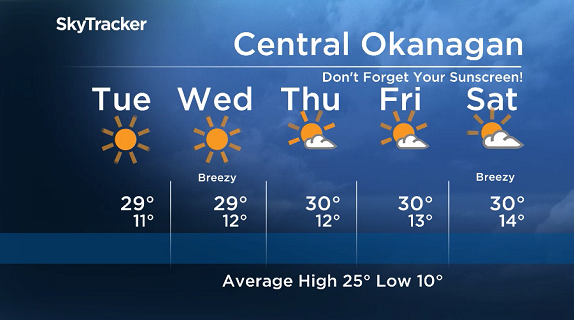
Blue skies will be the name of the game for the week ahead with nothing but sunshine both Tuesday and Wednesday.

Get breaking National news
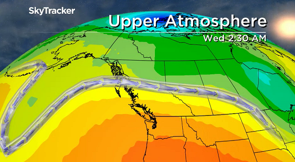
Daytime highs will sit around 29 degrees both days with morning lows in low double digits as a major upper ridge of high pressure builds in across southern BC.


By Thursday temperatures are likely to reach the low 30s in the afternoon with a few more clouds added into the mix.
30-degree daytime highs are expected to linger through Friday and right into the weekend under partly-to-mostly cloudy skies.
With a very high UV index, make sure to slather on some sunscreen if you’re heading out to the IPE in Armstrong or doing any other outdoor activities.
Skin can burn in 20 minutes when exposed to the UV rays expected this week.
For weather on the go download the Global News SkyTracker Weather App for iPhone, iPad or Android.


Comments