Extreme cold has gripped much of Canada thanks to a hovering polar vortex.

Large swaths of the country are under extreme cold alerts. Stretching from Saskatchewan through Manitoba and northern regions of Ontario and into Quebec, temperatures dipped south of -50C with the windchill Wednesday. And it’s not over yet.
“This polar vortex is expanding out to include more of North America on Thursday,” said Global News chief meteorologist Anthony Farnell.
WATCH: Winnipeg’s freezing cold temperatures are colder than Mars

“For areas downwind around the Great Lakes, snow squalls will continue for the rest of the week with some areas picking up close to a metre of snow. Winds are whipping the snow around and causing near-zero visibility on roads to the northeast and south of Toronto.”
A polar vortex is a mass of freezing air that typically spins over the North Pole. It has shifted south, bringing frigid temperatures to a large area of North America.

Get daily National news
“The polar vortex exists all year long, but mostly resides over the North Pole,” said Farnell. “When the clockwise wind flow in this large swirl of cold weakens, the circulation can be disrupted and split. When this occurs a section can travel south and bring record cold and wind to large areas that typically don’t deal with those temperatures.”
WATCH: Extreme cold warnings for much of Canada

Canada experienced similar polar vortex-induced chills back in 2014 and 2015. There is evidence to suggest that these severe weather events will become more frequent due to climate change.
Meanwhile, in B.C. the weather is positively balmy, with flowers sprouting. Areas of Canada’s East Coast enjoyed above-seasonal temperatures Wednesday, hovering above zero.
- False spring strikes again: Saskatchewan prepares for incoming winter weather
- Albertans’ interest in alternative forms of travel growing as fuel prices spike
- Massive avalanche closes Alberta’s Icefields Parkway until at least Saturday
- 13 years after Calgary’s devastating flood, 6 riverfront properties are for sale
However, Farnell predicts a change of fortunes is on the way.
WATCH: Polar vortex strikes U.S. Midwest, causing ‘life-threatening’ cold

“The good news is that when the polar vortex retreats north again, as is forecast this weekend, it will take the cold with it,” said Farnell.
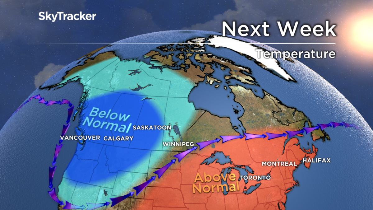
“Above-normal temperatures and even rain are expected next week in many of the cities that are in the deep freeze right now.”
Ottawa and the GTA are forecast to see temperatures above zero next week. Winnipeg’s deep freeze should see a relative reprieve with temperatures around -14C over the weekend.
Calgary, which enjoyed temperatures of 6C midday on Wednesday, should see the thermostat plunge to -20C by Sunday.
WATCH: Why does cold weather kill your phone battery?


Comments
Want to discuss? Please read our Commenting Policy first.