

A blast of snow, freezing rain and strong wind is on the way for the final weekend of January.

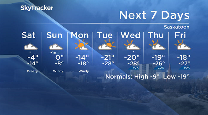
Saskatoon forecast
Friday
-30 is what it felt like early Friday morning with wind chill as temperatures tumbled back into the mid -20s to start the day.
Mostly cloudy skies stuck around through the morning as we warmed up into the minus teens before noon.
As a slight chance of a few flurries ripples through during the afternoon, the mercury should manage to make it up to around -12 C for a daytime high.
Friday night
Mostly cloudy skies stick around Friday night with a good chance of snow starting up overnight as conditions only cool back into the minus teens by a few degrees.
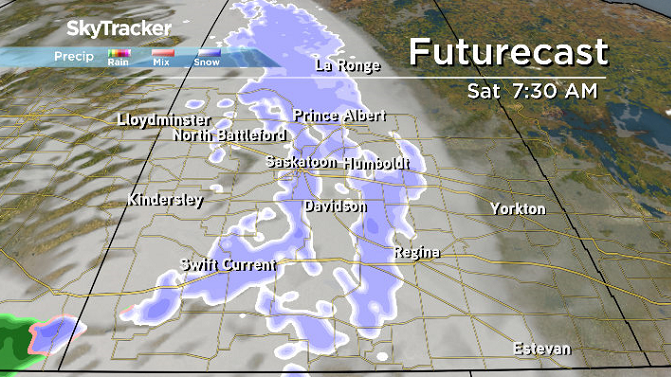
Saturday
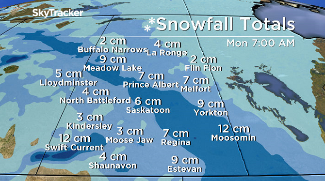
The weekend kicks off on a snowy note early Saturday with the first of two sets of fronts pushes in early in the day with snow expected to ease during the afternoon before the next round picks up at night.
After wind chills sit around -20 in the morning, the first front will help warm the region up to around -5 C later in the day.
Sunday
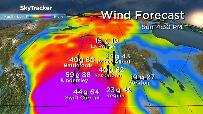
The second front will come coupled with a low pressure system packed with moisture and warm air on Sunday.
As a result, rain, freezing rain, and snow are all possible early in the day as temperatures hover around freezing before arctic air injects in behind the system and switches precipitation to snow.

As it does, conditions will cool back into minus single digits with strong winds picking up from the north up to sustained speeds of 50 km/h with gusts possible reaching 80 km/h at times, so expect reduced visibility, blowing snow and poor travel conditions.


Work week outlook
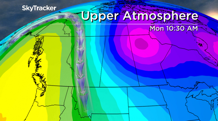
Calmer and colder conditions return for the final week of January with a piece of the polar vortex dropping daytime highs back into the -20s with overnight lows pushing the -30s and morning wind chills diving toward the -40s.
Jennifer Rogers took the Jan. 25 Your Saskatchewan photo near Alticane:

Saskatoon weather outlook is your source for Saskatoon’s most accurate forecast and is your one stop shop for all things weather for central and northern Saskatchewan with comprehensive, in depth analysis that you can only find here.
For weather on the go download the Global News SkyTracker Weather App for iPhone, iPad or Android.
Comments