

_848x480_1419454019853.jpg?w=1040&quality=70&strip=all)
Skiers and snowboarders will be happy to hear it but drivers may want to adjust their travel plans as Environment Canada issued a snowfall warning for Banff and Jasper on Wednesday.

The mountain parks are expecting total snowfall amounts of between 30 and 60 centimetres on Thursday and into Friday.
“A strong southwesterly flow over the mountains will bring upwards of 50 to 60 centimetres of snow to sections the Icefields Parkway (Highway 93),” Environment Canada said on its website on Thursday. “The heaviest snow is expected to fall until conditions improve overnight into Saturday.”
“Be prepared to adjust your driving with changing road conditions. Visibility may be suddenly reduced at times in heavy snow.”
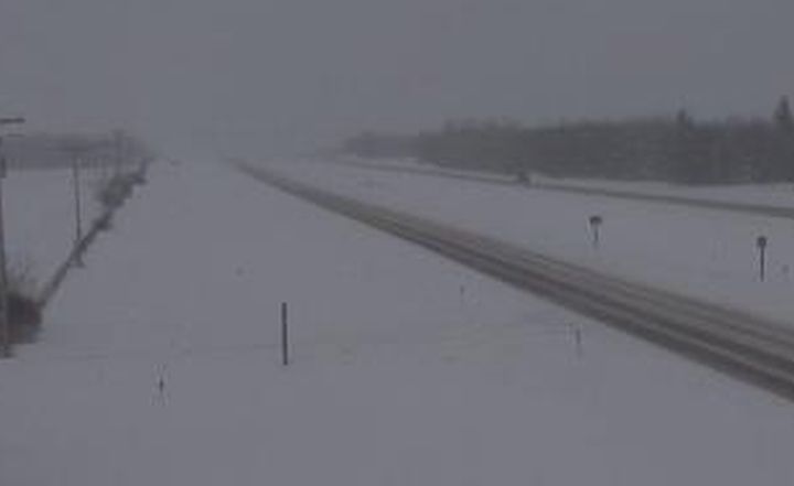
Snow led to less-than-ideal driving conditions near Banff, with Highway 93 north to Jasper closed on Thursday.
While the closures were later downgraded, drivers were still urged not to travel on Highway 93 north or south towards Radium due to poor conditions. Travel was also not recommended on Highway 1 west to the B.C. border.
“We’ve seen a lot more vehicles going off the road by themselves,” Staff Sgt. Michael Buxton-Carr said. “Fortunately, we have not had a lot of collisions involving multiple vehicles.
“Reduce your speed, leave room between you and the vehicle in front of you and if you don’t have good quality winter tires, don’t leave home; don’t use the car.”
Conditions worsened on Highway 1 approaching Lake Louise, where many drivers had trouble making it up the exit ramp. Some drivers were getting out of their vehicles to help push others up the hill. A weight restriction was later issued as larger vehicles were getting stuck in the area.
Matt Mayers is travelling through Canada from Australia and said Thursday was the most snow he’s seen yet.
“It’s ludicrous,” he said. “We’re on our second week now and this is probably the most treacherous we’ve driven in.”
Meanwhile, Dawson Barnes was heading back to Calgary from Lake Louise and wasn’t too concerned with the heavy snowfall thanks to his four-wheel-drive Jeep.

Get daily National news
“I’m not worried about the roads at all, I’ve got ‘The Judge’ here,” he said. “Four-wheel-drive is necessary in Canada.”
In B.C., Highway 1 was closed through Yoho National Park and between Golden and Revelstoke due to dangerous conditions as well as avalanche control measures. The highway reopened late Thursday night.
Watch below: (From Oct. 3, 2018) The Alberta Motor Association provides tips on being prepared for winter-driving emergencies

Parks Canada issued an avalanche bulletin on Thursday stating that danger ratings were extreme in the alpine and treeline levels throughout Banff, Yoho and Kootenay national parks, adding the ratings below treeline are also high.


The bulletin said the intensity of the incoming weather was uncertain, leading officials to have high confidence in the avalanche risk predictions.
“Heavy snowfall in Banff, Yoho and Kootenay national parks combined with warm temperatures and moderate to strong winds have elevated the avalanche hazard,” Amy Krause with Parks Canada said in a news release. “We remind visitors that anyone travelling into the backcountry is responsible for their own safety.”
Officials expect the danger ratings will be at lower levels for Saturday. However, as of Friday afternoon, a winter storm warning was in effect for Banff and Jasper.
Watch below: (From Jan. 4, 2019) Jasper National Park is under a winter storm warning and as Julia Wong reports, the avalanche risk is extreme.

Other parts of Alberta were also under a snowfall warning on Friday afternoon, including areas north and east of Edmonton.
“A band of snow over central Alberta has given near(ly) 10 to 15 cm accumulations with locally higher amounts near Fort Saskatchewan of 35 cm,” Environment Canada said on its website. “This band will continue to dissipate early this evening.”
For a complete list of weather warnings, watches and advisories in Alberta, click here.
READ MORE: ‘Dangerous wind gusts’ as strong as 150 km/h expected in southern Alberta on Thursday
Want your weather on the go? Download Global News’ Skytracker weather app for iPhone, iPad and Android.
Comments
Want to discuss? Please read our Commenting Policy first.