Smoke sticks around until weekend wind kicks in.

Special air quality statement
Environment Canada has issued a special air quality statement for Saskatoon, much of central and all southern Saskatchewan for smoke reducing visibility and causing poor air quality.
Widespread smoke from forest fires over Western Canada continues to produce poor air quality at times and reduced visibility over much of southern Saskatchewan Thursday.
A cold front over central portions of the province is slumping southward and behind this front winds switch to the north, which will help flush out the smoke and bring an improvement to air quality.
However this will be rather short-lived as smoke is expected to return later on Friday as winds shift back to the southwest pushing the smoke and poor air quality back in.
If you are having difficulty breathing you are advised to avoid spending time outdoors and remain in well-ventilated indoor spaces.

Get breaking National news
For the latest weather alerts download the Global News SkyTracker Weather App for iPhone, iPad or Android.
Saskatoon forecast
Thursday
After air quality fell to a high health risk of 10 on the air quality health index overnight, it improved up to a moderate health risk of 5 through Thursday morning.
Temperatures slid back to 9 C overnight before recovering up into double digits to start the day and bounding up even further into the low 20s before noon with some sun shining through the smoke.
Widespread smoke continues through the afternoon underneath mostly sunny skies attempting to shine through as we warm up to a daytime high in the mid-to-upper 20s.
Thursday night
A breezy east-southeasterly wind will ease late in the evening as a few clouds slide in over the smoke as we cool back into low double digits overnight.
Friday
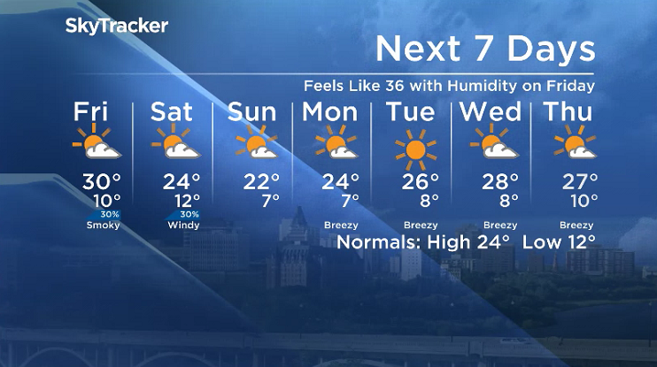
The brief reprieve from the smoke will end on Friday as a westerly flow aloft brings it back up to a moderate-to-high health risk during the day under partly to mostly sunny skies.
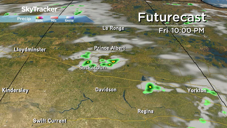
A trough swinging through will bring in a risk of a few isolated showers and even some storms, but the smoke will inhibit most storm development along with an upper ridge that’ll bring in a toasty afternoon high around 30 C.
Weekend
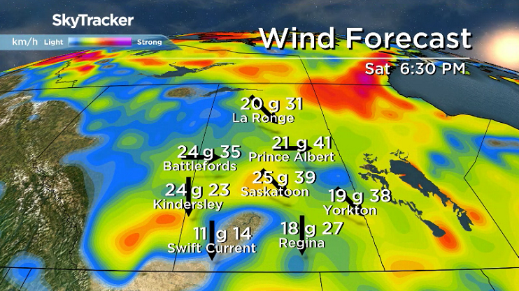
A windy start to the weekend is on tap on Saturday with a cold front helping switch around the flow to improve the smoke situation as a few clouds pass through with a slight chance of showers and storms.
After making it up to an afternoon high in the mid-20s on Saturday, cooler air will sink in under sunny skies to start Sunday before a few late day clouds spring up as winds ease back and high pressure digs in.
Work week outlook
That high pressure system will bring in a mostly sunny start to the work week with daytime highs gradually bounding up from the mid-20s into the upper 20s as an upper ridge builds in.
The Your Saskatchewan photo for August 16 was taken in Saskatoon by Tammy Ollenberg:
Saskatoon weather outlook is your source for Saskatoon’s most accurate forecast and is your one stop shop for all things weather for central and northern Saskatchewan with comprehensive, in depth analysis that you can only find here.


Comments
Want to discuss? Please read our Commenting Policy first.