
Snow, storms and a cold front sliding through.

Saskatoon Forecast
Monday
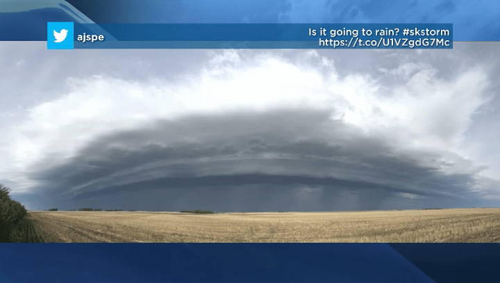
It was a stormy start to the first full week of June in Saskatoon with thunderstorms and rain rolling in during the morning, kicking up winds gusting upwards of 50 km/h.
11 degrees was where temperatures started things out, which warmed into the upper teens ahead of the storm, which knocked us back into the mid-teens.
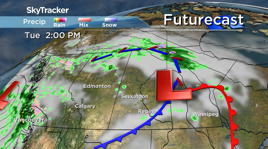
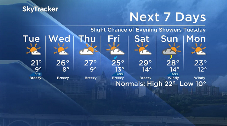
That brief setback gets overcome Monday afternoon as we continue warming up into the 20s with more thunderstorms expected as a low pressure system sweeps through, keeping winds breezy.

Get breaking National news
Parts of northeast Saskatchewan saw snow overnight weekend and into Monday, which will finally get pushed out in the days ahead.


Monday Night
The cold front associated with this system will push through Monday evening with the chance thundershowers easing as clouds start to clear and we cool down toward single digits with fog patches.
Tuesday
Any fog patches that do develop will clear early Tuesday as mostly sunny skies kick in after a few more clouds possible to start the day.
Cool northwesterly winds may be a bit breezy during the day, putting a damper on daytime heating with the mercury only expected to barely crack into the 20s in the afternoon with a slight chance of evening showers.
Wednesday-Friday
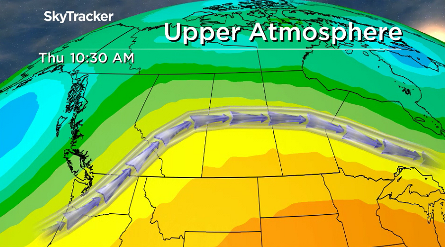
Mostly sunny skies get back into full swing on Wednesday before some clouds roll back in late Thursday and stick around with a better chance of rain on Friday as a weak upper low pushes toward the area.
Warmer air will also accompany the remainder of the work week with a building upper ridge bringing back mid-20 degree heat.
Weekend Outlook
A hot, humid and potentially stormy weekend is on the way with a system developing in Alberta setting up suitable severe weather parameters later in the weekend after a mostly sunny start to the weekend.
Daytime highs are expected to swing all the way into the upper 20s, with a decent shot at cracking 30 degrees both Saturday and Sunday.
The June 4 Your Saskatchewan photo was taken by Faith McDonald of the Rabbit Creek wildfire in Prince Albert National Park:

Saskatoon weather outlook is your source for Saskatoon’s most accurate forecast and is your one stop shop for all things weather for central and northern Saskatchewan with comprehensive, in depth analysis that you can only find here.
Comments
Want to discuss? Please read our Commenting Policy first.