
Editor’s note: This story was originally published on Tuesday, April 24, 2018. It has been updated throughout the week with the latest flood alerts. The latest updates were made on Monday, April 30, 2018.

As spring runoff and rising waters encroach on homes and properties across Alberta, overland flooding alerts have been issued for several communities and counties in the province.
Wondering how to prepare your property and family for possible flooding? Both the provincial and federal governments have online lists and tips for emergency preparedness.
Here’s a complete list of areas affected by floodwaters:
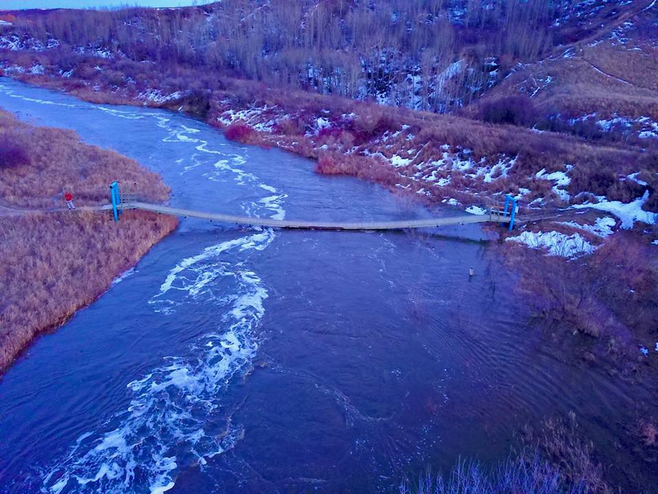
Beiseker
WATCH: Flooding forces evacuations in Beiseker.

A state of local emergency was declared for the village of Beiseker on Monday, April 24 because of overland flooding, according to village CAO Jo Lambert.
“For your own safety, please stay away from drainage ditches and any fast flowing water; avoid driving on flooded streets, and if you have water in your basement, stay away from electrical panels,” village officials said in a news release Tuesday.
The Alberta Emergency Management Agency cancelled the information alert for overland flooding at 1:32 p.m. Wednesday, April 25.
Birch Hills
Central Peace Regional Emergency Management issued an information alert for overland flooding Tuesday for Birch Hills County.
An update Thursday morning said “melting snow continues to cause flooding in Birch Hills resulting in road closures. Overland flooding has lessened in the Wanham area. Kakut Lake, Peoria, South Codesa, Eaglesham and Tangent areas are experiencing overland flooding. The flood situation is expected to continue throughout the weekend. Barricades and signs are being placed at affected locations.”
On Saturday, the alert was dropped as the melting snow that caused the flooding had stabilized.
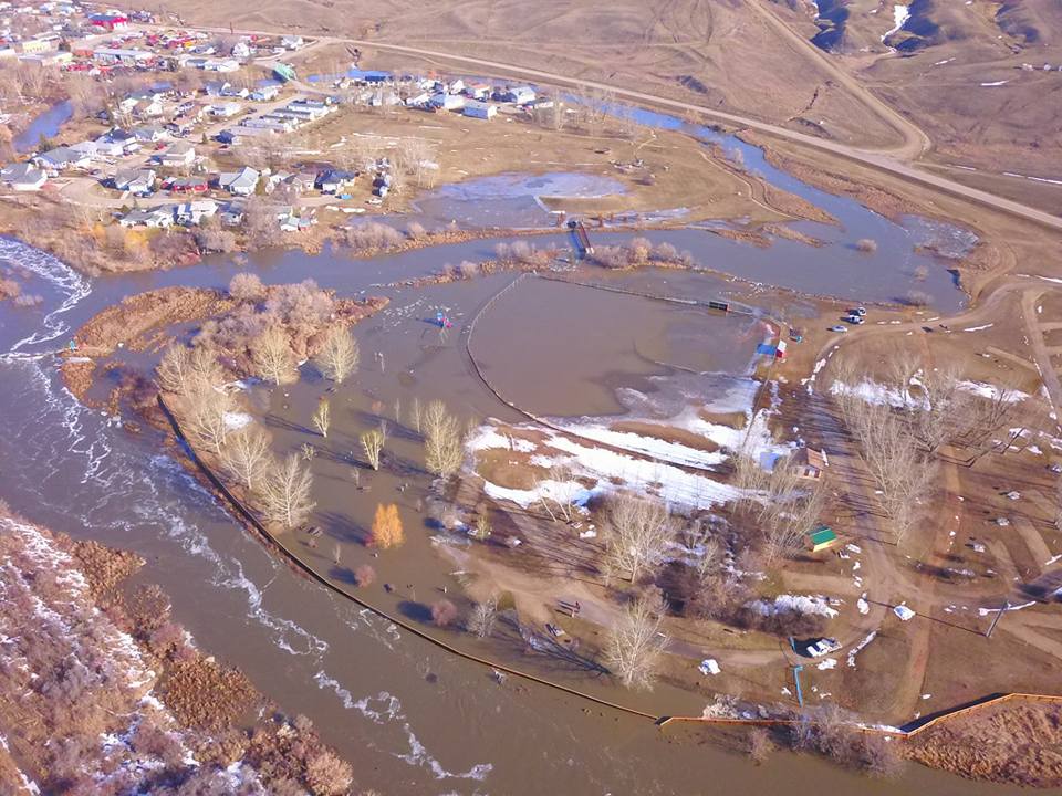
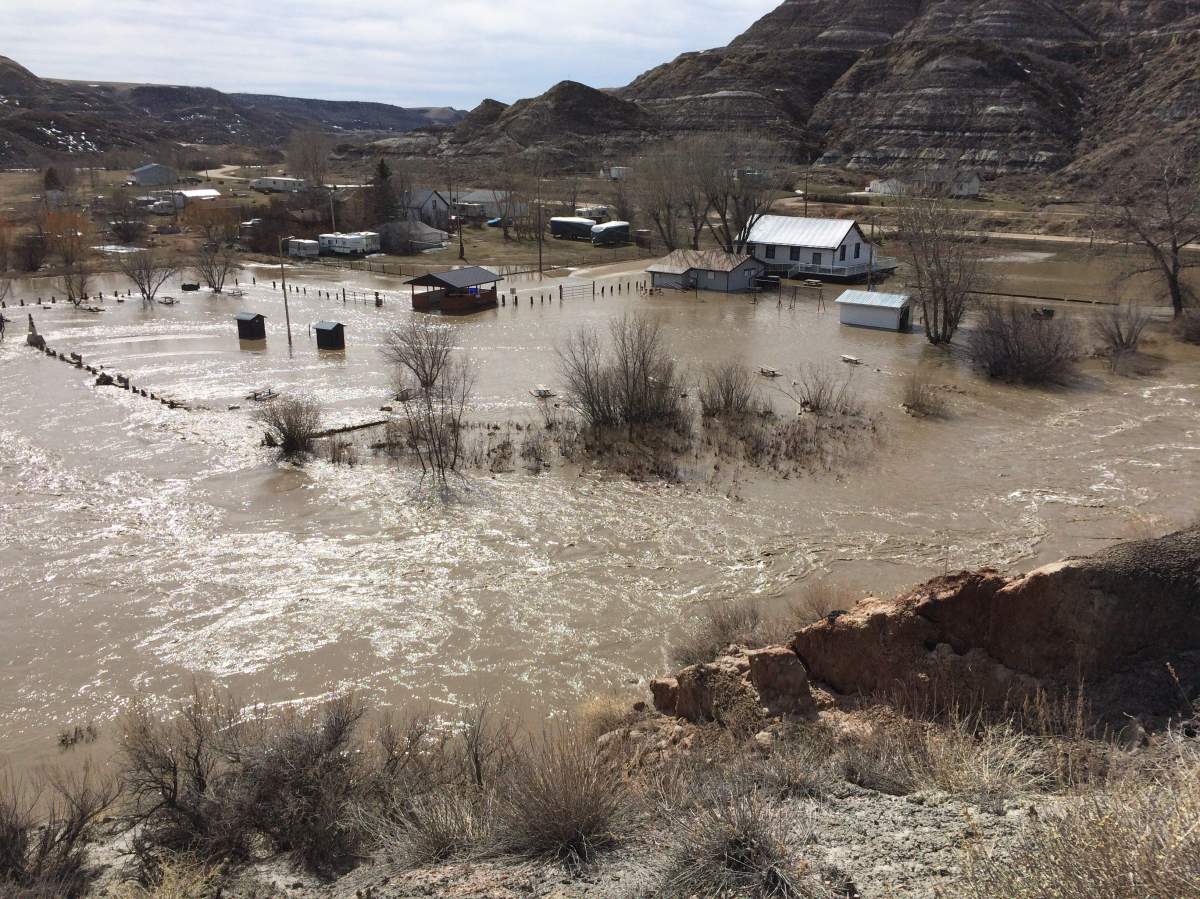
Carbon – Dunphy – Kirkpatrick area
While officials said no homes in Carbon were affected by floodwaters, campgrounds, ball diamonds and parks were under water. Two pedestrian bridges were destroyed, according to local emergency management staff.
Sandbagging was underway in the nearby community of Dunphy, where five to six homes were affected by flooding. Residents were under self-evacuation earlier in the week.
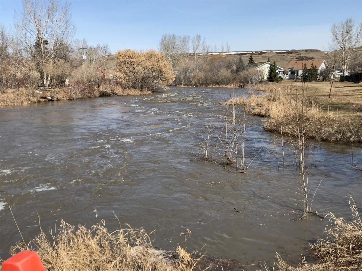
As waters rise in the Red Deer River and Kneehills Creek, basements and garages have seen flooding in the community of Kirkpatrick. Fifteen homes lie between the two waterways.


The region will likely not declare a state of local emergency unless evacuations become mandatory, officials said Tuesday.
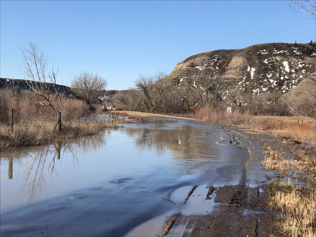
Drumheller
The Town of Drumheller issued a mandatory evacuation alert in the community of Wayne and along Highway 10X Monday at 6:42 p.m. High water was reported along the Rosebud River. About 75 people were affected by the evacuation order, town spokesperson Julia Fielding said.
On Wednesday, the mandatory evacuation alert was lifted. However, Highway 10X was restricted to local traffic only.
On Thursday, the high water information alert was cancelled by the municipality.


WATCH: Our Global 1 helicopter captured this footage of crews working on a bridge in Wayne, Alta., as floodwaters get close.

Fairview #136
An information alert for localized overland flooding for the Municipal District of Fairview No. 136 was issued on Monday at around 6 p.m. Barricades and signs were set up to warn residents of flooded areas.
On Friday afternoon, officials with the M.D. said that “although water is receding, overland flooding continues to cause significant road hazards.”
“Erosion has caused undermining of culverts and road hazards can appear without warning,” Friday’s alert said. “Drive with extreme caution.”
The flooding prompted the closure of numerous township roads and range roads in the area.
The alert in the area was dropped on Monday, April 30. The province asked residents to continue to obey road closures and barricades.
Forty Mile County #8
An information alert for overland flooding was issued by County of Forty Mile No. 8 on Monday. A state of local emergency was also in place Tuesday.


On Wednesday afternoon, the alert was cancelled. However, officials warned dangerous road conditions remained around the county and the hazard of flooded roads continued.
A map of the flooded roads is available here.
Grande Prairie County
An overland flooding alert was issued for Grande Prairie County on Wednesday at 11:30 a.m. Melting snow continues to cause flooding and road closures.
The alert was dropped on Saturday night.
On Wednesday, May 2, a notification was released that another emergency alert was cancelled after flooding in the county had stabilized.
Grande Prairie Regional Emergency Partnership
A flash flood alert was issued for the region on Saturday evening. By Sunday morning, Muskoseepi Park was evacuated. While the province said the main threat was under control, many paths are under water and creek banks remain extremely unstable.
The park will remain closed until the water recedes and a thorough damage assessment can be completed.

Get breaking National news
On Sunday, the province said the park would remain closed for at least three to four days.
On Monday, April 30, the flash flood alert was lifted although both the Muskoseepi Park and South Bear Creek Park were still expected to be closed for several more days until the water recedes and the damage and stability of the ground and infrastructure in the parks can be assessed.
“Water levels will remain high as remaining snow melts,” local officials said. “Creek slopes are very unstable. The parks will remain closed until the water recedes and a thorough assessment of damage and slope stability can be completed.”
Greenview
An overland flooding information alert was issued by the Municipal District of Greenview No. 16 on Monday at 12:15 p.m.
Melting snow was reportedly causing flooding on several roads in the area, leading to closures. Flooding resulted in additional closures overnight Thursday in the DeBolt and Valleyview areas.
New road closures were added Saturday night in the DeBolt, Sunset House and Grovedale areas.
On Tuesday, May 1, a notice was released that recovery and repairs had begun on roads in the area. Some roads require significant repairs and will remained closed until further notice.
People were asked to be aware of areas known to flood easily, such as streams, drainage channels and canyons. A request was also made to not bypass or move barricades or travel through flood-damaged areas.
Drivers are asked to obey the road closures and call 780-524-7602 to report any new roads that are flooded. A map of affected roads can be found on the municipal district’s website.
Hythe
The Village of Hythe declared a local state of emergency Friday night, a move it said was prompted by “extensive flooding” in the community located about 60 kilometres northwest of Grande Prairie.
On Saturday, the alert stated the flooded had receded in of Hythe. Pumping will continue to alleviate the flooding as crews continue to monitor the situation.
The alert was dropped on Monday, April 30, as conditions had improved substantially, according to the province. The Grande Prairie Regional Emergency Partnership said Hythe’s local state of emergency had also been lifted Monday.
Kneehill County
An information alert for overland flooding issued for Kneehill County on Sunday was cancelled Thursday. A flood watch had also been issued by Alberta Environment. Some roads were closed as of Tuesday.
The alert was cancelled on Thursday morning.
WATCH: Rising waters continue to threaten homes in Kneehill County, and as Lauren Pullen reports, even the Three Hills Golf Club is now under water.

Lamont County
Lamont County issued a state of local emergency Monday due to overland flooding. The county reported more than 40 flooded areas. Local authorities advised residents to exercise caution on county roads.
On Friday, the county said it had seen a significant improvement in areas south of Highway 29. The north half of the county was still seeing some flooding and the local state of emergency remained in place.
Updates are available on the county’s website.
Watch below: Vinesh Pratap spent time in Lamont County on Wednesday, one of several areas in Alberta experiencing flooding.

LISTEN: Heather Atkinson with Lamont County speaks with 630 CHED’s Ryan Jespersen
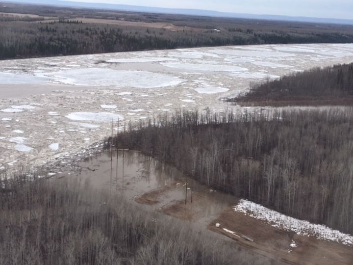
Mackenzie County
A flash flooding alert was issued for part of Mackenzie County in northwestern Alberta on Friday afternoon. Officials said there was an ice jam on the Peace River near Tompkins Landing and flooding was occurring in the area.
On Saturday morning, a state of local emergency was declared due to risk of flooding in Fort Vermilion and the surrounding area. Residents in North Vermilion and Buttertown were asked to leave their homes on Saturday.
Highway 88 near the junction of Highway 697 was impassable on Saturday afternoon due to flooding caused by an ice dam breakup, RCMP said. The flooding caused voluntary evacuations of residences in low-lying areas.
RCMP said the ice dam breakup caused a “significant surge of flood water into the region.”
The only access into Fort Vermilion and the La Crete area on Saturday afternoon was north through Red Earth Creek, RCMP said.


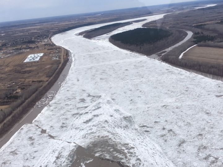


On Sunday, the province said water levels continued to rise in Fort Vermilion, leading to dangerous conditions and flooding along the Peace River.
A mandatory evacuation was in place Sunday for low-lying areas of Fort Vermilion and Buttertown. About 100 people were forced from their homes. Buttertown residents were asked Sunday to evacuate to High Level.
On Monday, April 30, the province said water levels had dropped overnight in Fort Vermilion and residents were allowed to return home.
Residents from North Vermilion remained on evacuation notice. A reception centre was open at the Fort Vermilion Public School at 4401 – 50 St.
On Wednesday, May 2, a notification was released that the mandatory evacuation for North Vermilion was cancelled, while a voluntary evacuation was in place for low-lying areas in Beaver Ranch.
For the latest information on the situation, area residents can go to the Mackenzie County Facebook page or call the Emergency Operation Centre at 780-927-3718.
Municipal District of Taber
The information alert for overland flooding issued for the Municipal District of Taber remained in effect Friday as well as a state of local emergency, as several roads were still impacted by flooding. A map of the impacted areas is available here. Road work was being done on Friday and road closures were in effect.
On Monday morning, the province said the situation had improved and stabilized, so the emergency alert was expected to be cancelled shortly.
Red Deer County
The flood alert issued for parts of Red Deer County due to an ice jam on the Little Red Deer River at Highway 587 was cancelled on Wednesday. Road closures will remain in effect until localized flooding stops and roads are repaired. A voluntary evacuation for the Silver Lagoon subdivision was lifted at 3:15 p.m. Tuesday. Alberta Health Services had issued a boil water advisory for the Silver Lagoon subdivision and Red Lodge Estates which remained in effect Tuesday afternoon.
Rocky View County
An overland flooding alert issued for Rocky View County on Monday was ended on Thursday. Several roads had been affected by rising waters.
Signs and barricades had been posted along affected routes where travel was not recommended as of Tuesday.
Rycroft
An information alert for localized overland flooding for Rycroft was called off Wednesday after being issued on Monday. Water levels have reached normal runoff levels but road closures were still in effect.
Saddle Hills County
An information alert issued Tuesday for Saddle Hills County for overland flooding was cancelled Thursday, however, travel was still not recommended on several roads. Officials advised against driving in low-lying areas as large amounts of water were travelling across the land in the area.
Sexsmith
An overland flooding alert was issued for the northern Alberta town of Sexsmith shortly before 10:30 p.m. on Thursday. Officials said the alert was prompted by melting snow that was resulting in road closures within the town.
People were being asked to avoid creeks and low-lying areas and to obey all road closure signs and the directions of local authorities.
On Saturday, the alert was dropped as flood waters in the town are receding. Pumping will continue and crews will monitor the situation.
Sexsmith is located about 20 kilometres north of Grande Prairie.
Siksika Reserve #146
An information alert for overland flooding ended Thursday. The government reported “80 per cent of the prior effect roads are now passable, but still use extreme caution as some of the roads are very rough.” For further information on flood repair efforts, visit the Siksika Nation website.
Smoky River #130
An information alert for overland flooding for the Municipal District of Smoky River No. 130 was cancelled Thursday morning. Melting snow had caused localized flooding. Signage and barricades were installed on the affected roads.
Spirit River
An overland flooding alert was issued for Spirit River at 4:45 p.m. Tuesday and ended on Thursday. Flooding closed Range Road 62A (between township roads 782A and 781.5), Township Road (between range roads 64 and 65), Range Road 51 (between Township Road 784 and Highway 49) and low-level crossing on Range Road 45.
Vulcan County
Vulcan County cancelled an overland flooding alert and lifted a state of local emergency on Wednesday. The alerts were issued on Tuesday. There were road closures in the north and west portions of the county. Roads in the south and east of the county have been reopened and Vulcan County crews are working to reopen all roadways.
Westlock County
A state of local emergency was declared in Westlock County at 4:30 p.m. on Monday due to spring flooding.
According to the county’s website, a number of roads were washed out while others were under water. It’s expected water levels will continue to rise over the next few days and weeks.

WATCH: In Westlock County a local state of emergency has been declared amid flooded roads and basements. Sarah Kraus reports.

Wheatland County
A boil water advisory issued by County of Warner No. 5 on Monday for the Village of Stirling and for Stirling rural water users was ended Thursday.
Woodlands County
A critical alert for overland flooding was issued for Woodlands County, northwest of Edmonton, on Saturday, April 28. A critical alert for high water level was issued Sunday evening. The Athabasca River rose “significantly,” leading to localized flooding along Flats Road. Residents from 25 houses along Flats Roads were forced from their homes on Saturday morning.


WATCH: A local state of emergency was issued for Woodlands County northwest of Edmonton on Saturday morning due to rising flood water. Dozens of people were forced from their homes. Alberta Delitala has the latest on the situation.

A local state of emergency was issued on Saturday morning due to the rising flood water. People were asked to avoid the area and call 780-778-8400 with questions or concerns.
On Sunday morning, the lower Pride Valley area was evacuated as a precautionary measure. The province said a large ice jam was affecting the Athabasca River, causing the river to rise rapidly Sunday morning in the area of Pride Valley east of Fort Assiniboine.
On Monday, April 30, officials said there was “currently no sign of change in the Flats Road area.”
“The water has risen slightly and the ice jam is still there. Flats Road continues to be barricaded and people are asked to avoid the area until further notice. Localized flooding continues and Flats Road remains closed. Staff are still monitoring the area and will continue to do so throughout the night.”


On Tuesday, May 1, Alberta Emergency Alert provided some good news in an update that said the ice jam on the Athabasca River in the Flats Road area had broken-up and dissipated, resulting in water beginning to recede. However, Flats Road remained impassable east of Whitecourt and people were asked to continue to avoid the area.
On Wednesday, May 2, a state of local emergency was lifted in the Fort Assiniboine Pride Valley area. A notification said “only one portion of the road remained damaged and barricades were still in place.”
On Thursday, May 3, a state of local emergency remained in place for the Flats Road area, where crews were working on a damaged portion of road.
The county was working on a re-entry plan for residents with a May 6 or 7 target for all essential services and access to be restored.
Comments
Want to discuss? Please read our Commenting Policy first.