
Tuesday, October 31, 2017 – Weather forecast update at 4:30pm:

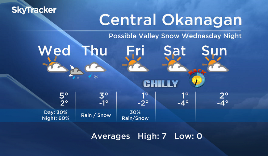
As cooler air continues to move in Wednesday, our freezing levels will drop down near the valley base by Wednesday night.

Get breaking National news
Get breaking Canada news delivered to your inbox as it happens so you won't miss a trending story.
By providing your email address, you have read and agree to Global News' Terms and Conditions and Privacy Policy.
This will bring the risk of valley snow for parts of the Southern Interior starting Wednesday night.
Drier air will move in by Friday and the weekend.
- Winter’s grip continues across much of Canada; forecasts call for snow, freezing rain
- Strong atmospheric river forecast to hit coastal B.C. as spring break begins
- A blizzard, polar vortex, heat dome and atmospheric river: U.S. faces weather chaos
- Hurricane-strength winds knocked over semi trucks on the Coquihalla Highway


Wednesday’s daytime high range: 3 to 10C
We will have the rest of your weather details coming up at 5, 6:30 and 11pm – Hope you can join us!
~ Duane/Wesla
Comments
Want to discuss? Please read our Commenting Policy first.