
A snowfall warning was issued for parts of northwest Alberta Tuesday in preparation for between 10 and 15 centimetres of snow overnight.

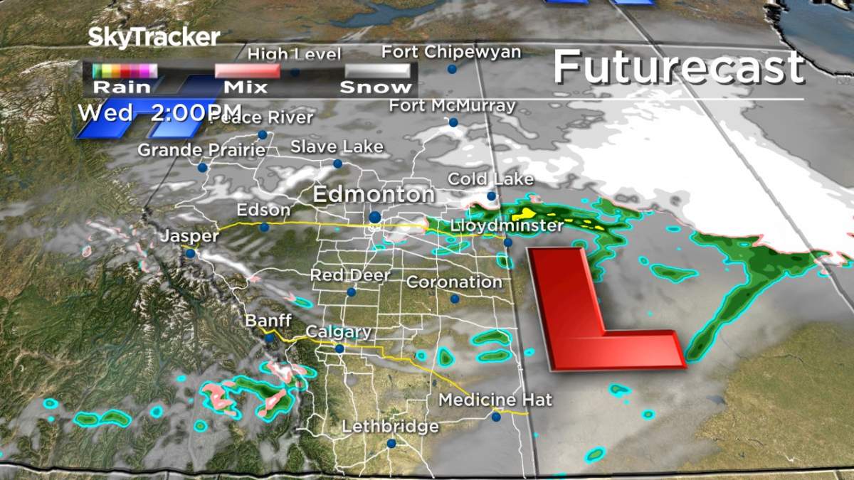
“A low pressure system moving southeast across the Rockies will bring some wintry conditions to Alberta Tuesday night and Wednesday,” Global Edmonton meteorologist Jesse Beyer said.
“Heavy snowfall is possible to the northwest. Ten to 15 cm of snow is possible, which may hinder travel plans on highways in the area.”
Environment Canada warned motorists to adjust their driving with changing road conditions.
“Rapidly accumulating snow could make travel difficult over some locations,” Environment Canada said.
“Surfaces such as highways, roads, walkways and parking lots may become difficult to navigate due to accumulating snow.”
As of 11 a.m. Tuesday, the snowfall warnings were in place for Peace River, Fairview, High Prairie, Manning, Wabasca, Peerless Lake, Gift Lake and Cadotte Lake.
For an updated list of warnings and watches, click here.

Get breaking National news
The weather system could have a ripple effect on the Capital Region.
“As the low moves southeast, we may see some rain and snow in Edmonton Wednesday,” Beyer said.
“Also with a change in pressure on the way Wednesday afternoon, wind gusts could approach 70-90 km/h in the Edmonton area, which may prompt wind warnings.”
Snowfall warnings are issued when significant snowfall is expected.
For up-to-date information on regions under weather warnings, visit Environment Canada’s website.
Want your weather on the go? Download the Global News Skytracker weather app for IOS and Android.


Comments
Want to discuss? Please read our Commenting Policy first.