

One calm day is on the way before wild winds return!

Saskatoon Forecast
Thursday
Thursday morning started off on a much calmer note with winds only up to 20 km/h, a far cry from the Wednesday morning’s 72 km/h wind gusts.
READ MORE: Hurricane force winds slam Saskatchewan with gusts up to 131 km/h
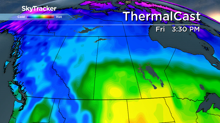
Mostly cloudy skies started the day as temperatures dipped back to 5 degrees before rising up into the mid teens by late morning.
Warm southwesterly winds remained breezy during the afternoon with gusts upwards of 40 km/h, which helped warm us up into the upper teens later on under mostly cloudy skies.

Get breaking National news
READ MORE: Open fire ban in Saskatchewan south of Highway 16
Friday
Warm air will stick around to finish off the work week thanks in part to a kick of heat ahead of a system sliding in from Alberta that’ll allow the mercury to rise into the upper teens or low 20s in the afternoon.

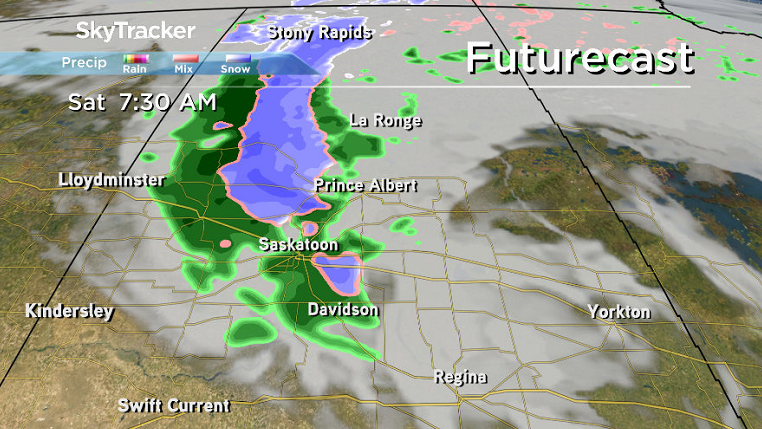
Partly to mostly cloudy skies will dominate the majority of the day with winds remaining calm until evening when a cold front slides through and brings in a risk of rain overnight.


Weekend
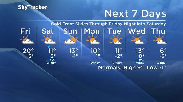
Rain is expected to start the weekend on Saturday as the cold front and upper trough dive back in with wind gusts upwards of 60 km/h possible as we struggle to a double digit daytime high.
A bit of sunshine may return to start the day Sunday before more clouds build back in and we attempt to spring back into the low teens by afternoon.
Work Week Outlook
Some clouds may start the work week with a very slight chance of showers and strong winds Monday, but we’ll bump back up into the low teens with more sunshine before a cold front slips through Wednesday that could kick up wind gusts in excess of 70 km/h.

Annette Brecht took the Your Saskatchewan photo for Oct. 19 in Hague.

Saskatoon weather outlook is your source for Saskatoon’s most accurate forecast and is your one stop shop for all things weather for central and northern Saskatchewan with comprehensive, in depth analysis that you can only find here.
Comments
Want to discuss? Please read our Commenting Policy first.