

UPDATE: All warnings mentioned in this story have ended.

Snow and strong wind move in to start October.
Winter Storm/Weather Warning
Environment Canada has issued winter storm and weather warnings in southwest Saskatchewan including Swift Current, Leader, Maple Creek and Cypress Hills for the first winter storm of the season.
Up to 30 centimetres of snow may fall along the Trans-Canada Highway from west of Swift Current to the Alberta border, including the Cypress Hills area.
The snow will be accompanied by 80 km/h northerly wind gusts, which will result in white-out conditions at times.
The agency says highway closures are likely and motorists are advised to postpone travel until the storm passes.
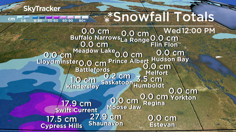
In addition, significant rainfall accumulations of 40 to 50 millimetres are possible in a band stretching between Saskatoon and Regina.
Rainfall Warning

Get breaking National news
Environment Canada has issued a rainfall warning south of Saskatoon for 50 to 70 millimetres of rain in the Outlook, Hanley, Humboldt and Wynyard areas.
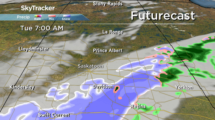
An intense low pressure system over eastern Saskatchewan is wrapping warm moist air in from the southeast and cold air from the northwest.

A band of heavy rain has developed from Swift Current to Humboldt.
Rainfall will taper off Tuesday afternoon as this system starts tracking eastward.

For the latest weather alerts download the Global News Skytracker weather app for iPhone, iPad or Android.
Saskatoon Forecast
Monday
After a beautiful, sunny and warm end to September, October started on a cool and cloudy note Sunday with moisture being added into the mix on Monday.
Light rain and drizzle started the day in Saskatoon as temperatures sitting around 8 and 9 degrees, which was where we sat all morning.


Winds will remain strong for the rest of the day after gusting upwards of 70 km/h in the morning as heavier rain moves in and we sit in high single digits.
Monday Night
Rain stuck around Monday night with winds easing back a bit to speeds of 30 to 40 km/h with gusts upwards of 60 km/h at times.
Tuesday
That light rain and wet snow may linger a bit into Tuesday morning as the low pressure system responsible for the precipitation slowly slides east and gets displaced by a high pressure system.
The big question will be whether the clouds will clear midday or late in the day, but what is more certain is that we should climb to a high in upper single digits with winds easing right back during the day.

Wednesday-Friday
Partly to mostly sunny skies will move in to dominate the rest of the week with breezy winds at times.
Daytime highs will pick back up from low double digits Wednesday into the mid-teens to end the week Thursday and Friday as an upper ridge builds back in.
Weekend Outlook
A cold front is slated to swing through on Saturday, bringing with it some clouds and a chance of showers and dropping daytime highs back into low double digits as cool northwesterly winds kick back up.

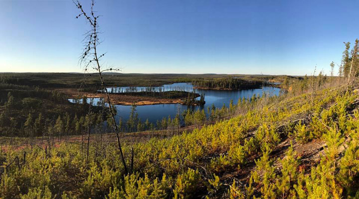
The Your Saskatchewan photo was taken by Christine McKechnie near Key Lake:
Saskatoon weather outlook is your source for Saskatoon’s most accurate forecast and is your one stop shop for all things weather for central and northern Saskatchewan with comprehensive, in depth analysis that you can only find here.
Comments
Want to discuss? Please read our Commenting Policy first.