
A tornado touched down southwest of Edmonton Thursday evening.

Environment Canada said a low pressure system triggered widespread severe thunderstorms, and one of those produced a twister that touched down around 5:30 p.m., about five kilometres northwest of Breton, Alta.
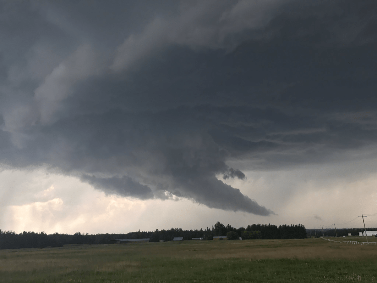
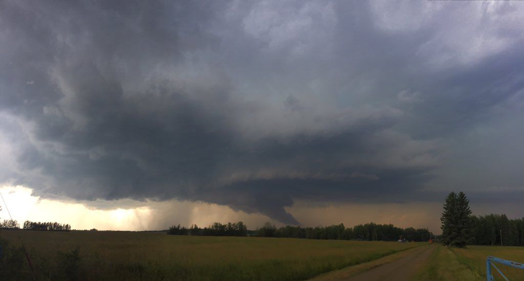
A video taken by a woman appears to show a funnel cloud touching down in that area.
The Breton tornado was just one of many instances that saw turbulent weather make its presence felt throughout central Alberta. Environment Canada recorded the following events:
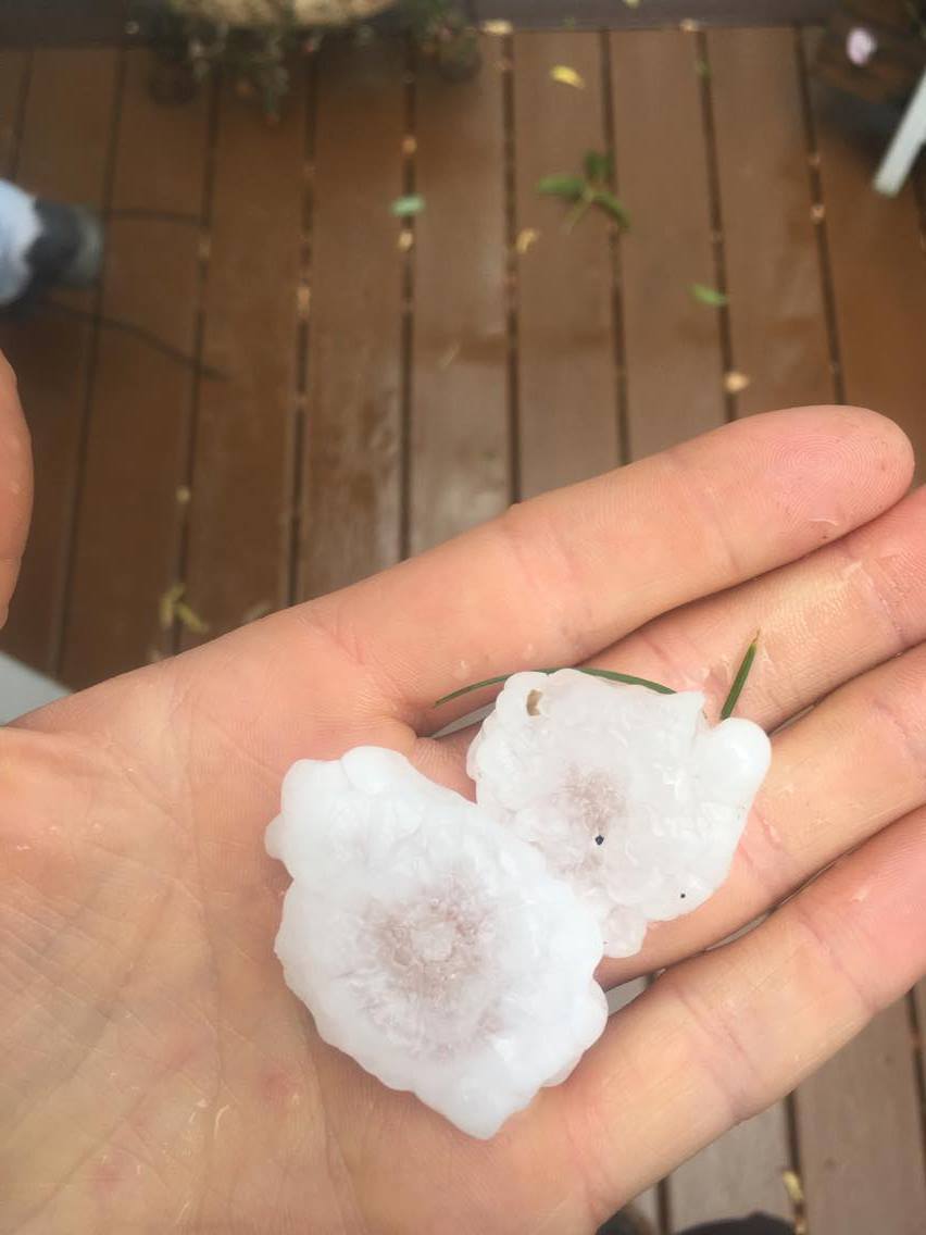
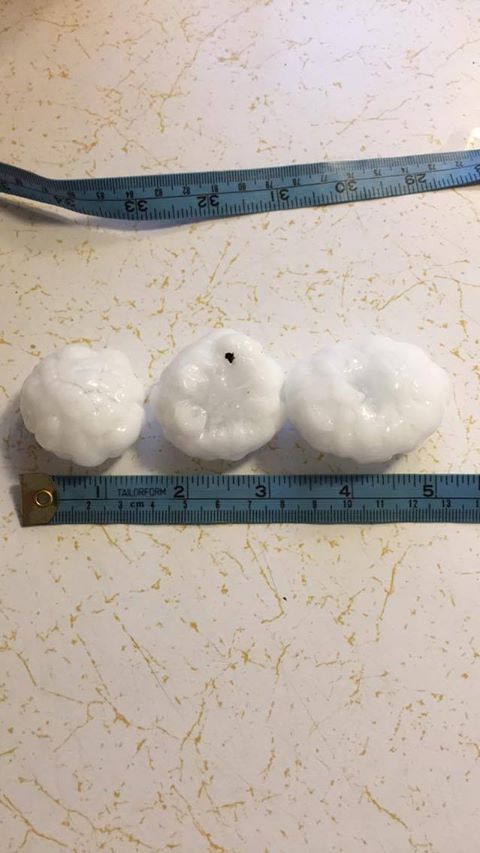
- 30 kilometres south of Fox Creek: Loonie-sized hail
- 20 kilometres west of Robb: Golf ball-sized hail
- 100 kilometres northwest of Drayton Valley: Golf ball-sized hail
- Drayton Valley: Golf ball-sized hail
- 5 kilometres northwest of Breton: Tornado
- Athabasca: Toonie-sized hail
- Warburg: Walnut-sized hail
- 15 kilometres southeast of Thorsby: Golf ball-sized hail
- Southwest of Calmar: Ping Pong-sized hail
- Edmonton: Tree limbs broken, shingles blown off
- St. Paul: Gusts to 85 km/h, trees blown down
- Waskatenau: Multiple trees blown down
- Gibbons: Trees blown down
- Elk Point: Nickel-sized hail
- Two Hills: Gusts to 89 km/h
By 11 p.m., however, all tornado and severe thunderstorm-related weather warnings and watches had been dropped in Alberta.
A tornado warning was issued shortly after 5 p.m. Thursday for parts of central Alberta, including Drayton Valley, Devon, Rimbey and Pigeon Lake. It was downgraded to a tornado watch just after 6:30 p.m. and later the watch was dropped as well.
Teresa Pinyon lives on an acreage near Breton, Alta., about 30 minutes southeast of Drayton Valley. She said video she took of several funnel clouds near her shows on that appears to touch down.
“I’d never seen anything like that before,” she said Thursday night.
“My daughter lived just like a mile from where I was at and they (funnel clouds) were overtop of her home. So I was kind of panicking for my daughter and my two young grandchildren.
“There was some family and I out in the yard and we were just kind of watching the clouds form and then I had to go down to the barn to take care of livestock and it started to get really windy and stuff so we were just standing in the barn door looking out and I decided to start videoing.”
According to Pinyon, five or six funnel clouds were in the area and the last one looked like it touched down at around 5:30 p.m. She drove by the area later and said “it did extensive damage.
“Not to anybody’s home. It missed the neighbour’s home… well she had trees and stuff down within 200 yards of her home. You can see where it went through the treeline and it took a swath probably… a fairly wide swatch through the trees.”
Watch below: Residents of central Alberta are cleaning up after a powerful storm spawned a tornado near Breton. As Fletcher Kent explains, some say it was a miracle the destruction wasn’t worse than it was.

“Persons in or near this area should be on the lookout for adverse weather conditions and take necessary safety precautions,” Environment Canada said.

Get daily National news
For an updated list of warnings and watches, visit Environment Canada’s website.
Shortly after 2 p.m., several areas were put under a tornado watch including Rocky Mountain House, Caroline, Spruce Grove, Morinville, Mayerthorpe and Evansburg. That watch was dropped Thursday evening.
Watch below: Several parts of central Alberta were under weather warnings and watches Thursday evening. Jesse Beyer delivered this weather forecast at 6:30 p.m.

At around 6:30 p.m., areas in Beaver County, Camrose County, the County of Wetaskiwin, Flagstaff County, Leduc County, Strathcona County, Athabasca County, the M.D. of Lesser Slave River, the County of Barrhead, Thorhild County, Westlock County and Woodlands County were also under a tornado watch. That watch was dropped later in the evening.
A few minutes later, the city of Edmonton was put under a severe thunderstorm warning as well as St. Albert and Sherwood Park. The warning was downgraded to a watch at 7:37 p.m.
Shortly after 8:30 p.m., a tornado watch was issued for the County of St. Paul, Smoky Lake County, Lac La Biche County and the M.D. of Bonnyville.
“Severe thunderstorms have begun in west-central Alberta,” the agency said Thursday afternoon. “A few of these severe thunderstorms will have the potential to produce tornadoes, baseball-sized hail, and destructive straight-line winds in excess of 120 km/h.
Watch below: Some very turbulent weather was seen across central Alberta on Thursday with some people seeing funnel clouds and hail. This is video of large hail coming down in the Drayton Valley area in the afternoon.


“Thunderstorms will move out of the region this evening. Be prepared for severe weather. Take cover immediately if threatening weather approaches.”


The weather agency previously put a large swath of central and northern Alberta under a severe thunderstorm watch Thursday morning, and Environment Canada said tornados may be possible south of Edmonton.
The thunderstorm watch extended from the peace region in the north, to the Alberta-B.C. border in the west, all the way south to just north of Calgary.
The unusually large storm prompted Calgary storm chaser Beth Allan to make the drive up north to see it. She “got on” the storm just south of Drayton Valley and followed it to Millet.
“I spend a lot of time looking a couple of days ahead, trying to see what’s brewing – what could potentially happen – and today has looked good… in terms of seeing storms. (It) was looking interesting for a couple of days,” she said Thursday night. “Once the storm actually started to go, you can usually tell if it’s going to be a big storm because it looks like cauliflower in the sky.
“For most of its lifecycle it was, I say impressive, not in an, ‘OK, look at this incredible storm that’s terrifying people’ way, just impressive like, ‘Wow, I can’t believe nature does this.'”
Large hail can damage property, break windows, dent vehicles and cause serious injury. Strong wind gusts can damage buildings, down trees and blow large vehicles off the road. Remember, severe thunderstorms can produce tornadoes.
Severe thunderstorm watches are issued when atmospheric conditions are favourable for the development of thunderstorms that could produce one or more of the following: large hail, damaging winds and torrential rainfall.
If safe to do so, share your weather photos with us via the Global Edmonton Facebook and Twitter accounts. You can also post updates from your community using the hashtags #yegwx and #abstorm.
Want your weather on the go? Download Global News’ Skytracker weather app for iPhone, iPad and Android.
Comments
Want to discuss? Please read our Commenting Policy first.