

Rain has arrived and there’s more in the forecast ahead!

Saskatoon Forecast
Wednesday
Saskatoon’s June drought has moved out and the rain has moved in, starting with some sprinkles Wednesday morning and temperatures in low double digits to start before warming into the mid-teens by midday.
READ MORE: Saskatoon airport sees no rain for first 12 days of what’s normally the wettest month of the year
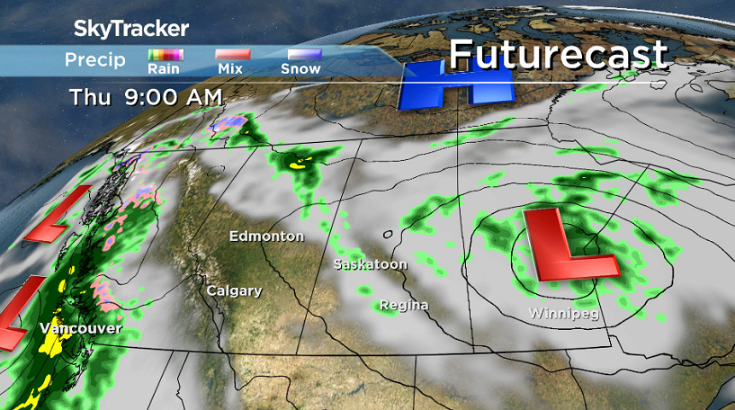
More organized rain moved in late morning as the precipitation-packed low pressure system pushed north along the Saskatchewan-Manitoba border.
Heaviest rain amounts were expected in eastern Saskatchewan where 40 to 50 millimetres possible by Thursday.

Rain is expected to continued at times into the afternoon and evening in Saskatoon under cloudy skies as we warmed up a few more degrees to a daytime high around 19 degrees.

Get daily National news
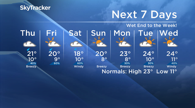
Thursday
The system carrying the rain will push off to the northeast into Manitoba on Thursday, keeping us under mostly cloudy skies with a slight chance of showers and risk of an afternoon thunderstorm.
A cool northwesterly flow behind the system will slide in and the added moisture in the area that will take some energy to evaporate will result in a daytime high struggling to get into the low 20s.


Friday
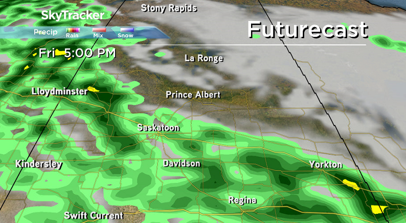
A trough draped over the region will keep the city mostly cloudy and unsettled on Friday with a good chance of showers and thunderstorms during the day.
Temperatures will once again make an attempt at reaching 20 degrees for a daytime high, but it’ll be close!
Weekend Outlook
Steadier rain is expected to move in on Saturday with a chance of embedded thunderstorms once again, which will keep us cool with a daytime high in the mid-to-upper teens.
We should get into a bit of sunshine at times on Sunday, but it depends how quickly the next disturbance moves in, however it does look like a 20 degree daytime high is more likely that day.
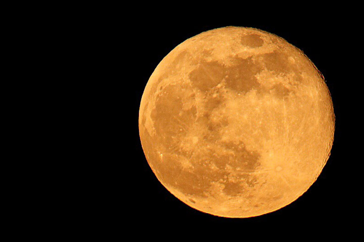
This Your Saskatchewan photo of the full moon over Saskatoon was taken by Taya Grueter:
Saskatoon weather outlook is your source for Saskatoon’s most accurate forecast and is your one stop shop for all things weather for central and northern Saskatchewan with comprehensive, in depth analysis that you can only find here.
Comments
Want to discuss? Please read our Commenting Policy first.