

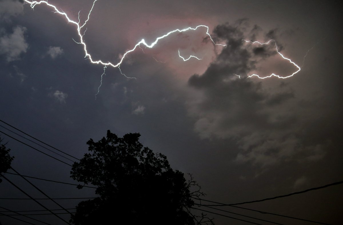
February’s wild and mild weather went out with a bang Tuesday night, as periods of heavy rainfall and thunderstorms swept through the London region.

A special weather statement from Environment Canada remains in effect Wednesday morning for London, Parkhill, Strathroy, and Komoka, as well as eastern and western Middlesex County.
Though total amounts vary, most areas received between 15 and 25 mm overnight.
“Getting a thunderstorm in the winter is not unusual, it’s not common, but getting a couple of thunderstorms overnight, that doesn’t happen very often,” said Environment Canada Severe Weather Meteorologist Rob Kuhn.
“It is a bit weird in that sense. It has happened before and it probably will happen again. This time of the year especially now with that sun getting stronger and higher, and we’re near the end of the winter as it is, we’re really seeing spring and winter duke it out.”
Spotty showers are expected Wednesday morning, then there will be a brief break before the rain ramps up once again in the afternoon. An additional 5mm is expected, with a risk of thunderstorms.
There will be a dramatic shift in temperature, from a record-setting high of 16 C Wednesday afternoon, to a low of -6 C Wednesday evening.
Kuhn blames the temperature change on a sharp arctic cold front.
“Folks out there should be prepared,” he said. “Any untreated section of highway or anything like that that remains damp could become icy and we’re basically going to be expecting a return to winter driving conditions by Thursday morning with a few flurries coming in off Lake Huron. Maybe a couple of centimetres, not a huge amount, but windy, cold, blustery, we might even have a bit of drifting snow.”


According to a media release, issued Tuesday afternoon by the Upper Thames River Conservation Authority, the ground is already saturated so the rain will be running off into watercourses.
“We expect the rain to keep streams and rivers high all week,” said Senior Water Resources Engineer Mark Helsten in the release. “Flows will start to peak on Wednesday and into the early hours of Thursday, as the crest moves downstream into London.”
The UTRCA is reminding residents to use extreme caution near all watercourses, and keep children and pets away. Streambanks are slippery, the water is very cold, and any remaining ice is unstable and thin.
With the current forecasts, the UTRCA expects some minor flooding of low lying areas. Localized higher flows could be observed as a result of thunderstorm activity.
The UTRCA’s flood control reservoirs at Fanshawe, Wildwood and Pittock Conservation Areas will be operated to assist in managing runoff. UTRCA officials are monitoring the situation, and will report on any changing conditions if necessary.
Homeowners may also want to keep an eye on their basements for signs of flooding.
Comments