Rain moves in for Friday before a tricky forecast for Halloween weekend.

Saskatoon Forecast
Today
It’s a pretty nice post election day in Saskatoon with the mercury dipping back to the freezing mark overnight before bumping up to mid-single digits by morning in the clouds.
Temperatures continued to climb up into high single digits by late morning with an expected high in low double digits today under mostly cloudy skies.
Tonight
Rain moves in tonight with a low pressure system passing by south of the city as temperatures hold in mid-single digits through the evening before falling back toward freezing overnight.
Friday
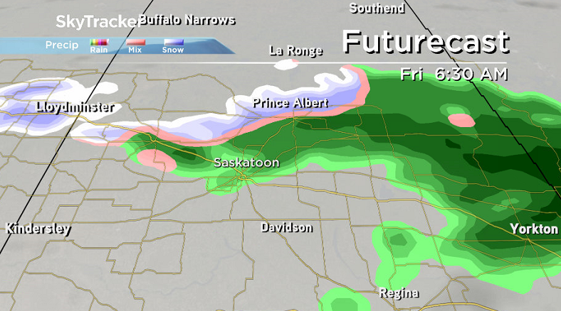
The final full work week of October finishes on a wet note with rain associated with the system continuing into the morning before tapering off later in the day.
It looks like precipitation should stay as liquid form tomorrow, but as the atmosphere cools behind the system later we may see a few flakes mix in.
Temperatures will sit in the 3 to 4 C range throughout most of the day before falling back toward the freezing mark in the evening.
Weekend
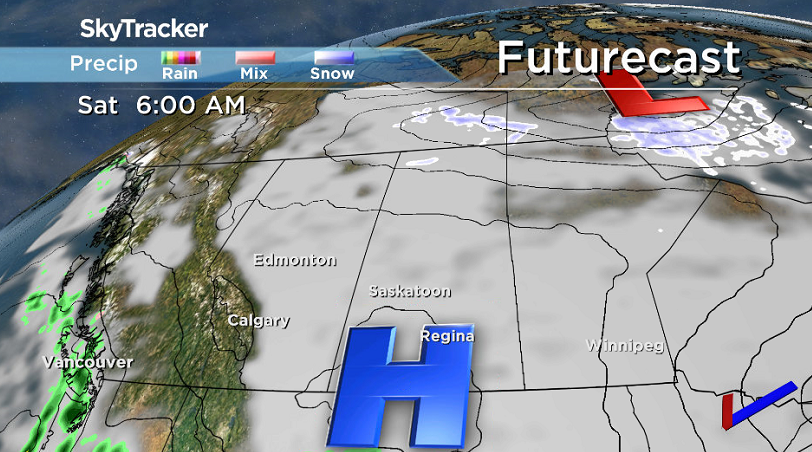
Saturday is a tricky one to forecast right now as there is a high pressure system swinging through, however the extent of the cloud cover that will stick around is still up in the air.

Get breaking National news
Right now it looks like it’ll probably be a mostly cloudy day, however if the projection of that high pressure system strengthens, it may be enough to clear skies out enough to give us some sunshine.
Our daytime high is also very dependent on how much sunshine we see, but right now a high temperature in mid-single digits is a fairly safe bet for the day.
Sunday is more predictable as another low pressure system slides through keeping us in the clouds with a good chance of showers from late morning into the afternoon and a daytime high in mid-to-high single digits expected.
Halloween
The outlook for Halloween is also proving to be a tricky one.
It looks like the day will be mostly cloudy, but it’s during the all-important evening hours that a low pressure system could push in some showers that we will also continue to keep an eye on and will have a better idea as to what will materialize tomorrow.
The mercury looks like it’ll manifest a daytime high around four degrees, but we will keep a close eye on the day and bring you the latest updated forecast when we get a more precise idea of what will happen on Friday.
Work Week Outlook
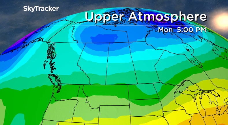
Clouds look like they’ll clear out of the area for the first few days of November with a return to sunshine Tuesday and Wednesday and daytime highs also pushing back up through mid-single digits as an upper ridge builds in.
October 2016
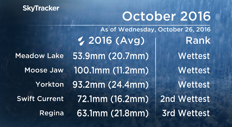
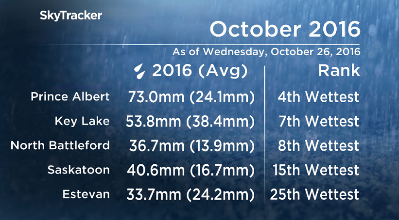
It has been the wettest October ever recorded for in a number of Saskatchewan communities including Meadow Lake, Moose Jaw and Yorkton where up to 8 times the normal precipitation has fallen in some areas, and the month isn’t even over yet.
Moose Jaw has seen an impressive 100 millimetres fall when on average they only see 11.2 millimetres.
As of Wednesday, October 27, 2016, it has been Saskatoon’s 15th wettest October on record with 40.6 millimetres of precipitation having fallen so far, which is nearly 2 and a half times the normal monthly total of 16.7 millimetres.
READ MORE: 100-year-old snowfall record surpassed in Saskatoon
Significant snow at the beginning of the month followed by moderate to heavy rainfalls later on have accounted for a large portion of these impressive totals.
WATCH BELOW: Schools closed, harvest halted devastating farmers from heavy snow

This Your Saskatchewan photo was taken in Wilkie by Brayden Johnson:
Saskatoon weather outlook is your one stop shop for all things weather for Saskatoon, central and northern Saskatchewan with a comprehensive look at your local forecast that you can only find here.






Comments
Want to discuss? Please read our Commenting Policy first.