B.C. fire crews are being stretched to the limit as they fight a number of fires in northern B.C.

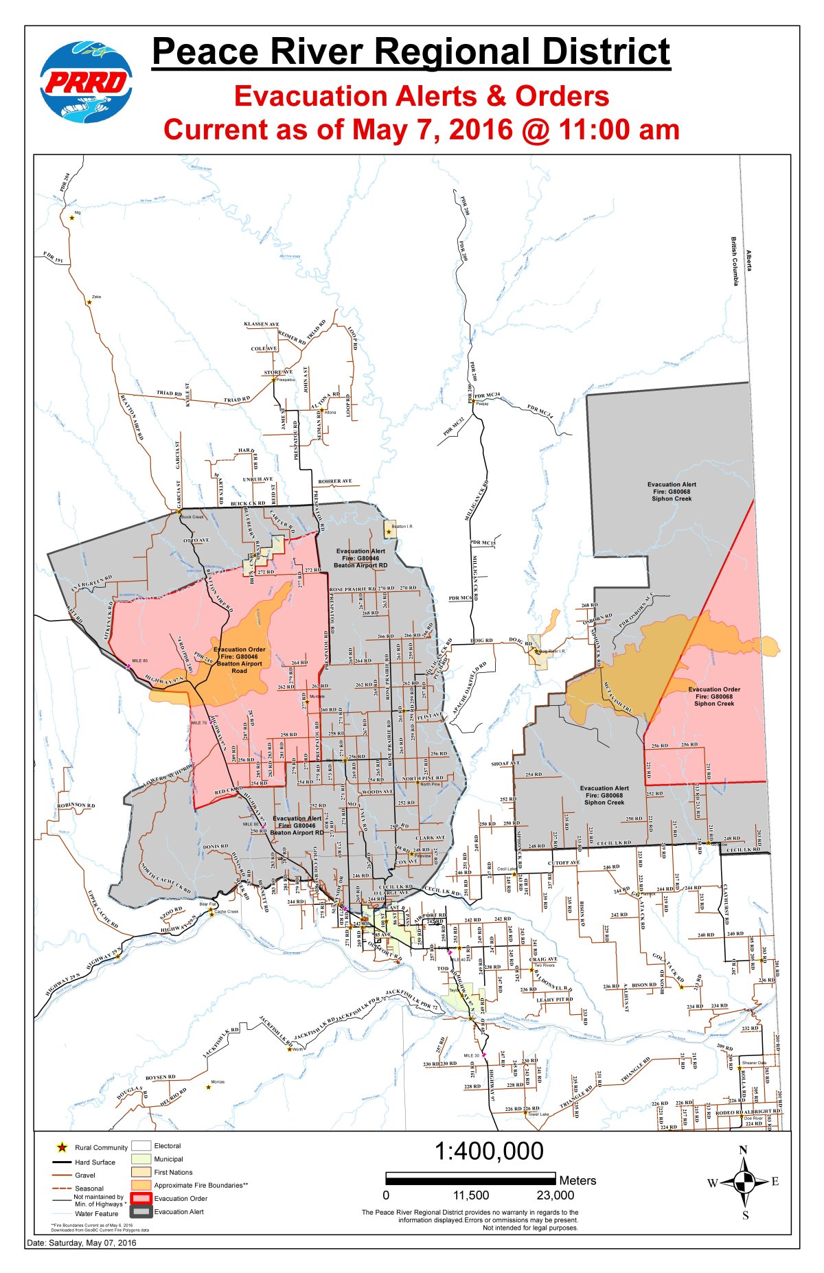
There are now two evacuation orders in place in the region.
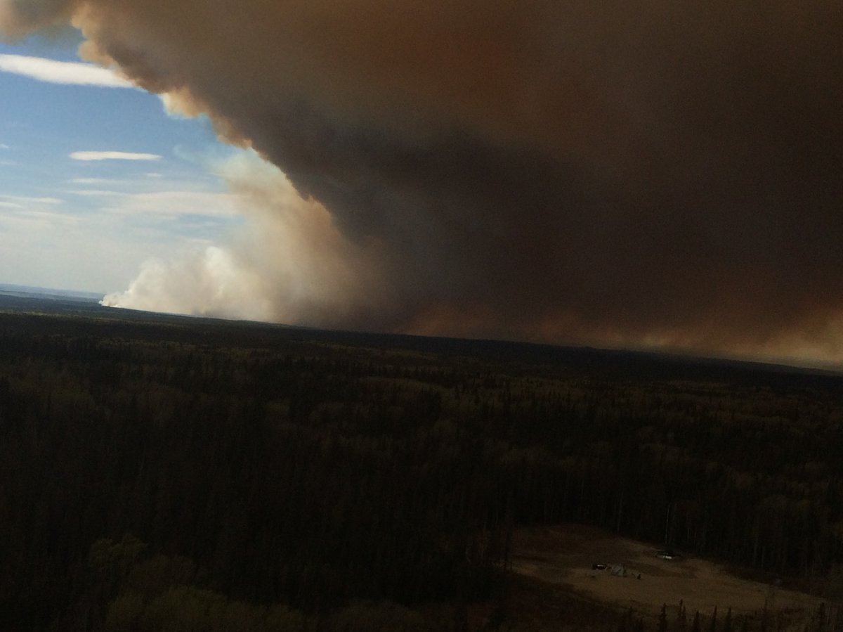
The Beatton Airport Road fire has also grown in size after it merged with another fire, the Stoddart Road fire, yesterday. The blaze, now burning about 50 kilometres northwest of Fort St. John, is about 12,000 hectares in size.
According to the BC Wildfire Service, 129 firefighters, along with 10 helicopters and 16 pieces of heavy equipment, are in the area.
WATCH: Marg Drysdale, a B.C. wildfire information officer, has an update for Global News of several fires burning in the province.

Due to this fire, the Peace River Regional District has expanded the evacuation order to include all properties along the following roads:
- Red Creek Road
- 254 Road from the Alaska Highway east to the 281 Road
- 289 Road, 287 Road, 285 Road, 283 Road and 281 Road all north from the 254 Road
- 256 Road from 281 Road to Prespatou Road
- North on the Prespatou Road from 256 Road south west along the Blueberry River, crossing the Beatton Airport Road, to the junction of the Aitken Creek Road, south along Aitken Creek Road to Alaska Highway
- Following Red Creek south adjacent to the Alaska Highway to Red Creek Road including a portion of the Lower Cache Road
- 260 Road off the Alaska Highway, and 260 Road west of the Prespatou Road
- Beatton Airport Road to the Blueberry River
- 272 Road of the Prespatou Road
- 277 Road off 272 Road
- 277 Road north off the 256 Road
- 279 Road between the 262 Road and 264 Road
- 264 Road, 260 Road, 258 Road all west of the Prespatou Road

Get daily National news
The evacuation alert around the evacuation order area has now been expanded. The City of Fort St. John says people in that area should be prepared to leave at a moment’s notice.
An evacuation alert for locations two kilometres north of Doig River First Nations has been rescinded.
On Thursday, the Beatton Airport Road fire also prompted the complete closure of the Alaska Highway for some time.
There are 112 firefighters and nine helicopters in the area battling the blaze. Crews are expecting a challenging day and fire information officer Marg Drysdale says they are expecting the fire to grow due to the strong winds.
She says they are asking everyone to cooperate with any fire prohibitions in place in the area.
Another wildfire in the region is also on the move.
The large Siphon Creek fire, near Fort St. John, has now jumped the border into Alberta.
A portion of the evacuation alert, already in place, has now been upgraded to an evacuation order.
This includes all properties along the following roads:
- 256 Road between 221 Road and 211 Road
- 221 Road just north of the 252 Road
- 211 Road just north of the 252 Road
- Alberta border from just north of the 252 Road, to approximately 40 km north along the Alberta border, then southwest to just north of the 256 Road, then south to just north of the 252 Road and then east to the Alberta border
These 11 addresses are on evacuation order, while 1,726 are on evacuation alert.
The wildfire is currently sitting at 17,000 hectares and is zero per cent contained. It is burning 60 kilometres northeast of Fort St. John. The fire crossed into Alberta late Thursday night, pursued by B.C. firefighters. B.C. is leading the fight so Alberta crews can focus on Fort McMurray.
Everyone who is under an evacuation order must leave their homes immediately.
The Peace River Regional District has declared a state of emergency for an area near Fort St. John due to the fires.
Environment Canada has also issued a special air quality statement for all of Fort St. John and the surrounding region due to the fires. Smoke concentrations will vary widely as winds, fire behaviour and temperatures change.
More than 100 crews are in the region, battling the flames.
– With files from Jon Azpiri


Comments