
Tuesday, January 12, 2016 – Weather forecast update at 4:30 pm:

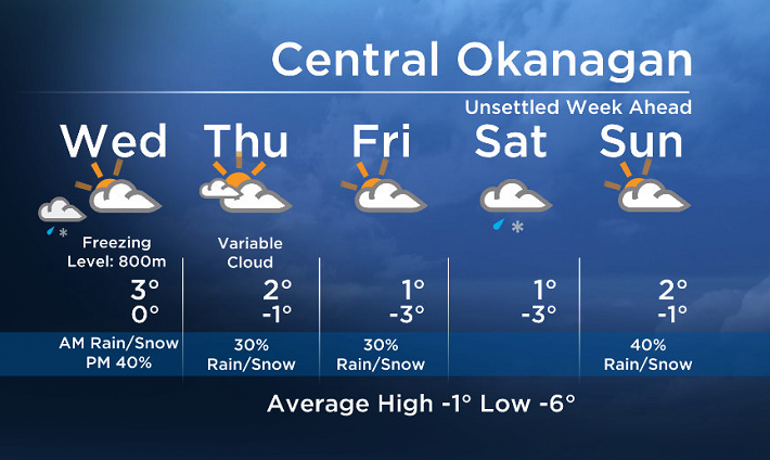
Circulation from a low off the central coast will keep a moist southwesterly flow over the BC Southern Interior. Expect bands of rain or snow to move across our region Tuesday night and Wednesday morning.

Get daily National news
Get daily Canada news delivered to your inbox so you'll never miss the day's top stories.
By providing your email address, you have read and agree to Global News' Terms and Conditions and Privacy Policy.
Freezing levels will be near valley bottoms but will rise to between 600 and 1000m by Wednesday afternoon.
The precip will taper off by Wednesday afternoon and it will stay mostly dry for the rest of the work week with just isolated showers.


We are moderately confident that another system will arrive this weekend.
Wednesday’s daytime high range: 0 to 6C
We will have the rest of your weather details coming up at 5 and 6:30pm – Hope you can join us!
~ Duane/Wesla
Comments
Want to discuss? Please read our Commenting Policy first.