
WINNIPEG — We all knew it would end.

The mild weather most of the province enjoyed over the weekend will seem like a distant memory come Wednesday.
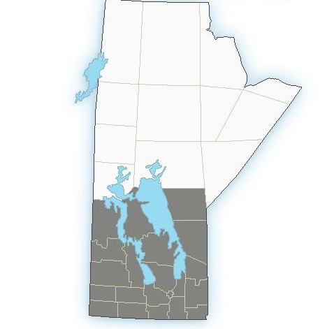
Environment Canada has issued a Special Weather Statement for all of southern Manitoba and stretching into central Manitoba as a strong cold front will sweep into the province beginning late Wednesday.
RELATED: Throwback Thursday: Snowstorm shuts down Winnipeg in 1986
What’s ahead is not just colder temperatures, but very high winds and snow.

Get breaking National news
Once the front passes, our temperatures will drop with lows overnight in the minus double digits. The winds will also be brutal.
Coming out of the northwest at 60 kilometres an hour with gusts up to 90 km/h.
On top of that, flurries. Due to the high winds combined with the flakes will reduce visibility in many areas. The high winds and flurries will last into Thursday with conditions not slated to improve until Thursday night.
How much snow we’ll get is still unknown until we get closer to Wednesday.


Here is a map depicting which areas of the province are affected.
Global will continue to have updates on the weather conditions as the system draws near.
Comments
Want to discuss? Please read our Commenting Policy first.