
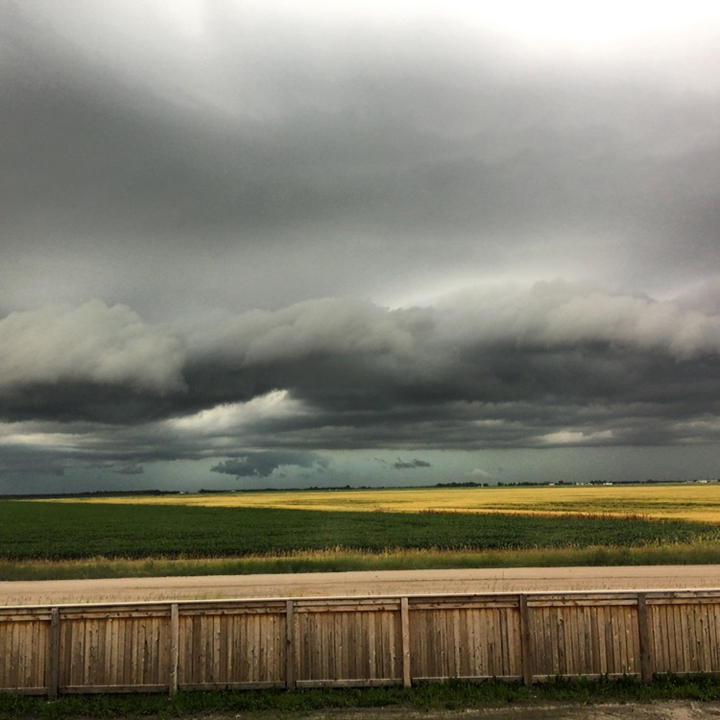
WINNIPEG – A Prairie thunderstorm rolled across southern Manitoba Thursday night, bringing heavy rain and wild light shows to many communities.

Holland had ping-pong-ball-sized hail, Environment Canada reported. While general rain amounts were 20 to 30 millimetres, Portage la Prairie got 76 mm. The Richardson International Airport had 11 mm of rain, but other areas of the city may have had more, as localized amounts spiked higher.
READ MORE: Global News weather

Get daily National news
The highest preliminary rainfall amounts reported by Environment Canada were:
- Portage la Prairie – 76 mm;
- Pinawa – 56 mm;
- Starbuck – 51 mm;
- St. Pierre – 50 mm;
- Selkirk – 42 mm;
- Gimli – 32 mm; and
- Carman – 30 mm.


The Winnipeg forecast Thursday calls for clearing skies this morning but a 30 per cent chance of showers this evening with a risk of thunderstorms. Although it won’t be as hot as Thursday, Friday will be another hot and humid day, with the humidex making it feel above 30. Saturday and Sunday should have good lake weather, with clear skies and highs around 30 C.
READ MORE: Manitobans remain under heat advisory issued by province
Send your weather photos to winnipeg@globalnews.ca.
To get real-time weather for your area, download the Global News Skytracker weather app.
Comments
Want to discuss? Please read our Commenting Policy first.